Estimated Value: $360,000 - $591,000
5
Beds
1
Bath
2,543
Sq Ft
$187/Sq Ft
Est. Value
About This Home
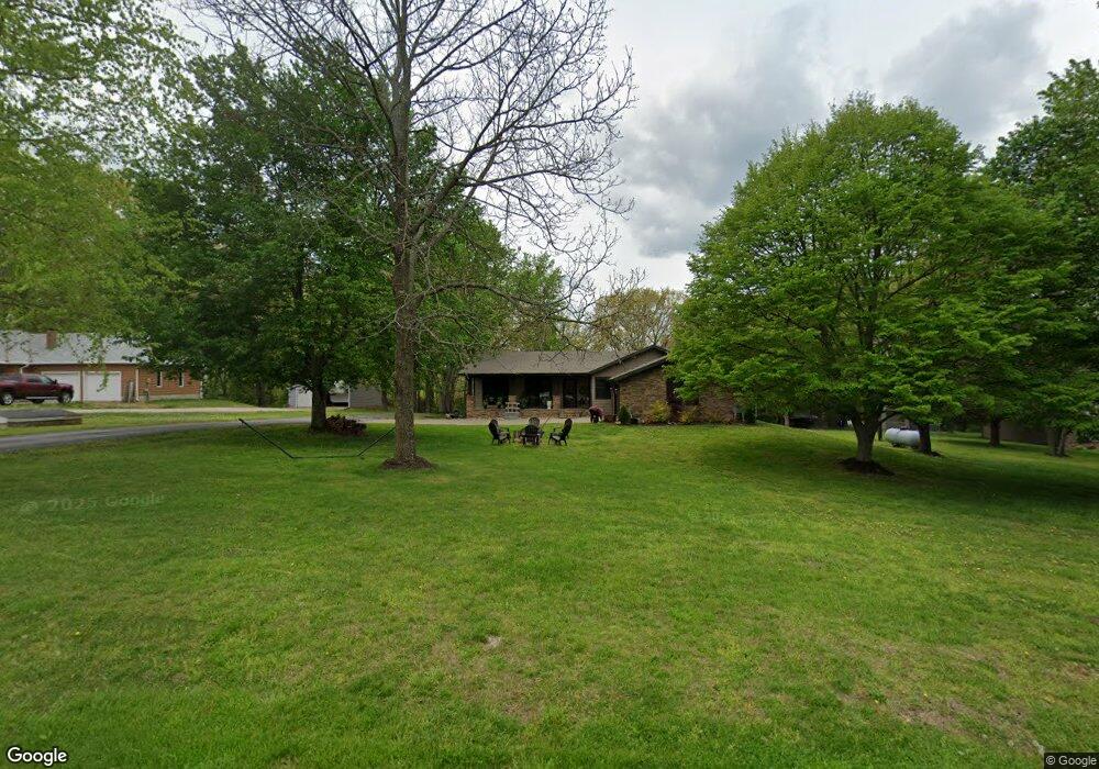
This home is located at 1723 S Deer Ridge Dr, Nixa, MO 65714 and is currently estimated at $476,262, approximately $187 per square foot. 1723 S Deer Ridge Dr is a home with nearby schools including P.S. 40 Samuel Huntington, Espy Elementary School, and Queens Gateway to Health Sciences Secondary School.
Ownership History
Date
Name
Owned For
Owner Type
Purchase Details
Closed on
May 7, 2009
Sold by
Hooten Wilburn C and Hooten Connie S
Bought by
Taylor Timothy and Taylor Kristin J
Current Estimated Value
Purchase Details
Closed on
Sep 25, 2007
Sold by
Hooten Wilburn C and Hooten Connie S
Bought by
Taylor Timothy M and Taylor Kristin J
Home Financials for this Owner
Home Financials are based on the most recent Mortgage that was taken out on this home.
Original Mortgage
$209,000
Interest Rate
6.66%
Mortgage Type
Seller Take Back
Create a Home Valuation Report for This Property
The Home Valuation Report is an in-depth analysis detailing your home's value as well as a comparison with similar homes in the area
Home Values in the Area
Average Home Value in this Area
Purchase History
| Date | Buyer | Sale Price | Title Company |
|---|---|---|---|
| Taylor Timothy | -- | None Available | |
| Taylor Timothy M | -- | None Available |
Source: Public Records
Mortgage History
| Date | Status | Borrower | Loan Amount |
|---|---|---|---|
| Previous Owner | Taylor Timothy M | $209,000 |
Source: Public Records
Tax History Compared to Growth
Tax History
| Year | Tax Paid | Tax Assessment Tax Assessment Total Assessment is a certain percentage of the fair market value that is determined by local assessors to be the total taxable value of land and additions on the property. | Land | Improvement |
|---|---|---|---|---|
| 2024 | $3,526 | $59,430 | -- | -- |
| 2023 | $3,526 | $59,430 | $0 | $0 |
| 2022 | $3,424 | $57,630 | $0 | $0 |
| 2021 | $3,426 | $57,630 | $0 | $0 |
| 2020 | $3,126 | $50,290 | $0 | $0 |
| 2019 | $3,126 | $50,290 | $0 | $0 |
| 2018 | $1,398 | $50,290 | $0 | $0 |
| 2017 | $1,398 | $24,260 | $0 | $0 |
| 2016 | $1,375 | $24,260 | $0 | $0 |
| 2014 | $1,333 | $24,110 | $0 | $0 |
| 2013 | $1,335 | $24,110 | $0 | $0 |
| 2011 | -- | $48,220 | $0 | $0 |
Source: Public Records
Map
Nearby Homes
- 1719 S Rabbit Ln
- 347 W Monarchwood Dr
- 343 W Monarchwood Dr
- 1294 S Amber Ridge Dr
- Lot #4 Lone Star
- Lot 4 Kelby Creek Phase 4
- Lot 2 Kelby Creek Phase 4
- 2007 Lone Star Dr
- Lot 9 Kelby Creek Phase 4
- Lot 5 Kelby Creek Phase 4
- Lot 21 Kelby Creek Phase 4
- Lot 10 Kelby Creek Phase 4
- Lot 14 Kelby Creek Phase 4
- Lot 19 Kelby Creek Phase 4
- Lot 8 Kelby Creek Phase 4
- Lot 16 Kelby Creek Phase 4
- Lot 18 Kelby Creek Phase 4
- Lot 6 Kelby Creek Phase 4
- Lot 11 Kelby Creek Phase 4
- Lot 3 Kelby Creek Phase 4
- 1715 S Deer Ridge Dr
- 1734 S Deer Ridge Dr
- 1755 Deer Ridge Dr
- 1716 Deer Ridge Cir
- 1718 S Rabbit Ln
- 1782 Deer Ridge Dr
- 621 W Bobwhite Ln
- 621 Bobwhite Ln
- Tbd Bobwhite Ln
- 1742 S Rabbit Ln
- 525 W Deer Valley Dr
- 1783 Deer Ridge Dr
- 620 W Bobwhite Ln
- 1753 S Rabbit Ln
- 1784 Deer Ridge Dr
- 1719 Rabbit Ln
- 105a Whipoorwill Hills Rd
- 575 W Turtle Pond Dr
- 2 Songbird Cir
- 1786 S Deer Ridge Dr