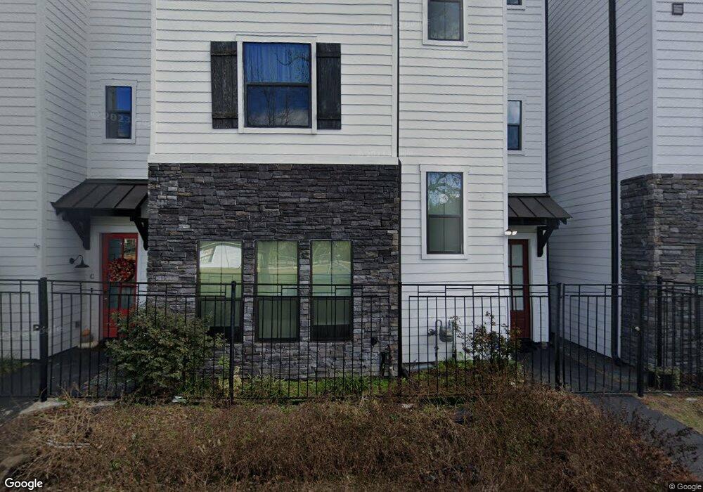
1723 W 14th St Unit B Houston, TX 77008
Greater Heights NeighborhoodEstimated Value: $477,000 - $608,000
3
Beds
4
Baths
2,146
Sq Ft
$257/Sq Ft
Est. Value
About This Home
This home is located at 1723 W 14th St Unit B, Houston, TX 77008 and is currently estimated at $550,474, approximately $256 per square foot. 1723 W 14th St Unit B is a home located in Harris County with nearby schools including Love Elementary School, Hamilton Middle, and Waltrip High School.
Ownership History
Date
Name
Owned For
Owner Type
Purchase Details
Closed on
Jul 6, 2018
Sold by
B & M Re Group Inc
Bought by
Peskowitz Rachel E
Current Estimated Value
Home Financials for this Owner
Home Financials are based on the most recent Mortgage that was taken out on this home.
Original Mortgage
$291,900
Outstanding Balance
$253,534
Interest Rate
4.6%
Mortgage Type
New Conventional
Estimated Equity
$296,940
Purchase Details
Closed on
Aug 15, 2017
Sold by
Bb Residential Group Inc
Bought by
B & B North Loop Group Inc
Home Financials for this Owner
Home Financials are based on the most recent Mortgage that was taken out on this home.
Original Mortgage
$1,227,633
Interest Rate
3.92%
Mortgage Type
Purchase Money Mortgage
Create a Home Valuation Report for This Property
The Home Valuation Report is an in-depth analysis detailing your home's value as well as a comparison with similar homes in the area
Home Values in the Area
Average Home Value in this Area
Purchase History
| Date | Buyer | Sale Price | Title Company |
|---|---|---|---|
| Peskowitz Rachel E | -- | Fidelity National Title | |
| Peskowitz Rachel E | -- | Fidelity National Title | |
| B & B North Loop Group Inc | -- | None Available | |
| B & B North Loop Group Inc | -- | None Available |
Source: Public Records
Mortgage History
| Date | Status | Borrower | Loan Amount |
|---|---|---|---|
| Open | Peskowitz Rachel E | $291,900 | |
| Previous Owner | B & B North Loop Group Inc | $1,227,633 |
Source: Public Records
Tax History Compared to Growth
Tax History
| Year | Tax Paid | Tax Assessment Tax Assessment Total Assessment is a certain percentage of the fair market value that is determined by local assessors to be the total taxable value of land and additions on the property. | Land | Improvement |
|---|---|---|---|---|
| 2025 | $7,030 | $511,821 | $137,700 | $374,121 |
| 2024 | $7,030 | $519,587 | $137,700 | $381,887 |
| 2023 | $7,030 | $428,245 | $137,700 | $290,545 |
| 2022 | $10,288 | $474,478 | $114,750 | $359,728 |
| 2021 | $9,900 | $424,757 | $99,450 | $325,307 |
| 2020 | $10,212 | $421,692 | $99,450 | $322,242 |
| 2019 | $10,479 | $414,115 | $99,450 | $314,665 |
| 2018 | $4,392 | $173,552 | $91,800 | $81,752 |
| 2017 | $2,397 | $94,803 | $91,800 | $3,003 |
| 2016 | $2,014 | $79,660 | $79,560 | $100 |
| 2015 | -- | $119,589 | $116,586 | $3,003 |
| 2014 | -- | $119,589 | $116,586 | $3,003 |
Source: Public Records
Map
Nearby Homes
- 1326 Dian St
- 1310 Dian St
- 1405 Nashua St
- 1241 Prince St
- 1813 W 14th St
- 1438 Dian St Unit A
- 1438 Dian St Unit B
- 1430 Nashua St
- 1646 W 13th St
- 1438 Prince St
- 1229 Prince St
- 1442 Nashua St
- 1223 Prince St
- 1321 Laird St
- 1632 W 13th St
- 1901 W 14th 1/2 St Unit C
- 1011 Wynnwood Ln
- 1211 Bay Oaks Rd
- 1211 N Durham Dr
- 1906 W 14th St
- 1723 W 14th St
- 1723 W 14th St
- 1723 W 14th St
- 1723 W 14th St
- 1723 W 14th St
- 1723 W 14th St
- 1723 W 14th St
- 1723 W 14th St Unit A
- 1723 W 14th St Unit G
- 1723 W 14th St Unit F
- 1723 W 14th St Unit E
- 1723 W 14th St Unit D
- 1723 W 14th St Unit C
- 1723 W 14th St
- 1407 Prince St
- 1411 Prince St
- 1405A Prince St
- 1801 W 14th 1/2 St
- 1401 Prince St
- 1418 Dian St Unit B