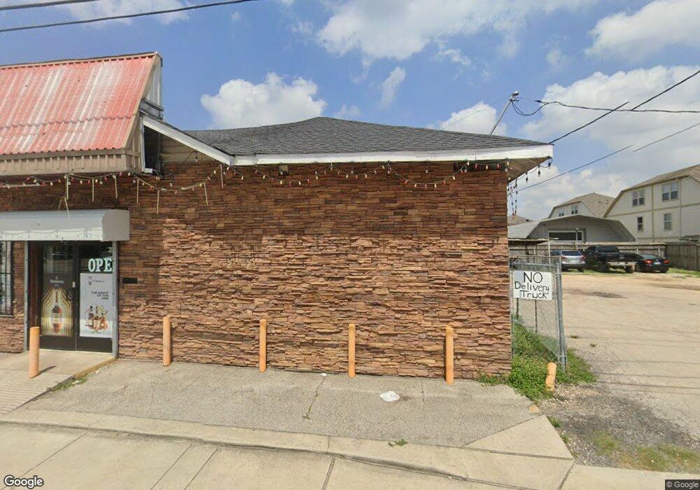
1724 Airline Dr Houston, TX 77009
Greater Heights Neighborhood
--
Bed
--
Bath
2,730
Sq Ft
0.26
Acres
About This Home
This home is located at 1724 Airline Dr, Houston, TX 77009. 1724 Airline Dr is a home located in Harris County with nearby schools including Browning Elementary School, Hogg Middle, and Heights High School.
Ownership History
Date
Name
Owned For
Owner Type
Purchase Details
Closed on
May 20, 2022
Sold by
Prince William R and Prince Julie
Bought by
Lahey Bruce D
Purchase Details
Closed on
Mar 28, 2007
Sold by
Bui Cu An and Vo Huong Thi
Bought by
Nguyen Jimmy
Home Financials for this Owner
Home Financials are based on the most recent Mortgage that was taken out on this home.
Original Mortgage
$200,000
Interest Rate
6.71%
Mortgage Type
Seller Take Back
Create a Home Valuation Report for This Property
The Home Valuation Report is an in-depth analysis detailing your home's value as well as a comparison with similar homes in the area
Home Values in the Area
Average Home Value in this Area
Purchase History
| Date | Buyer | Sale Price | Title Company |
|---|---|---|---|
| Lahey Bruce D | -- | Wfg National Title Insurance C | |
| Nguyen Jimmy | -- | Pinnacle Title Company |
Source: Public Records
Mortgage History
| Date | Status | Borrower | Loan Amount |
|---|---|---|---|
| Previous Owner | Nguyen Jimmy | $200,000 |
Source: Public Records
Tax History Compared to Growth
Tax History
| Year | Tax Paid | Tax Assessment Tax Assessment Total Assessment is a certain percentage of the fair market value that is determined by local assessors to be the total taxable value of land and additions on the property. | Land | Improvement |
|---|---|---|---|---|
| 2025 | $18,527 | $886,423 | $784,000 | $102,423 |
| 2024 | $18,527 | $885,459 | $784,000 | $101,459 |
| 2023 | $18,527 | $881,670 | $784,000 | $97,670 |
| 2022 | $13,595 | $617,422 | $537,600 | $79,822 |
| 2021 | $13,845 | $594,022 | $537,600 | $56,422 |
| 2020 | $14,318 | $591,246 | $537,600 | $53,646 |
| 2019 | $15,143 | $598,414 | $537,600 | $60,814 |
| 2018 | $11,317 | $447,241 | $392,000 | $55,241 |
| 2017 | $9,710 | $384,014 | $336,000 | $48,014 |
| 2016 | $9,716 | $384,258 | $336,000 | $48,258 |
| 2015 | $6,127 | $306,045 | $257,600 | $48,445 |
| 2014 | $6,127 | $229,416 | $193,200 | $36,216 |
Source: Public Records
Map
Nearby Homes
- 1340 Idylwild St
- 738 Redwing Place Dr
- 1719 Redwing Pines Dr
- 1707 Redwing Cove Dr
- 905 Kern St
- 1737 Airline Dr
- 1723 Redwing Ridge Dr
- 1805 Emir St Unit G
- 1805 Emir St Unit D
- 1805 Emir St Unit L
- 1805 Emir St Unit E
- 1718 Redwing Ridge Dr
- 1005 Kern St Unit C
- 1005 Kern St Unit B
- 1213 Northwood St
- 931 Louise St
- 1611 Airline Dr
- 1209 Tabor St
- 1101 Tabor St
- 1415 Tabor St
- 1343 Idylwild St
- 818 Redwing Place Dr
- 814 Redwing Place Dr
- 810 Redwing Place Dr
- 806 Redwing Place Dr
- 1339 Idylwild St
- 802 Redwing Place Dr
- 1802 Airline Dr
- 746 Redwing Place Dr
- 1735 Redwing Pines Dr
- 1335 Idylwild St
- 1734 Redwing Pines Dr
- 742 Redwing Place Dr
- 1731 Redwing Pines Dr
- 1727 Redwing Bluff Dr
- 1730 Redwing Pines Dr
- 1327 Idylwild St
- 1327 Idylwild St Unit B
- 1327 Idylwild St Unit A
- 1336 Idylwild St