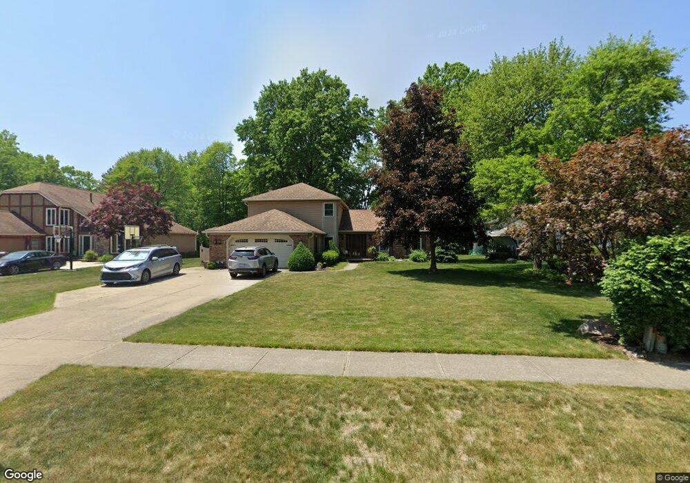
1724 Farrs Garden Path Westlake, OH 44145
Estimated Value: $455,000 - $527,000
3
Beds
3
Baths
2,644
Sq Ft
$187/Sq Ft
Est. Value
About This Home
This home is located at 1724 Farrs Garden Path, Westlake, OH 44145 and is currently estimated at $493,541, approximately $186 per square foot. 1724 Farrs Garden Path is a home located in Cuyahoga County with nearby schools including Dover Intermediate School, Lee Burneson Middle School, and Westlake High School.
Ownership History
Date
Name
Owned For
Owner Type
Purchase Details
Closed on
Jun 25, 2002
Sold by
Oleary Timothy W and Oleary Mary K
Bought by
Bobal Mark and Bobal Carole
Current Estimated Value
Home Financials for this Owner
Home Financials are based on the most recent Mortgage that was taken out on this home.
Original Mortgage
$226,350
Interest Rate
6.93%
Purchase Details
Closed on
Oct 8, 1985
Bought by
Oleary Timothy W and Oleary Mary K
Purchase Details
Closed on
Sep 22, 1983
Bought by
Hennie Homes Inc
Purchase Details
Closed on
Jan 1, 1982
Bought by
Rockport Dev Corp
Create a Home Valuation Report for This Property
The Home Valuation Report is an in-depth analysis detailing your home's value as well as a comparison with similar homes in the area
Home Values in the Area
Average Home Value in this Area
Purchase History
| Date | Buyer | Sale Price | Title Company |
|---|---|---|---|
| Bobal Mark | $251,500 | Millennium Land Title | |
| Oleary Timothy W | $134,300 | -- | |
| Hennie Homes Inc | -- | -- | |
| Rockport Dev Corp | -- | -- |
Source: Public Records
Mortgage History
| Date | Status | Borrower | Loan Amount |
|---|---|---|---|
| Previous Owner | Bobal Mark | $226,350 |
Source: Public Records
Tax History Compared to Growth
Tax History
| Year | Tax Paid | Tax Assessment Tax Assessment Total Assessment is a certain percentage of the fair market value that is determined by local assessors to be the total taxable value of land and additions on the property. | Land | Improvement |
|---|---|---|---|---|
| 2024 | $6,863 | $144,865 | $32,760 | $112,105 |
| 2023 | $6,511 | $117,500 | $26,010 | $91,490 |
| 2022 | $6,407 | $117,500 | $26,010 | $91,490 |
| 2021 | $6,415 | $117,500 | $26,010 | $91,490 |
| 2020 | $6,474 | $108,780 | $24,080 | $84,700 |
| 2019 | $6,277 | $310,800 | $68,800 | $242,000 |
| 2018 | $6,305 | $108,780 | $24,080 | $84,700 |
| 2017 | $5,913 | $95,940 | $23,870 | $72,070 |
| 2016 | $5,881 | $95,940 | $23,870 | $72,070 |
| 2015 | $5,348 | $95,940 | $23,870 | $72,070 |
| 2014 | $5,348 | $85,650 | $21,320 | $64,330 |
Source: Public Records
Map
Nearby Homes
- 28323 Farrs Garden Path
- 29379 Detroit Rd
- 29363 Detroit Rd Unit 5
- 29331 Graystone Dr
- 1476 Bobby Ln Unit 7
- 1900 Sperrys Forge Trail
- 28167 Zinfandel Ct
- Bowman Plan at Hope Pointe Place
- Ashton Plan at Hope Pointe Place
- 28200 Detroit Rd Unit D3
- 1721 Merlot Ln
- 28744 Woodmill Dr
- 1625 Cedarwood Dr Unit 218
- 27923 Hilliard Blvd
- 1480 Cedarwood Dr Unit 21F
- 1510 Alder Ln Unit 7C
- 1670 Cedarwood Dr Unit 148
- 1360 Cedarwood Dr Unit C2
- 1316 Cedarwood Dr Unit D3
- 879 S Parkside Dr
- 28434 Farrs Garden Path
- 1732 Farrs Garden Path
- 1740 Farrs Garden Path
- 28371 Farrs Garden Path
- 28418 Farrs Garden Path
- 1748 Farrs Garden Path
- 28402 Farrs Garden Path
- 1735 Farrs Garden Path
- 28386 Farrs Garden Path
- 28355 Farrs Garden Path
- 1743 Farrs Garden Path
- 1743 Farrs Garden 4bac
- 28370 Farrs Garden Path
- 1756 Farrs Garden Path
- 1751 Farrs Garden Path
- 28354 Farrs Garden Path
- 28339 Farrs Garden Path
- 1715 Bassett Rd
- 1745 Bassett Rd
- 1764 Farrs Garden Path