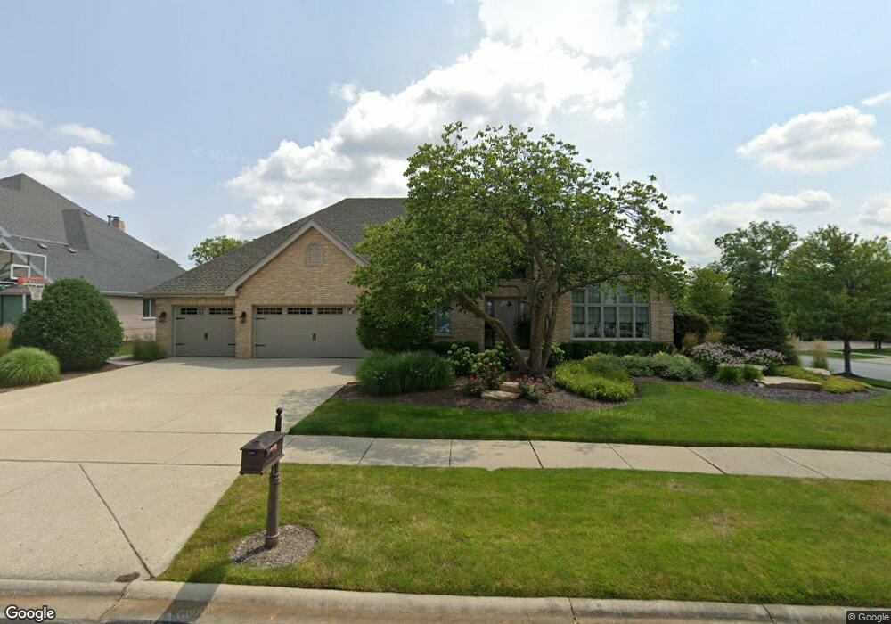
17249 Doe Ln Orland Park, IL 60467
Grasslands NeighborhoodEstimated Value: $650,240 - $746,000
4
Beds
3
Baths
3,131
Sq Ft
$226/Sq Ft
Est. Value
About This Home
This home is located at 17249 Doe Ln, Orland Park, IL 60467 and is currently estimated at $707,560, approximately $225 per square foot. 17249 Doe Ln is a home located in Cook County with nearby schools including Meadow Ridge School, Orland Center School, and Century Junior High School.
Ownership History
Date
Name
Owned For
Owner Type
Purchase Details
Closed on
Aug 16, 2021
Sold by
First Midwest Bank
Bought by
Weber James D and Weber Nancy A
Current Estimated Value
Purchase Details
Closed on
Nov 10, 2004
Sold by
Picard Robert J and Picard Jean M
Bought by
Weber James D and Weber Nancy A
Home Financials for this Owner
Home Financials are based on the most recent Mortgage that was taken out on this home.
Original Mortgage
$400,000
Interest Rate
4.87%
Mortgage Type
Unknown
Purchase Details
Closed on
Jun 17, 1997
Sold by
Leonard Kamp & Sons Inc
Bought by
Picard Robert J and Picard Jean M
Home Financials for this Owner
Home Financials are based on the most recent Mortgage that was taken out on this home.
Original Mortgage
$265,000
Interest Rate
8.01%
Create a Home Valuation Report for This Property
The Home Valuation Report is an in-depth analysis detailing your home's value as well as a comparison with similar homes in the area
Home Values in the Area
Average Home Value in this Area
Purchase History
| Date | Buyer | Sale Price | Title Company |
|---|---|---|---|
| Weber James D | -- | None Available | |
| Weber James D | $480,000 | Atgf Inc | |
| Picard Robert J | $347,000 | Chicago Title Insurance Co | |
| Leonard Kamp & Sons Inc | -- | -- |
Source: Public Records
Mortgage History
| Date | Status | Borrower | Loan Amount |
|---|---|---|---|
| Previous Owner | Weber James D | $400,000 | |
| Previous Owner | Picard Robert J | $265,000 |
Source: Public Records
Tax History Compared to Growth
Tax History
| Year | Tax Paid | Tax Assessment Tax Assessment Total Assessment is a certain percentage of the fair market value that is determined by local assessors to be the total taxable value of land and additions on the property. | Land | Improvement |
|---|---|---|---|---|
| 2024 | $12,934 | $55,000 | $8,230 | $46,770 |
| 2023 | $11,483 | $55,000 | $8,230 | $46,770 |
| 2022 | $11,483 | $41,756 | $7,133 | $34,623 |
| 2021 | $11,116 | $41,754 | $7,132 | $34,622 |
| 2020 | $10,763 | $41,754 | $7,132 | $34,622 |
| 2019 | $11,384 | $44,905 | $6,583 | $38,322 |
| 2018 | $11,071 | $44,905 | $6,583 | $38,322 |
| 2017 | $10,836 | $44,905 | $6,583 | $38,322 |
| 2016 | $10,577 | $40,402 | $6,035 | $34,367 |
| 2015 | $10,440 | $40,402 | $6,035 | $34,367 |
| 2014 | $10,300 | $40,402 | $6,035 | $34,367 |
| 2013 | $11,336 | $46,859 | $6,035 | $40,824 |
Source: Public Records
Map
Nearby Homes
- 17140 Deer Run Dr
- 10653 Great Egret Dr
- 10509 San Luis Ln
- 10816 Kimberly Ln Unit 48
- 10595 W 167th St
- 17708 Pennsylvania Ct Unit 211
- 10958 New Mexico Ct Unit 166
- 17259 Lakebrook Dr
- 16738 Lee St
- 17816 New Hampshire Ct Unit 137
- 17321 Lakebrook Dr
- 16629 Grants Trail
- 16620 Grants Trail
- 17292 Lakebrook Dr
- 17396 Brook Crossing Ln
- 16705 Wolf Rd
- 17921 Alaska Ct Unit 8
- 17926 Alabama Ct Unit 5
- 11424 Lakebrook Ct Unit 281
- 9601 W 179th St
- 17239 Doe Ln
- 10726 White Tail Run
- 10737 White Tail Run
- 17229 Doe Ln
- 17244 Doe Ln
- 10733 White Tail Run
- 10720 White Tail Run
- 10721 Buck Dr
- 10741 White Tail Run
- 17234 Doe Ln
- 10715 Buck Dr
- 10745 White Tail Run
- 17224 Doe Ln
- 10714 White Tail Run
- 10746 Olde Mill Dr
- 10750 Olde Mill Dr
- 10740 Olde Mill Dr Unit II
- 10709 Buck Dr
- 10724 Olde Mill Dr Unit II
- 10722 Olde Mill Dr