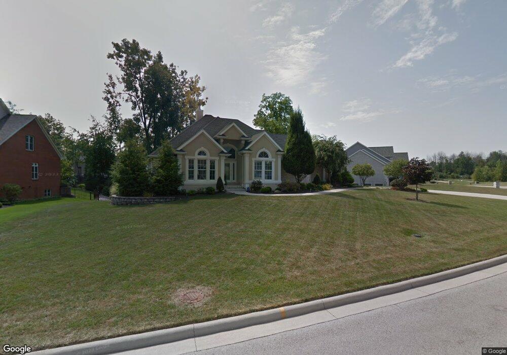
1725 Pinehurst Dr Findlay, OH 45840
Estimated Value: $489,000 - $652,000
4
Beds
4
Baths
2,464
Sq Ft
$235/Sq Ft
Est. Value
About This Home
This home is located at 1725 Pinehurst Dr, Findlay, OH 45840 and is currently estimated at $578,729, approximately $234 per square foot. 1725 Pinehurst Dr is a home located in Hancock County with nearby schools including Liberty-Benton Elementary School, Liberty-Benton Middle School, and Liberty-Benton High School.
Ownership History
Date
Name
Owned For
Owner Type
Purchase Details
Closed on
Sep 29, 2004
Sold by
Koehler Construction Ltd
Bought by
Bryant Jeffrey S and Bryant Kristi A
Current Estimated Value
Home Financials for this Owner
Home Financials are based on the most recent Mortgage that was taken out on this home.
Original Mortgage
$322,700
Outstanding Balance
$152,813
Interest Rate
5.12%
Mortgage Type
Purchase Money Mortgage
Estimated Equity
$425,916
Create a Home Valuation Report for This Property
The Home Valuation Report is an in-depth analysis detailing your home's value as well as a comparison with similar homes in the area
Purchase History
| Date | Buyer | Sale Price | Title Company |
|---|---|---|---|
| Bryant Jeffrey S | $370,466 | Midam Title |
Source: Public Records
Mortgage History
| Date | Status | Borrower | Loan Amount |
|---|---|---|---|
| Open | Bryant Jeffrey S | $322,700 |
Source: Public Records
Tax History
| Year | Tax Paid | Tax Assessment Tax Assessment Total Assessment is a certain percentage of the fair market value that is determined by local assessors to be the total taxable value of land and additions on the property. | Land | Improvement |
|---|---|---|---|---|
| 2024 | $6,564 | $176,560 | $27,940 | $148,620 |
| 2023 | $6,409 | $176,560 | $27,940 | $148,620 |
| 2022 | $6,346 | $176,560 | $27,940 | $148,620 |
| 2021 | $6,182 | $151,830 | $27,920 | $123,910 |
| 2020 | $6,234 | $151,830 | $27,920 | $123,910 |
| 2019 | $5,981 | $151,830 | $27,920 | $123,910 |
| 2018 | $5,000 | $140,090 | $18,610 | $121,480 |
| 2017 | $2,579 | $140,090 | $18,610 | $121,480 |
| 2016 | $4,991 | $140,090 | $18,610 | $121,480 |
| 2015 | $5,397 | $147,380 | $21,670 | $125,710 |
| 2014 | $5,446 | $147,380 | $21,670 | $125,710 |
| 2012 | $5,686 | $147,380 | $21,670 | $125,710 |
Source: Public Records
Map
Nearby Homes
- 6535 Silver Lake Dr
- 0 County Road 95 Unit 6097574
- 3106 Saddlebrook
- 9894 Smokies Way
- 3018 Gleneagle Dr
- 3237 Gleneagle Dr
- 0 County Road 140
- 0 Rock Candy Rd Or Bushwillow Dr Unit Lot 173
- 0 Rock Candy Rd Unit Lot 159
- 0 Rock Candy Rd Unit Lot 170
- 0 Rock Candy Rd Unit Lot 172 206819
- 0 Rock Candy Rd Unit Lot 162
- 0 Rock Candy Rd Unit Lot 171
- 0 Rock Candy Rd Unit Lot 168
- 0 Bushwillow Dr Or Rock Candy Rd Unit Lot 157
- 0 Bearcat Way Or Rock Candy Rd Unit Lot 167
- 925 W Melrose Ave
- 9960 W 224 Us Hwy
- 0 County Road 223
- 0 Allen Township 142
- 1733 Pinehurst Dr
- 1717 Pinehurst Dr
- 1726 Bay Hill Dr
- 1718 Bay Hill Dr
- 1741 Pinehurst Dr
- 1720 Pinehurst Dr
- 1709 Pinehurst Dr
- 1726 Pinehurst Dr
- 60 Pebble Beach Ct
- 2900 Pebble Beach Ct
- 1714 Pinehurst Dr
- 1710 Bay Hill Dr
- 1708 Pinehurst Dr
- 0 Firestone Dr Unit 6040150
- 0 Firestone Dr Unit 6083947
- 0 Firestone Dr Unit H139520
- 69 Firestone Dr
- 68 Firestone Dr
- 67 Firestone Dr
- 0 Firestone Dr Unit 6040140
Your Personal Tour Guide
Ask me questions while you tour the home.