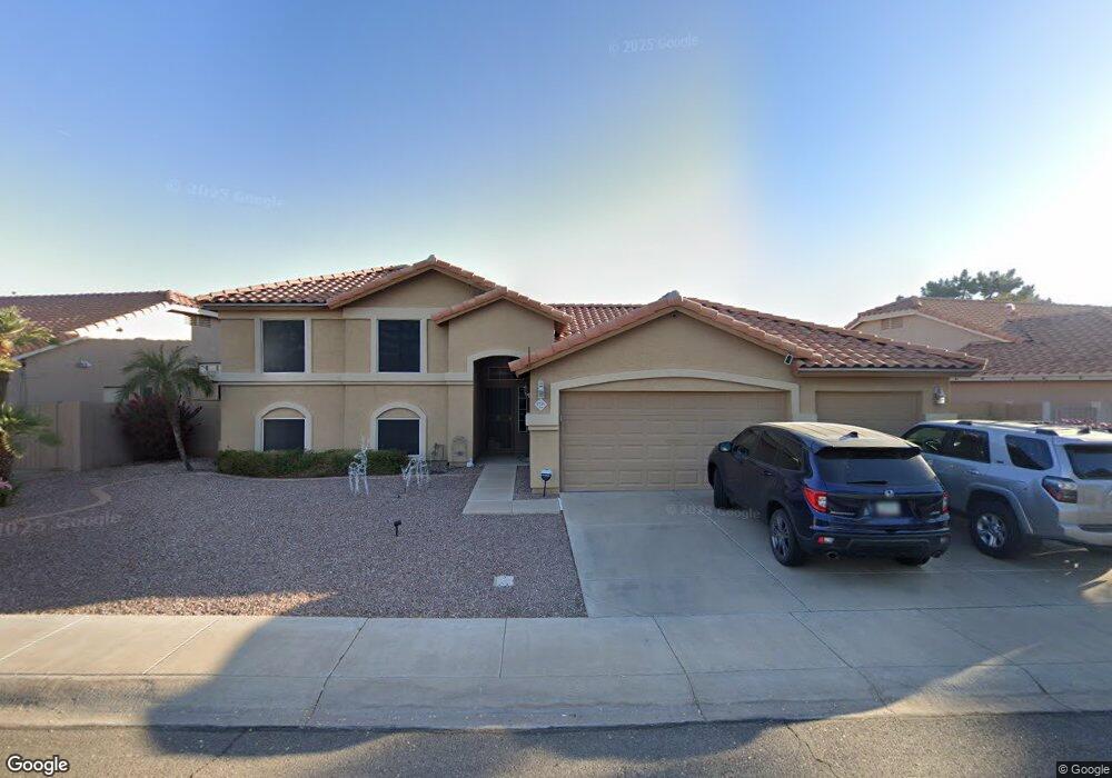
1725 W Gunstock Loop Chandler, AZ 85286
Central Chandler NeighborhoodEstimated Value: $617,102 - $879,000
--
Bed
4
Baths
1,625
Sq Ft
$463/Sq Ft
Est. Value
About This Home
This home is located at 1725 W Gunstock Loop, Chandler, AZ 85286 and is currently estimated at $752,776, approximately $463 per square foot. 1725 W Gunstock Loop is a home located in Maricopa County with nearby schools including Jacobson Elementary School, Bogle Junior High School, and Hamilton High School.
Ownership History
Date
Name
Owned For
Owner Type
Purchase Details
Closed on
Feb 14, 2006
Sold by
Bock Richard A and Bock Delynne
Bought by
Brock Paul H and Brock Donna C
Current Estimated Value
Home Financials for this Owner
Home Financials are based on the most recent Mortgage that was taken out on this home.
Original Mortgage
$416,000
Outstanding Balance
$234,192
Interest Rate
6.2%
Mortgage Type
New Conventional
Estimated Equity
$518,585
Create a Home Valuation Report for This Property
The Home Valuation Report is an in-depth analysis detailing your home's value as well as a comparison with similar homes in the area
Home Values in the Area
Average Home Value in this Area
Purchase History
| Date | Buyer | Sale Price | Title Company |
|---|---|---|---|
| Brock Paul H | $520,000 | Transnation Title Ins Co |
Source: Public Records
Mortgage History
| Date | Status | Borrower | Loan Amount |
|---|---|---|---|
| Open | Brock Paul H | $416,000 |
Source: Public Records
Tax History Compared to Growth
Tax History
| Year | Tax Paid | Tax Assessment Tax Assessment Total Assessment is a certain percentage of the fair market value that is determined by local assessors to be the total taxable value of land and additions on the property. | Land | Improvement |
|---|---|---|---|---|
| 2025 | $2,881 | $36,988 | -- | -- |
| 2024 | $2,783 | $35,226 | -- | -- |
| 2023 | $2,783 | $48,530 | $9,700 | $38,830 |
| 2022 | $2,685 | $36,630 | $7,320 | $29,310 |
| 2021 | $2,814 | $35,280 | $7,050 | $28,230 |
| 2020 | $2,802 | $33,880 | $6,770 | $27,110 |
| 2019 | $2,695 | $34,110 | $6,820 | $27,290 |
| 2018 | $2,609 | $31,300 | $6,260 | $25,040 |
| 2017 | $2,432 | $30,720 | $6,140 | $24,580 |
| 2016 | $2,343 | $30,210 | $6,040 | $24,170 |
| 2015 | $2,270 | $27,620 | $5,520 | $22,100 |
Source: Public Records
Map
Nearby Homes
- 1470 S Villas Ct
- 1832 W Wildhorse Dr
- 1770 W Mulberry Dr
- 1892 W Wildhorse Dr
- 1751 W Mulberry Dr
- 1913 W Remington Dr
- 1563 S Pennington Dr
- 1605 S Ash Dr
- 2005 W Longhorn Dr
- 1694 S Villas Ln
- 1511 W Wildhorse Ct
- 1574 W Maplewood St
- 1838 W Enfield Way
- 1627 W Maplewood St
- 2109 W Wildhorse Dr
- 1831 W Armstrong Way
- 1701 W Springfield Way
- 1761 W Derringer Way
- 1874 W Musket Way
- 1393 W Winchester Way
- 1729 W Gunstock Loop
- 1733 W Gunstock Loop
- 1461 S Cholla Place
- 1451 S Cholla Place
- 1471 S Cholla Place
- 1441 S Cholla Place
- 1737 W Gunstock Loop
- 1713 W Gunstock Loop
- 1431 S Cholla Place
- 1421 S Cholla Place
- 1450 S Villas Ct
- 1460 S Villas Ct
- 1741 W Gunstock Loop
- 1709 W Gunstock Loop
- 1411 S Cholla Place
- 1440 S Villas Ct
- 1823 W Remington Dr
- 1480 S Villas Ct
- 1822 W Wildhorse Dr
- 1824 W Remington Dr