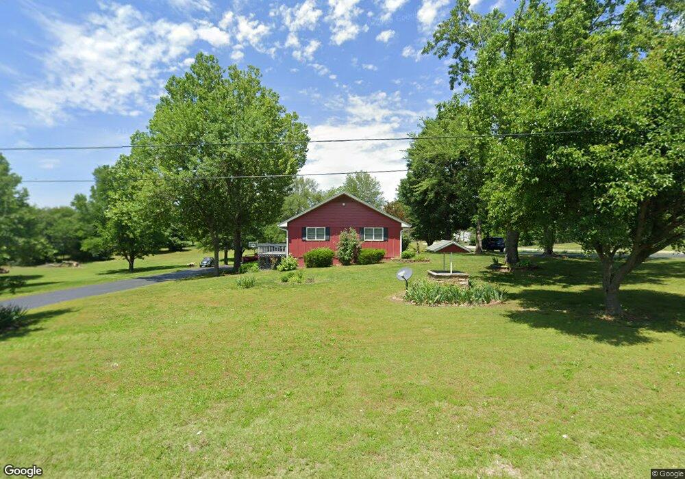
17251 Hawthorne Rd Carthage, MO 64836
Estimated Value: $360,000 - $446,000
4
Beds
3
Baths
3,900
Sq Ft
$105/Sq Ft
Est. Value
About This Home
This home is located at 17251 Hawthorne Rd, Carthage, MO 64836 and is currently estimated at $408,408, approximately $104 per square foot. 17251 Hawthorne Rd is a home located in Jasper County with nearby schools including Carthage High School.
Ownership History
Date
Name
Owned For
Owner Type
Purchase Details
Closed on
Jan 8, 2026
Sold by
Broady Mark and Broady Kayla
Bought by
Mark And Kayla Broady Revocable Trust
Current Estimated Value
Purchase Details
Closed on
Oct 3, 2012
Sold by
Samuelson Michael and Samuelson Lora
Bought by
Broady Mark and Broady Kayla
Home Financials for this Owner
Home Financials are based on the most recent Mortgage that was taken out on this home.
Original Mortgage
$140,000
Interest Rate
3.7%
Mortgage Type
New Conventional
Purchase Details
Closed on
Jan 18, 2005
Sold by
Lawrence Michael G and Lawrence Rayma G
Bought by
Samuelson Michael R and Samuelson Lora D
Home Financials for this Owner
Home Financials are based on the most recent Mortgage that was taken out on this home.
Original Mortgage
$158,000
Interest Rate
5.68%
Mortgage Type
New Conventional
Create a Home Valuation Report for This Property
The Home Valuation Report is an in-depth analysis detailing your home's value as well as a comparison with similar homes in the area
Purchase History
| Date | Buyer | Sale Price | Title Company |
|---|---|---|---|
| Mark And Kayla Broady Revocable Trust | -- | None Listed On Document | |
| Broady Mark | -- | None Available | |
| Samuelson Michael R | -- | -- |
Source: Public Records
Mortgage History
| Date | Status | Borrower | Loan Amount |
|---|---|---|---|
| Previous Owner | Broady Mark | $140,000 | |
| Previous Owner | Samuelson Michael R | $158,000 |
Source: Public Records
Tax History
| Year | Tax Paid | Tax Assessment Tax Assessment Total Assessment is a certain percentage of the fair market value that is determined by local assessors to be the total taxable value of land and additions on the property. | Land | Improvement |
|---|---|---|---|---|
| 2025 | $2,134 | $49,930 | $7,580 | $42,350 |
| 2024 | $2,134 | $45,620 | $7,580 | $38,040 |
| 2023 | $2,134 | $45,620 | $7,580 | $38,040 |
| 2022 | $2,086 | $44,750 | $7,580 | $37,170 |
| 2021 | $2,061 | $44,750 | $7,580 | $37,170 |
| 2020 | $2,000 | $41,720 | $7,580 | $34,140 |
| 2019 | $2,004 | $41,720 | $7,580 | $34,140 |
| 2018 | $1,744 | $36,350 | $0 | $0 |
| 2017 | $1,749 | $36,350 | $0 | $0 |
| 2016 | $1,787 | $37,270 | $0 | $0 |
| 2015 | $1,638 | $37,270 | $0 | $0 |
| 2014 | $1,638 | $37,270 | $0 | $0 |
Source: Public Records
Map
Nearby Homes
- 1019 Hawthorne St
- 8070 County Road 166
- 221 Trowbridge Rd
- 1271 S Plum Ln
- 000 County Lane 175
- 2012 Beau Dr
- 2000 Beau Dr
- 2038 W Trolley Car Ln
- 2038 W 2038 Trolley Car Ln
- 2133 W Fairview Ave
- 2000 Amber Ln
- 1624 Liam St
- 1641 Alexandra Dr
- Lot 3 2nd Addition (Piper Dr) Unit 3
- 1704 Liam St
- 7953 County Lane 192
- 16575 Fir Rd
- 16924 Fir Rd
- 1206 Douglas Ct
- 18136 Fir Rd
- 17203 Hawthorne Rd
- 17238 Hawthorne Rd
- 17202 Irish Rd
- 17184 Hawthorne Rd
- 17168 Irish Rd
- 17153 Hawthorne Rd
- 17169 Irish Rd
- 17144 Irish Rd
- 17124 Hawthorne Rd
- 17133 Irish Rd
- 17192 Isabel Ln
- 17128 Irish Rd
- 17168 Isabel Ln
- 17102 Hawthorne Rd
- 17187 Isabel Ln
- 17375 Hawthorne Rd
- 17012 Ignition Ln
- 17107 Irish Rd
- 7910 County Lane 172
- 17124 Isabel Ln
Your Personal Tour Guide
Ask me questions while you tour the home.