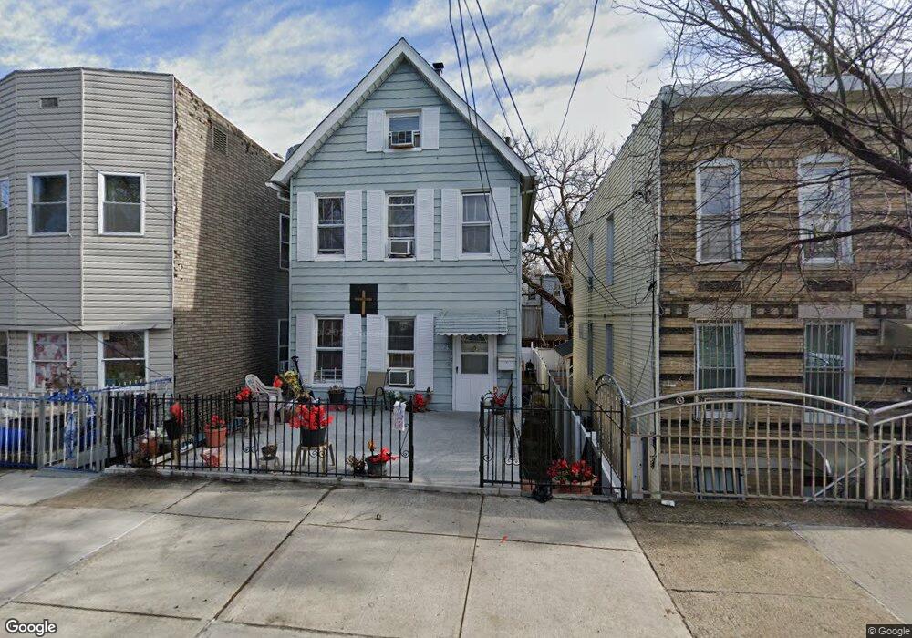
1726 Fillmore St Bronx, NY 10460
Van Nest NeighborhoodEstimated Value: $511,000 - $695,977
--
Bed
--
Bath
1,830
Sq Ft
$350/Sq Ft
Est. Value
About This Home
This home is located at 1726 Fillmore St, Bronx, NY 10460 and is currently estimated at $640,494, approximately $349 per square foot. 1726 Fillmore St is a home located in Bronx County with nearby schools including P.S. 105 Senator Abraham Bernstein, Pelham Academy, and Bronx Green Middle School.
Ownership History
Date
Name
Owned For
Owner Type
Purchase Details
Closed on
Jan 18, 1999
Sold by
First Home Properties Corp
Bought by
Shoulders James and Shoulders Alfreda
Current Estimated Value
Home Financials for this Owner
Home Financials are based on the most recent Mortgage that was taken out on this home.
Original Mortgage
$178,850
Interest Rate
6.78%
Mortgage Type
FHA
Purchase Details
Closed on
Nov 19, 1998
Sold by
Kelly Martin T and Kelly Dorothy
Bought by
First Home Properties Corp
Home Financials for this Owner
Home Financials are based on the most recent Mortgage that was taken out on this home.
Original Mortgage
$178,850
Interest Rate
6.78%
Mortgage Type
FHA
Create a Home Valuation Report for This Property
The Home Valuation Report is an in-depth analysis detailing your home's value as well as a comparison with similar homes in the area
Home Values in the Area
Average Home Value in this Area
Purchase History
| Date | Buyer | Sale Price | Title Company |
|---|---|---|---|
| Shoulders James | $185,000 | Fidelity National Title Ins | |
| First Home Properties Corp | $120,000 | Commonwealth Land Title Ins |
Source: Public Records
Mortgage History
| Date | Status | Borrower | Loan Amount |
|---|---|---|---|
| Previous Owner | Shoulders James | $178,850 |
Source: Public Records
Tax History Compared to Growth
Tax History
| Year | Tax Paid | Tax Assessment Tax Assessment Total Assessment is a certain percentage of the fair market value that is determined by local assessors to be the total taxable value of land and additions on the property. | Land | Improvement |
|---|---|---|---|---|
| 2025 | $5,890 | $29,549 | $6,198 | $23,351 |
| 2024 | $5,890 | $29,326 | $6,796 | $22,530 |
| 2023 | $5,619 | $27,666 | $7,411 | $20,255 |
| 2022 | $5,211 | $35,460 | $8,760 | $26,700 |
| 2021 | $5,182 | $28,800 | $8,760 | $20,040 |
| 2020 | $5,212 | $29,520 | $8,760 | $20,760 |
| 2019 | $5,112 | $29,520 | $8,760 | $20,760 |
| 2018 | $4,700 | $23,055 | $7,480 | $15,575 |
| 2017 | $4,434 | $21,751 | $8,060 | $13,691 |
| 2016 | $4,102 | $20,520 | $7,585 | $12,935 |
| 2015 | $2,255 | $20,520 | $8,524 | $11,996 |
| 2014 | $2,255 | $20,365 | $8,331 | $12,034 |
Source: Public Records
Map
Nearby Homes
- 677 van Nest Ave
- 1679 Unionport Rd
- 591 van Nest Ave
- 679 van Nest Ave
- 633 Mead St
- 1721 White Plains Rd
- 1731 White Plains Rd
- 1713 Taylor Ave
- 1827 Amethyst St
- 1738 Melville St
- 1667 Hunt Ave
- 1622 Van Buren St
- 518 Morris Park Ave
- 506 van Nest Ave
- 504 van Nest Ave
- 508 van Nest Ave
- 681 Rhinelander Ave
- 500 van Nest Ave
- 1865 Hunt Ave
- 1760 E Tremont Ave
- 1728 Fillmore St
- 1722 Fillmore St
- 1730 Fillmore St
- 1734 Fillmore St
- 1714 Fillmore St
- 1736 Fillmore St
- 1727 Unionport Rd
- 1723 Unionport Rd
- 1729 Unionport Rd
- 1731 Unionport Rd
- 1721 Unionport Rd
- 1733 Unionport Rd
- 1738 Fillmore St
- 1712 Fillmore St
- 1712 Fillmore Ave
- 1719 Unionport Rd
- 1735 Unionport Rd
- 1717 Unionport Rd
- 1740 Fillmore St Unit 3
- 1740 Fillmore St Unit 2