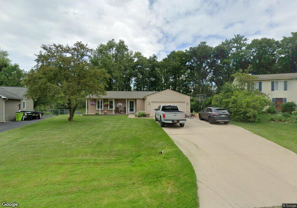
1726 Henbert Rd West Bloomfield, MI 48324
Estimated Value: $284,048 - $356,000
3
Beds
2
Baths
1,225
Sq Ft
$253/Sq Ft
Est. Value
About This Home
This home is located at 1726 Henbert Rd, West Bloomfield, MI 48324 and is currently estimated at $310,012, approximately $253 per square foot. 1726 Henbert Rd is a home located in Oakland County with nearby schools including Haviland Elementary School, Pierce Middle School, and Waterford Mott High School.
Ownership History
Date
Name
Owned For
Owner Type
Purchase Details
Closed on
Mar 31, 2000
Sold by
Emming Steve R
Bought by
Carter Steve E
Current Estimated Value
Home Financials for this Owner
Home Financials are based on the most recent Mortgage that was taken out on this home.
Original Mortgage
$139,150
Outstanding Balance
$45,541
Interest Rate
8.24%
Estimated Equity
$264,471
Purchase Details
Closed on
Aug 21, 1998
Sold by
Jacobs Stephen L
Bought by
Emming Steve R
Create a Home Valuation Report for This Property
The Home Valuation Report is an in-depth analysis detailing your home's value as well as a comparison with similar homes in the area
Home Values in the Area
Average Home Value in this Area
Purchase History
| Date | Buyer | Sale Price | Title Company |
|---|---|---|---|
| Carter Steve E | $146,500 | -- | |
| Emming Steve R | $144,000 | -- |
Source: Public Records
Mortgage History
| Date | Status | Borrower | Loan Amount |
|---|---|---|---|
| Open | Carter Steve E | $139,150 |
Source: Public Records
Tax History
| Year | Tax Paid | Tax Assessment Tax Assessment Total Assessment is a certain percentage of the fair market value that is determined by local assessors to be the total taxable value of land and additions on the property. | Land | Improvement |
|---|---|---|---|---|
| 2025 | $2,789 | $142,530 | $48,600 | $93,930 |
| 2024 | $1,634 | $129,200 | $0 | $0 |
| 2022 | $1,559 | $121,710 | $36,000 | $85,710 |
| 2021 | $2,399 | $103,420 | $0 | $0 |
| 2020 | $1,427 | $98,700 | $26,570 | $72,130 |
| 2018 | $2,294 | $86,550 | $21,000 | $65,550 |
| 2015 | -- | $70,370 | $0 | $0 |
| 2014 | -- | $65,020 | $0 | $0 |
| 2011 | -- | $59,510 | $0 | $0 |
Source: Public Records
Map
Nearby Homes
- 1763 Henbert Rd
- 6620 Red Cedar Ln Unit 37
- VAC Mercedes Ave
- 2275 Forest Glen
- 6313 Kiev St
- 1150 Jay St
- 0000 Hiller Rd
- 6301 Mission Dr
- 5617 Millpointe Dr
- 5920 Greer Rd
- 9999 Cooley Lake Rd
- 5699 Applegrove Dr
- 2110 Peachtree Ct
- 1701 Marylestone Dr
- Lot 94 Hiller Rd
- 1295 Edelweiss Ln Unit 60
- 7093 Rolling Hills Dr Unit 13
- 1630 Weymouth St
- 5783 Williamsburg Ct
- 1860 Hiller Rd
- 1702 Henbert Rd
- 1734 Henbert Rd
- 1703 Henbert Rd
- 1750 Henbert Rd
- 1747 Henbert Rd
- 1717 Henbert Rd
- 1752 Henbert Rd
- 1761 Henbert Rd
- 1733 Henbert Rd
- 1770 Henbert Rd
- 1749 Henbert Rd
- 1775 Henbert Rd
- 1788 Henbert Rd
- 1804 Henbert Rd
- 1789 Henbert Rd
- 1739 Henbert Ct
- 1779 Henbert Rd
- 1777 Henbert Ct Unit Bldg-Unit
- 1777 Henbert Ct
- 6304 Hermana Rd
Your Personal Tour Guide
Ask me questions while you tour the home.