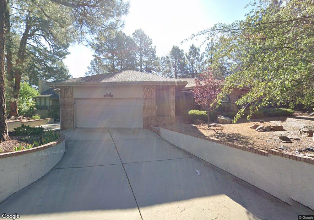
1726 Rolling Hills Dr Prescott, AZ 86303
Estimated Value: $671,460 - $817,000
3
Beds
2
Baths
1,987
Sq Ft
$371/Sq Ft
Est. Value
About This Home
This home is located at 1726 Rolling Hills Dr, Prescott, AZ 86303 and is currently estimated at $736,365, approximately $370 per square foot. 1726 Rolling Hills Dr is a home located in Yavapai County with nearby schools including Lincoln Elementary School, Granite Mountain Middle School, and Prescott Mile High Middle School.
Ownership History
Date
Name
Owned For
Owner Type
Purchase Details
Closed on
Apr 6, 2015
Sold by
Alexander James A
Bought by
Alexander James A
Current Estimated Value
Purchase Details
Closed on
Sep 2, 2009
Sold by
Relth Erwin H and Relth Arlene E
Bought by
Alexander James A and Alexander Susie E
Home Financials for this Owner
Home Financials are based on the most recent Mortgage that was taken out on this home.
Original Mortgage
$260,000
Outstanding Balance
$169,086
Interest Rate
5.08%
Mortgage Type
Seller Take Back
Estimated Equity
$567,279
Purchase Details
Closed on
Apr 15, 1998
Sold by
Lewis Richard W
Bought by
Relth Erwin and Relth Arlene
Home Financials for this Owner
Home Financials are based on the most recent Mortgage that was taken out on this home.
Original Mortgage
$89,900
Interest Rate
7.11%
Mortgage Type
New Conventional
Create a Home Valuation Report for This Property
The Home Valuation Report is an in-depth analysis detailing your home's value as well as a comparison with similar homes in the area
Home Values in the Area
Average Home Value in this Area
Purchase History
| Date | Buyer | Sale Price | Title Company |
|---|---|---|---|
| Alexander James A | -- | None Available | |
| Alexander James A | $310,000 | Pioneer Title Agency Inc | |
| Relth Erwin | $189,900 | Capital Title Agency |
Source: Public Records
Mortgage History
| Date | Status | Borrower | Loan Amount |
|---|---|---|---|
| Open | Alexander James A | $260,000 | |
| Previous Owner | Relth Erwin | $89,900 |
Source: Public Records
Tax History Compared to Growth
Tax History
| Year | Tax Paid | Tax Assessment Tax Assessment Total Assessment is a certain percentage of the fair market value that is determined by local assessors to be the total taxable value of land and additions on the property. | Land | Improvement |
|---|---|---|---|---|
| 2026 | $1,765 | $56,511 | -- | -- |
| 2024 | $1,728 | $57,451 | -- | -- |
| 2023 | $1,728 | $47,875 | $0 | $0 |
| 2022 | $1,704 | $36,541 | $7,877 | $28,664 |
| 2021 | $1,829 | $36,267 | $7,164 | $29,103 |
| 2020 | $1,837 | $0 | $0 | $0 |
| 2019 | $1,824 | $0 | $0 | $0 |
| 2018 | $1,743 | $0 | $0 | $0 |
| 2017 | $1,679 | $0 | $0 | $0 |
| 2016 | $1,672 | $0 | $0 | $0 |
| 2015 | $1,622 | $0 | $0 | $0 |
| 2014 | -- | $0 | $0 | $0 |
Source: Public Records
Map
Nearby Homes
- 1733 Rolling Hills Dr
- 1183 Ravens Ct
- 1088 Pine Country Ct
- 1167 Eagles Nest
- 1224 Timber Point N
- 1171 Eagles Nest
- 1751 W Wilderness Trail
- 1620 S Sunnyside Rd
- 01 W Wilderness Trail
- 1155 Trails End
- 0 W Wilderness Trail
- 1180 W Timber Ridge Rd
- 1786 Rolling Hills Dr
- 1970 Copper Basin Rd
- 1190 W Cougar Ln
- 1289 S Manzanita Hill Rd
- 1804 Pony Soldier Rd
- 855 Angelita Dr
- 1314 W Skyview Dr
- 1700 Sheriffs Posse Trail
- 1728 Rolling Hills Dr
- 1203 Rolling Hills Cir
- 1201 Rolling Hills Cir
- 1730 Rolling Hills Dr Unit 2
- 1727 Rolling Hills Dr
- 1727 Rolling Hills Dr Unit 2
- 1205 Rolling Hills Cir
- 1729 Rolling Hills Dr Unit 11
- 1729 Rolling Hills Dr Unit 2
- 1732 Rolling Hills Dr
- 1731 Rolling Hills Dr Unit 2
- 1720 Rolling Hills Dr Unit 2
- 1723 Rolling Hills Dr Unit 2
- 1169 W Copper Canyon Dr
- 1734 Rolling Hills Dr
- 1207 Rolling Hills Cir
- 1169 Copper Canyon Dr
- 1206 Rolling Hills Cir
- 1208 Rolling Hills Cir Unit 2
- 1189 Fox Trail