Estimated Value: $665,298 - $716,000
3
Beds
2
Baths
1,664
Sq Ft
$420/Sq Ft
Est. Value
About This Home
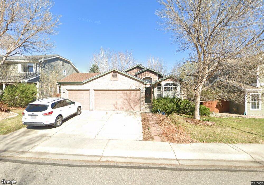
This home is located at 1726 Walker St, Erie, CO 80516 and is currently estimated at $698,325, approximately $419 per square foot. 1726 Walker St is a home located in Boulder County with nearby schools including Meadowlark School, Centaurus High School, and Peak to Peak Charter School.
Ownership History
Date
Name
Owned For
Owner Type
Purchase Details
Closed on
Nov 18, 2005
Sold by
Hildreth Karen
Bought by
Sturgis Harold R
Current Estimated Value
Home Financials for this Owner
Home Financials are based on the most recent Mortgage that was taken out on this home.
Original Mortgage
$248,000
Outstanding Balance
$134,885
Interest Rate
5.92%
Mortgage Type
Fannie Mae Freddie Mac
Estimated Equity
$563,440
Purchase Details
Closed on
Jul 28, 2000
Sold by
Villalon Martin Don S and Villalon Dori
Bought by
Hildreth Karen
Home Financials for this Owner
Home Financials are based on the most recent Mortgage that was taken out on this home.
Original Mortgage
$210,000
Interest Rate
8.15%
Purchase Details
Closed on
Dec 7, 1998
Sold by
Kdb Homes Inc
Bought by
Martin Don S
Home Financials for this Owner
Home Financials are based on the most recent Mortgage that was taken out on this home.
Original Mortgage
$181,543
Interest Rate
7.05%
Create a Home Valuation Report for This Property
The Home Valuation Report is an in-depth analysis detailing your home's value as well as a comparison with similar homes in the area
Home Values in the Area
Average Home Value in this Area
Purchase History
| Date | Buyer | Sale Price | Title Company |
|---|---|---|---|
| Sturgis Harold R | $310,000 | Title America | |
| Hildreth Karen | $262,500 | -- | |
| Martin Don S | $201,939 | First American Heritage Titl |
Source: Public Records
Mortgage History
| Date | Status | Borrower | Loan Amount |
|---|---|---|---|
| Open | Sturgis Harold R | $248,000 | |
| Previous Owner | Hildreth Karen | $210,000 | |
| Previous Owner | Martin Don S | $181,543 | |
| Closed | Hildreth Karen | $26,250 |
Source: Public Records
Tax History Compared to Growth
Tax History
| Year | Tax Paid | Tax Assessment Tax Assessment Total Assessment is a certain percentage of the fair market value that is determined by local assessors to be the total taxable value of land and additions on the property. | Land | Improvement |
|---|---|---|---|---|
| 2025 | $3,582 | $40,225 | $10,694 | $29,531 |
| 2024 | $3,582 | $40,225 | $10,694 | $29,531 |
| 2023 | $3,531 | $40,636 | $14,231 | $30,090 |
| 2022 | $2,833 | $32,456 | $9,000 | $23,456 |
| 2021 | $2,825 | $33,390 | $9,259 | $24,131 |
| 2020 | $2,648 | $31,518 | $5,792 | $25,726 |
| 2019 | $3,382 | $31,518 | $5,792 | $25,726 |
| 2018 | $3,151 | $28,829 | $8,136 | $20,693 |
| 2017 | $2,964 | $31,872 | $8,995 | $22,877 |
| 2016 | $2,879 | $27,120 | $11,622 | $15,498 |
| 2015 | $2,752 | $22,097 | $6,686 | $15,411 |
| 2014 | $2,291 | $22,097 | $6,686 | $15,411 |
Source: Public Records
Map
Nearby Homes
- 1842 Southard St
- 1426 Lyons Ln
- 1321 Alexandria St
- 1381 Siltstone St
- 1305 Balmora St
- 1305 Inverness Dr
- 1331 Fountain Ln
- 1195 Fox Hills Ct
- 848 Sandstone Cir
- 309 Baron Ave
- 2326 Carbonate Cir
- 1063 Sandstone Cir
- 1920 Marfell St
- 304 W Beacon Hill Dr
- 972 Carbonate Ln
- 300 Lucerne Dr
- 908 Dinosaur Dr
- 1182 Red Iron Ct
- 1205 Red Iron Ct
- 2268 Front Range Rd
- 1736 Walker St
- 1716 Walker St
- 1704 Walker St
- 1699 Woodward St
- 1685 Woodward St
- 1751 Powell St
- 1737 Powell St
- 1735 Walker St
- 1725 Walker St
- 1694 Walker St
- 1743 Walker St
- 1715 Walker St
- 1673 Woodward St
- 1725 Powell St
- 1765 Powell St
- 1705 Walker St
- 1697 Walker St
- 1777 Powell St
- 1684 Walker St
- 1760 MacCullen Dr