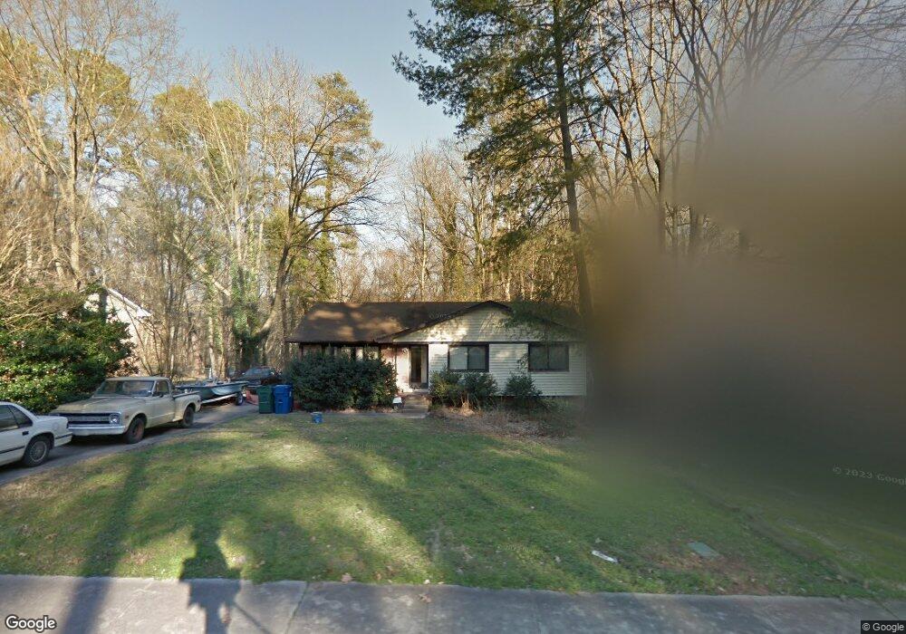
1727 Euclid Rd Durham, NC 27713
Estimated Value: $330,000 - $386,903
4
Beds
2
Baths
1,848
Sq Ft
$195/Sq Ft
Est. Value
About This Home
This home is located at 1727 Euclid Rd, Durham, NC 27713 and is currently estimated at $361,226, approximately $195 per square foot. 1727 Euclid Rd is a home located in Durham County with nearby schools including Parkwood Elementary, Lowe's Grove Middle, and Hillside High School.
Ownership History
Date
Name
Owned For
Owner Type
Purchase Details
Closed on
Jul 3, 2014
Sold by
Stancil Scott A and Stancil Beth D
Bought by
Quattlebaum William F
Current Estimated Value
Purchase Details
Closed on
Apr 26, 2002
Sold by
Mauer Shirley Walker and Walker Shirley
Bought by
Stancil Scott A and Stancil Beth D
Home Financials for this Owner
Home Financials are based on the most recent Mortgage that was taken out on this home.
Original Mortgage
$142,782
Interest Rate
7.07%
Mortgage Type
VA
Create a Home Valuation Report for This Property
The Home Valuation Report is an in-depth analysis detailing your home's value as well as a comparison with similar homes in the area
Purchase History
| Date | Buyer | Sale Price | Title Company |
|---|---|---|---|
| Quattlebaum William F | $136,000 | None Available | |
| Stancil Scott A | $138,000 | -- |
Source: Public Records
Mortgage History
| Date | Status | Borrower | Loan Amount |
|---|---|---|---|
| Previous Owner | Stancil Scott A | $142,782 |
Source: Public Records
Tax History
| Year | Tax Paid | Tax Assessment Tax Assessment Total Assessment is a certain percentage of the fair market value that is determined by local assessors to be the total taxable value of land and additions on the property. | Land | Improvement |
|---|---|---|---|---|
| 2025 | $3,792 | $382,529 | $129,000 | $253,529 |
| 2024 | $3,186 | $228,380 | $38,730 | $189,650 |
| 2023 | $2,637 | $201,277 | $38,730 | $162,547 |
| 2022 | $2,576 | $201,277 | $38,730 | $162,547 |
| 2021 | $2,564 | $201,277 | $38,730 | $162,547 |
| 2020 | $2,504 | $201,277 | $38,730 | $162,547 |
| 2019 | $2,504 | $201,277 | $38,730 | $162,547 |
| 2018 | $2,252 | $165,984 | $35,502 | $130,482 |
| 2017 | $2,235 | $165,984 | $35,502 | $130,482 |
| 2016 | $2,160 | $165,984 | $35,502 | $130,482 |
| 2015 | $2,214 | $159,945 | $26,083 | $133,862 |
| 2014 | $2,214 | $159,945 | $26,083 | $133,862 |
Source: Public Records
Map
Nearby Homes
- 1509 Clermont Rd Unit T27
- 1509 Clermont Rd Unit T24
- 1621 Clermont Rd
- 1304 Seaton Rd Unit 1
- 27 Sunflower Ct
- 1215 Lotus Lilly Dr
- 1203 Lotus Lilly Dr
- 111 Wenonah Way
- 1022 Orchard Grass Rd
- 1208 Catch Fly Ln
- 1039 Laceflower Dr
- 1142 Metropolitan Dr
- 1038 Laceflower Dr
- 1049 Laceflower Dr
- 1107 Rocketcress Dr
- 1115 Rocketcress Dr
- 104 Deblyn Ct
- 109 Settlers Mill Ln
- 5504 Pelham Rd
- 4517 Grandale Dr
- 1729 Euclid Rd
- 1725 Euclid Rd
- 1731 Euclid Rd
- 1723 Euclid Rd
- 1724 Euclid Rd
- 1726 Euclid Rd
- 1722 Euclid Rd
- 1733 Euclid Rd
- 1721 Euclid Rd
- 1720 Euclid Rd
- 1730 Euclid Rd
- 1801 Euclid Rd
- 1719 Euclid Rd
- 1718 Euclid Rd
- 1803 Euclid Rd
- 1717 Euclid Rd
- 101 Emerald Cir
- 1716 Euclid Rd
- 109 Bradley Cir
- 104 Emerald Cir