Estimated Value: $233,000 - $299,000
4
Beds
3
Baths
1,092
Sq Ft
$233/Sq Ft
Est. Value
About This Home
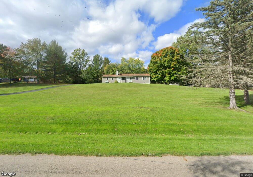
This home is located at 1727 Gunn Rd, Holt, MI 48842 and is currently estimated at $254,338, approximately $232 per square foot. 1727 Gunn Rd is a home located in Ingham County with nearby schools including Horizon Elementary School, Washington Woods Middle School, and Holt Junior High School.
Ownership History
Date
Name
Owned For
Owner Type
Purchase Details
Closed on
Jan 27, 2022
Sold by
Slear James N
Bought by
Slear James N
Current Estimated Value
Purchase Details
Closed on
Nov 23, 2010
Sold by
Slear James N
Bought by
Slear James N and Slear Bridgitt M
Home Financials for this Owner
Home Financials are based on the most recent Mortgage that was taken out on this home.
Original Mortgage
$86,500
Interest Rate
4.5%
Mortgage Type
New Conventional
Purchase Details
Closed on
Jun 9, 2000
Sold by
Barnard Diane A and Barnard James C
Bought by
Slear James N
Home Financials for this Owner
Home Financials are based on the most recent Mortgage that was taken out on this home.
Original Mortgage
$107,050
Interest Rate
8.56%
Mortgage Type
Purchase Money Mortgage
Create a Home Valuation Report for This Property
The Home Valuation Report is an in-depth analysis detailing your home's value as well as a comparison with similar homes in the area
Home Values in the Area
Average Home Value in this Area
Purchase History
| Date | Buyer | Sale Price | Title Company |
|---|---|---|---|
| Slear James N | -- | None Listed On Document | |
| Slear James N | -- | Bell Title | |
| Slear James N | $112,700 | Midstate Title Company |
Source: Public Records
Mortgage History
| Date | Status | Borrower | Loan Amount |
|---|---|---|---|
| Previous Owner | Slear James N | $86,500 | |
| Previous Owner | Slear James N | $107,050 |
Source: Public Records
Tax History Compared to Growth
Tax History
| Year | Tax Paid | Tax Assessment Tax Assessment Total Assessment is a certain percentage of the fair market value that is determined by local assessors to be the total taxable value of land and additions on the property. | Land | Improvement |
|---|---|---|---|---|
| 2025 | $3,630 | $95,600 | $15,200 | $80,400 |
| 2024 | $9 | $81,800 | $15,200 | $66,600 |
| 2023 | $3,395 | $80,600 | $15,200 | $65,400 |
| 2022 | $3,220 | $75,600 | $14,500 | $61,100 |
| 2021 | $3,135 | $74,500 | $13,700 | $60,800 |
| 2020 | $3,144 | $70,000 | $13,700 | $56,300 |
| 2019 | $3,077 | $64,200 | $13,700 | $50,500 |
| 2018 | $3,059 | $61,000 | $13,700 | $47,300 |
| 2017 | $2,780 | $61,000 | $13,700 | $47,300 |
| 2016 | $2,756 | $58,500 | $13,700 | $44,800 |
| 2015 | $2,700 | $55,900 | $27,339 | $28,561 |
| 2014 | $2,700 | $54,700 | $35,146 | $19,554 |
Source: Public Records
Map
Nearby Homes
- 1800 N Onondaga Rd
- 5243 Witherspoon Way
- 1946 Gunn Rd
- 5386 Auben Ln
- 1820 Merganser Dr
- 1819 Merganser Dr
- 5360 Holt Rd
- 1812 Hollowbrook Dr
- 1851 Hollowbrook Dr
- 5064 Glendurgan Ct
- TBD N Onondaga Rd
- 5058 Glendurgan Ct
- The Newton Plan at Meadow Ridge
- The Windsor Plan at Meadow Ridge
- The Hickory Plan at Meadow Ridge
- The Hatfield Plan at Meadow Ridge
- The Norway Plan at Meadow Ridge
- The Waverly Plan at Meadow Ridge
- The Westfield Plan at Meadow Ridge
- The Nantucket Plan at Meadow Ridge
- 1715 Gunn Rd
- 1733 Gunn Rd
- 1701 Gunn Rd
- 1729 Gunn Rd
- 1741 Gunn Rd
- 1693 Gunn Rd
- 1755 Gunn Rd
- 1670 Gunn Rd
- 1660 Gunn Rd
- 1679 Gunn Rd
- 1657 Royal Crescent
- 5348 Somerset Dr
- 1649 Royal Crescent Dr
- 1668 Royal Crescent Dr
- 1763 Gunn Rd
- 1643 Gunn Rd
- 1674 Royal Crescent Dr
- 1674 Royal Crescent
- 5344 Somerset Dr
- 5340 Somerset Dr