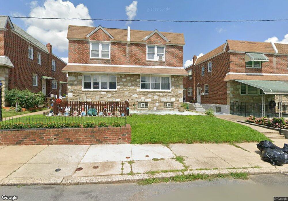
1727 Kendrick St Philadelphia, PA 19152
Rhawnhurst NeighborhoodEstimated Value: $276,000 - $339,000
--
Bed
--
Bath
1,354
Sq Ft
$232/Sq Ft
Est. Value
About This Home
This home is located at 1727 Kendrick St, Philadelphia, PA 19152 and is currently estimated at $314,275, approximately $232 per square foot. 1727 Kendrick St is a home with nearby schools including Farrell Louis H School, Northeast High School, and Tacony Academy Charter School.
Ownership History
Date
Name
Owned For
Owner Type
Purchase Details
Closed on
Oct 10, 2019
Sold by
Shlomo Ofer and Shlomo Michelle Jaye
Bought by
Lin John and Cheung Chi Hung
Current Estimated Value
Home Financials for this Owner
Home Financials are based on the most recent Mortgage that was taken out on this home.
Original Mortgage
$100,000
Outstanding Balance
$66,498
Interest Rate
3.4%
Mortgage Type
New Conventional
Estimated Equity
$247,777
Purchase Details
Closed on
Aug 31, 2001
Sold by
Burstein Hyman and Berstein Ruth
Bought by
Ofer Shlomo Michelle Jaye and Ofer Shlomo
Create a Home Valuation Report for This Property
The Home Valuation Report is an in-depth analysis detailing your home's value as well as a comparison with similar homes in the area
Home Values in the Area
Average Home Value in this Area
Purchase History
| Date | Buyer | Sale Price | Title Company |
|---|---|---|---|
| Lin John | $180,000 | Northwest Abstract Co Inc | |
| Ofer Shlomo Michelle Jaye | -- | -- |
Source: Public Records
Mortgage History
| Date | Status | Borrower | Loan Amount |
|---|---|---|---|
| Open | Lin John | $100,000 |
Source: Public Records
Tax History Compared to Growth
Tax History
| Year | Tax Paid | Tax Assessment Tax Assessment Total Assessment is a certain percentage of the fair market value that is determined by local assessors to be the total taxable value of land and additions on the property. | Land | Improvement |
|---|---|---|---|---|
| 2025 | $3,340 | $298,400 | $59,680 | $238,720 |
| 2024 | $3,340 | $298,400 | $59,680 | $238,720 |
| 2023 | $3,340 | $238,600 | $47,720 | $190,880 |
| 2022 | $3,340 | $238,600 | $47,720 | $190,880 |
| 2021 | $2,844 | $0 | $0 | $0 |
| 2020 | $2,844 | $0 | $0 | $0 |
| 2019 | $2,590 | $0 | $0 | $0 |
| 2018 | $2,398 | $0 | $0 | $0 |
| 2017 | $2,398 | $0 | $0 | $0 |
| 2016 | $2,398 | $0 | $0 | $0 |
| 2015 | $2,272 | $0 | $0 | $0 |
| 2014 | -- | $171,300 | $34,280 | $137,020 |
| 2012 | -- | $23,552 | $3,089 | $20,463 |
Source: Public Records
Map
Nearby Homes
- 1716 Bergen St
- 1711 Kendrick St
- 1804 Megargee St
- 1712 Tustin St
- 1828 Megargee St
- 1907 Tustin St
- 1832 Mower St
- 1834 Mower St
- 8606 Frontenac St
- 8614 Agusta St
- 1617 Solly Ave
- 1702 Arthur St
- 1704 Stanwood St
- 8523 Benton Ave
- 8562 Benton Ave
- 8563 Benton Ave
- 2155 Benson St
- 1625 Rhawn St
- 2162 Strahle St
- 1718 Rhawn St
- 1725 Kendrick St
- 1729 Kendrick St
- 1731 Kendrick St
- 1723 Kendrick St
- 1733 Kendrick St
- 1721 Kendrick St
- 1726 Bergen St
- 1724 Bergen St
- 1735 Kendrick St
- 1728 Bergen St
- 1730 Bergen St
- 1719 Kendrick St
- 1722 Bergen St
- 1732 Bergen St
- 1720 Bergen St
- 1717 Kendrick St
- 1734 Bergen St
- 1726 Kendrick St
- 1724 Kendrick St
- 1728 Kendrick St