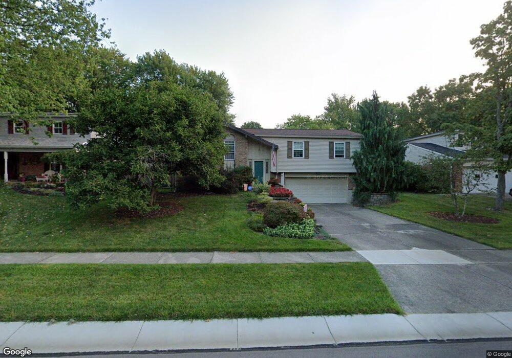
1727 Loisdale Ct Cincinnati, OH 45255
Estimated Value: $306,000 - $381,000
3
Beds
3
Baths
1,839
Sq Ft
$186/Sq Ft
Est. Value
About This Home
This home is located at 1727 Loisdale Ct, Cincinnati, OH 45255 and is currently estimated at $342,929, approximately $186 per square foot. 1727 Loisdale Ct is a home located in Hamilton County with nearby schools including Summit Elementary School, Nagel Middle School, and Anderson High School.
Ownership History
Date
Name
Owned For
Owner Type
Purchase Details
Closed on
Aug 21, 1998
Sold by
Romerill James P
Bought by
Shehan Robin L
Current Estimated Value
Home Financials for this Owner
Home Financials are based on the most recent Mortgage that was taken out on this home.
Original Mortgage
$121,500
Interest Rate
7.03%
Mortgage Type
VA
Purchase Details
Closed on
Nov 3, 1994
Sold by
Molin Gregory L and Molin Lori A
Bought by
Romerill James P
Home Financials for this Owner
Home Financials are based on the most recent Mortgage that was taken out on this home.
Original Mortgage
$60,000
Interest Rate
8.91%
Create a Home Valuation Report for This Property
The Home Valuation Report is an in-depth analysis detailing your home's value as well as a comparison with similar homes in the area
Home Values in the Area
Average Home Value in this Area
Purchase History
| Date | Buyer | Sale Price | Title Company |
|---|---|---|---|
| Shehan Robin L | $121,500 | -- | |
| Shehan Robin L | $121,500 | -- | |
| Romerill James P | -- | -- |
Source: Public Records
Mortgage History
| Date | Status | Borrower | Loan Amount |
|---|---|---|---|
| Open | Shehan Robin L | $121,500 | |
| Closed | Shehan Robin L | $121,500 | |
| Previous Owner | Romerill James P | $60,000 |
Source: Public Records
Tax History Compared to Growth
Tax History
| Year | Tax Paid | Tax Assessment Tax Assessment Total Assessment is a certain percentage of the fair market value that is determined by local assessors to be the total taxable value of land and additions on the property. | Land | Improvement |
|---|---|---|---|---|
| 2024 | $5,517 | $90,857 | $16,737 | $74,120 |
| 2023 | $5,248 | $90,857 | $16,737 | $74,120 |
| 2022 | $3,984 | $61,408 | $14,550 | $46,858 |
| 2021 | $3,890 | $61,408 | $14,550 | $46,858 |
| 2020 | $3,935 | $61,408 | $14,550 | $46,858 |
| 2019 | $3,836 | $54,345 | $12,877 | $41,468 |
| 2018 | $3,593 | $54,345 | $12,877 | $41,468 |
| 2017 | $3,388 | $54,345 | $12,877 | $41,468 |
| 2016 | $3,275 | $51,318 | $12,618 | $38,700 |
| 2015 | $3,181 | $51,318 | $12,618 | $38,700 |
| 2014 | $3,183 | $51,318 | $12,618 | $38,700 |
| 2013 | $3,071 | $52,368 | $12,877 | $39,491 |
Source: Public Records
Map
Nearby Homes
- 1797 Muskegon Dr
- 1728 Rockhurst Ln
- 8486 Bethany Ln
- 1624 Pinebluff Ln
- 2051 Tall Pines Ln
- 4172 Brandonmore Dr
- 8557 Linderwood Ln
- 471 Sanctuary Way
- 473 Sanctuary Way
- 475 Sanctuary Way
- 477 Sanctuary Way
- 477 Sanctuary Way Unit 23
- 482 Sanctuary Way
- 486 Sanctuary Way
- 488 Sanctuary Way
- 490 Sanctuary Way
- 492 Sanctuary Way
- 8410 Kilkenny Dr
- 494 Sanctuary Way
- 496 Sanctuary Way
- 1721 Loisdale Ct
- 1733 Loisdale Ct
- 1715 Loisdale Ct
- 8609 Denallen Dr
- 8617 Denallen Dr
- 8601 Denallen Dr
- 1741 Loisdale Ct
- 1771 Loisdale Ct
- 1730 Loisdale Ct
- 1724 Loisdale Ct
- 8625 Denallen Dr
- 1777 Loisdale Ct
- 1709 Loisdale Ct
- 8593 Denallen Dr
- 1718 Loisdale Ct
- 1736 Loisdale Ct
- 1787 Loisdale Ct
- 1742 Loisdale Ct
- 1712 Loisdale Ct
- 8585 Denallen Dr