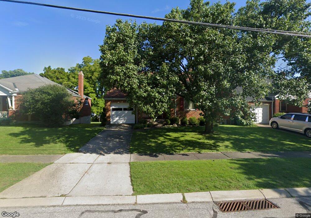
1727 Tuxworth Ave Cincinnati, OH 45238
West Price Hill NeighborhoodEstimated Value: $148,000 - $215,000
3
Beds
2
Baths
987
Sq Ft
$195/Sq Ft
Est. Value
About This Home
This home is located at 1727 Tuxworth Ave, Cincinnati, OH 45238 and is currently estimated at $192,501, approximately $195 per square foot. 1727 Tuxworth Ave is a home located in Hamilton County with nearby schools including Carson School, Gilbert A. Dater High School, and Western Hills High School.
Ownership History
Date
Name
Owned For
Owner Type
Purchase Details
Closed on
Dec 5, 2023
Sold by
Shaffer Christopher G
Bought by
Ramirez Nicolas Juarez and Lopez Maria Marta
Current Estimated Value
Purchase Details
Closed on
Aug 7, 2003
Sold by
Johnson Mark G
Bought by
Shaffer Christopher G
Home Financials for this Owner
Home Financials are based on the most recent Mortgage that was taken out on this home.
Original Mortgage
$98,600
Interest Rate
5.62%
Mortgage Type
Unknown
Create a Home Valuation Report for This Property
The Home Valuation Report is an in-depth analysis detailing your home's value as well as a comparison with similar homes in the area
Home Values in the Area
Average Home Value in this Area
Purchase History
| Date | Buyer | Sale Price | Title Company |
|---|---|---|---|
| Ramirez Nicolas Juarez | $145,000 | None Listed On Document | |
| Ramirez Nicolas Juarez | $145,000 | None Listed On Document | |
| Shaffer Christopher G | $116,000 | -- |
Source: Public Records
Mortgage History
| Date | Status | Borrower | Loan Amount |
|---|---|---|---|
| Previous Owner | Shaffer Christopher G | $98,600 |
Source: Public Records
Tax History Compared to Growth
Tax History
| Year | Tax Paid | Tax Assessment Tax Assessment Total Assessment is a certain percentage of the fair market value that is determined by local assessors to be the total taxable value of land and additions on the property. | Land | Improvement |
|---|---|---|---|---|
| 2024 | $3,005 | $50,173 | $5,590 | $44,583 |
| 2023 | $3,072 | $50,173 | $5,590 | $44,583 |
| 2022 | $2,070 | $30,240 | $5,551 | $24,689 |
| 2021 | $1,989 | $30,240 | $5,551 | $24,689 |
| 2020 | $2,047 | $30,240 | $5,551 | $24,689 |
| 2019 | $2,035 | $27,493 | $5,047 | $22,446 |
| 2018 | $2,038 | $27,493 | $5,047 | $22,446 |
| 2017 | $1,936 | $27,493 | $5,047 | $22,446 |
| 2016 | $2,248 | $31,525 | $5,394 | $26,131 |
| 2015 | $2,028 | $31,525 | $5,394 | $26,131 |
| 2014 | $2,042 | $31,525 | $5,394 | $26,131 |
| 2013 | $2,359 | $35,823 | $6,129 | $29,694 |
Source: Public Records
Map
Nearby Homes
- 1774 Ashbrook Dr
- 4764 Clevesdale Dr
- 1803 Ashbrook Dr
- 1861 Ashbrook Dr
- 1869 Ashbrook Dr
- 4798 Prosperity Place
- 4769 Hardwick Dr
- 4826 Prosperity Place
- 4885 N Overlook Ave
- 4965 Glenway Ave
- 4934 Relleum Ave
- 4910 Ferguson Place
- 5020 Sidney Rd
- 4925 Shirley Place
- 5027 Sidney Rd
- 1131 Olivia Ln
- 4638 Glenway Ave
- 5009 Relleum Ave
- 4975 Heuwerth Ave
- 4998 Western Hills Ave
- 1723 Tuxworth Ave
- 1731 Tuxworth Ave
- 1719 Tuxworth Ave
- 1735 Tuxworth Ave
- 1762 Ashbrook Dr
- 1758 Ashbrook Dr
- 1766 Ashbrook Dr
- 1754 Ashbrook Dr
- 1739 Tuxworth Ave
- 1770 Ashbrook Dr
- 1750 Ashbrook Dr
- 4515 Western Hills Ave
- 1726 Tuxworth Ave
- 1722 Tuxworth Ave
- 1711 Tuxworth Ave
- 1746 Ashbrook Dr
- 1734 Tuxworth Ave
- 1734 Tuxworth Ave Unit 1
- 1743 Tuxworth Ave
- 1718 Tuxworth Ave