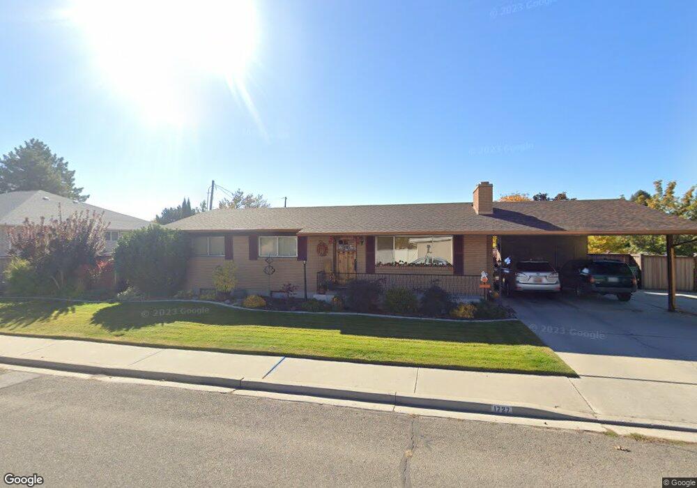
1727 W 1320 N Provo, UT 84604
Grandview South NeighborhoodEstimated Value: $508,706 - $570,000
5
Beds
3
Baths
1,242
Sq Ft
$429/Sq Ft
Est. Value
About This Home
This home is located at 1727 W 1320 N, Provo, UT 84604 and is currently estimated at $533,177, approximately $429 per square foot. 1727 W 1320 N is a home with nearby schools including Westridge Elementary School, Dixon Middle School, and Provo High School.
Create a Home Valuation Report for This Property
The Home Valuation Report is an in-depth analysis detailing your home's value as well as a comparison with similar homes in the area
Home Values in the Area
Average Home Value in this Area
Tax History Compared to Growth
Tax History
| Year | Tax Paid | Tax Assessment Tax Assessment Total Assessment is a certain percentage of the fair market value that is determined by local assessors to be the total taxable value of land and additions on the property. | Land | Improvement |
|---|---|---|---|---|
| 2025 | $2,434 | $261,305 | $175,700 | $299,400 |
| 2024 | $2,434 | $239,635 | $0 | $0 |
| 2023 | $2,432 | $236,005 | $0 | $0 |
| 2022 | $2,647 | $259,050 | $0 | $0 |
| 2021 | $2,036 | $347,500 | $111,400 | $236,100 |
| 2020 | $1,963 | $314,000 | $101,300 | $212,700 |
| 2019 | $1,828 | $304,200 | $101,300 | $202,900 |
| 2018 | $1,609 | $271,500 | $94,100 | $177,400 |
| 2017 | $1,464 | $135,740 | $0 | $0 |
| 2016 | $1,560 | $134,805 | $0 | $0 |
| 2015 | $1,543 | $134,805 | $0 | $0 |
| 2014 | $1,276 | $116,215 | $0 | $0 |
Source: Public Records
Map
Nearby Homes
- 1471 W 1460 N
- 1620 W 1000 N
- 1375 W 1460 N
- 932 N 1760 W
- 1503 N 1980 W
- 1127 Independence Ave
- 2043 W 1100 N
- 927 Independence Ave
- 2075 W 1080 N
- 1525 N 1250 W
- 1188 W 1380 N
- 1616 N 2100 W
- 1250 Jordan Ave
- 1451 Arthur Dr
- 1662 N 2250 W
- 1682 N 2250 W
- 2056 S 160 E
- 1454 Lancelot Dr Unit 6F
- 1516 W 1970 N
- 1679 N 2250 W