Estimated Value: $1,090,000 - $1,530,077
4
Beds
6
Baths
2,725
Sq Ft
$462/Sq Ft
Est. Value
About This Home
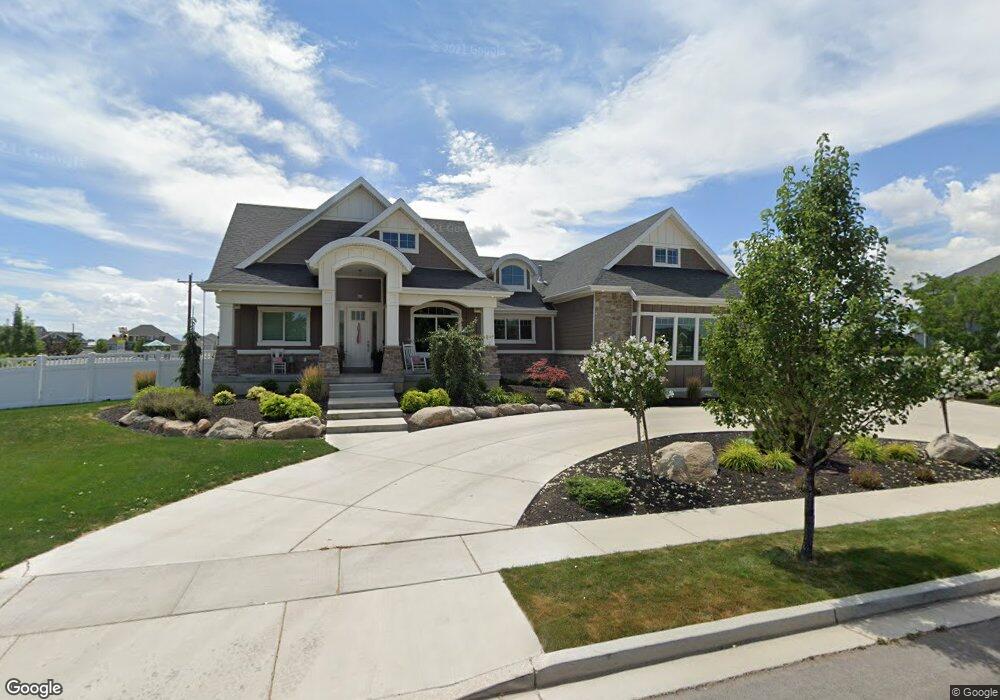
This home is located at 1727 W 550 N Unit 9, Lehi, UT 84043 and is currently estimated at $1,260,019, approximately $462 per square foot. 1727 W 550 N Unit 9 is a home located in Utah County with nearby schools including River Rock Elementary, Willowcreek Middle School, and Lehi High School.
Ownership History
Date
Name
Owned For
Owner Type
Purchase Details
Closed on
Oct 7, 2019
Sold by
Fox Jedediah and Fox Erika J
Bought by
Fox Jed and Fox Erika
Current Estimated Value
Home Financials for this Owner
Home Financials are based on the most recent Mortgage that was taken out on this home.
Original Mortgage
$328,000
Outstanding Balance
$218,671
Interest Rate
3.5%
Mortgage Type
New Conventional
Estimated Equity
$1,041,348
Purchase Details
Closed on
Nov 21, 2013
Sold by
Hall Jason E
Bought by
Fox Jedediah and Fox Erika J
Home Financials for this Owner
Home Financials are based on the most recent Mortgage that was taken out on this home.
Original Mortgage
$380,000
Interest Rate
3.25%
Mortgage Type
Construction
Purchase Details
Closed on
May 30, 2013
Sold by
Bailey Properties Llc
Bought by
Hall Jason E
Home Financials for this Owner
Home Financials are based on the most recent Mortgage that was taken out on this home.
Original Mortgage
$82,500
Interest Rate
3.38%
Mortgage Type
Purchase Money Mortgage
Create a Home Valuation Report for This Property
The Home Valuation Report is an in-depth analysis detailing your home's value as well as a comparison with similar homes in the area
Home Values in the Area
Average Home Value in this Area
Purchase History
| Date | Buyer | Sale Price | Title Company |
|---|---|---|---|
| Fox Jed | -- | Highland Title | |
| Fox Jedediah | -- | Title West | |
| Hall Jason E | -- | Mountain View Title |
Source: Public Records
Mortgage History
| Date | Status | Borrower | Loan Amount |
|---|---|---|---|
| Open | Fox Jed | $328,000 | |
| Closed | Fox Jedediah | $380,000 | |
| Previous Owner | Hall Jason E | $82,500 |
Source: Public Records
Tax History Compared to Growth
Tax History
| Year | Tax Paid | Tax Assessment Tax Assessment Total Assessment is a certain percentage of the fair market value that is determined by local assessors to be the total taxable value of land and additions on the property. | Land | Improvement |
|---|---|---|---|---|
| 2025 | $5,208 | $706,970 | $330,400 | $955,000 |
| 2024 | $5,208 | $609,455 | $0 | $0 |
| 2023 | $4,354 | $553,245 | $0 | $0 |
| 2022 | $4,881 | $601,315 | $0 | $0 |
| 2021 | $4,472 | $832,900 | $191,200 | $641,700 |
| 2020 | $4,219 | $776,700 | $177,000 | $599,700 |
| 2019 | $3,919 | $749,900 | $177,000 | $572,900 |
| 2018 | $3,592 | $649,900 | $151,700 | $498,200 |
| 2017 | $3,668 | $352,825 | $0 | $0 |
| 2016 | $3,553 | $317,075 | $0 | $0 |
| 2015 | $3,707 | $314,050 | $0 | $0 |
| 2014 | $1,154 | $97,200 | $0 | $0 |
Source: Public Records
Map
Nearby Homes
- 2162 W Main St Unit E303
- 2178 W Main St Unit D301
- 131 S 1900 W Unit 2
- 1032 Titan Dr
- 41 N 2150 W
- 1127 N 1500 W
- 161 S 1475 W
- 1132 Titan Dr
- 202 S 2035 W
- 373 N Willow Haven Ave
- 1784 W Grays Place
- 122 N 2430 W Unit 1
- 2512 W 610 N Unit 99
- 1743 W Grays Place
- 105 N 2430 W
- 1215 W 125 S
- The Roslyn Plan at Carla's Cove
- The Tracie Plan at Carla's Cove
- The Brooke Plan at Carla's Cove
- The Jackie Plan at Carla's Cove
- 1727 W 550 N
- 1759 W 550 N Unit 10
- 591 N 1700 W
- 1728 W 475 N Unit 22
- 1756 W 475 N Unit 21
- 1793 W 550 N Unit 11
- 1733 W Timp Meadows Dr Unit 1
- 1794 W 475 N Unit 20
- 1794 W 475 N
- 1729 W 475 N Unit 23
- 1729 W 475 N
- 1761 W Timp Meadows Dr
- 1761 W Timp Meadows Dr Unit 2
- 1761 W 475 N Unit 24
- 1663 W Timp Meadows Dr
- 3007 N Twin Flower Way
- 1797 W 475 N Unit 25
- 1831 W 550 N
- 1828 W 475 N Unit 19
- 1789 W Timp Meadows Dr Unit 3