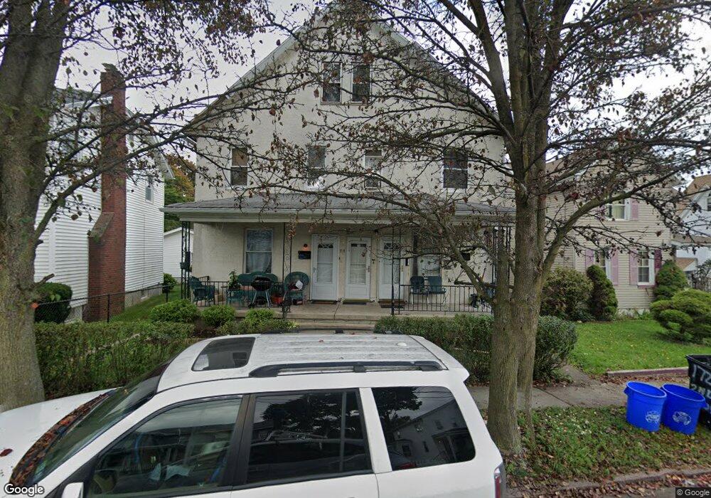
1727 Wayne Ave Scranton, PA 18508
Tripp's Park NeighborhoodEstimated Value: $184,000 - $204,000
Studio
--
Bath
--
Sq Ft
4,269
Sq Ft
About This Home
This home is located at 1727 Wayne Ave, Scranton, PA 18508 and is currently estimated at $191,000. 1727 Wayne Ave is a home located in Lackawanna County with nearby schools including Neil Armstrong Elementary School, Northeast Scranton Intermediate School, and Scranton High School.
Ownership History
Date
Name
Owned For
Owner Type
Purchase Details
Closed on
Sep 13, 2019
Sold by
Ruane Michael P and Ruane Kathi
Bought by
Ruane Michael P
Current Estimated Value
Home Financials for this Owner
Home Financials are based on the most recent Mortgage that was taken out on this home.
Original Mortgage
$69,000
Interest Rate
3.6%
Mortgage Type
New Conventional
Purchase Details
Closed on
Jun 27, 2008
Sold by
Lloyd David M and Lloyd Karen
Bought by
Ruane Michael P and Ruane Kathi L
Home Financials for this Owner
Home Financials are based on the most recent Mortgage that was taken out on this home.
Original Mortgage
$76,717
Interest Rate
6.07%
Mortgage Type
Commercial
Create a Home Valuation Report for This Property
The Home Valuation Report is an in-depth analysis detailing your home's value as well as a comparison with similar homes in the area
Home Values in the Area
Average Home Value in this Area
Purchase History
| Date | Buyer | Sale Price | Title Company |
|---|---|---|---|
| Ruane Michael P | -- | None Available | |
| Ruane Michael P | -- | Harris Land Abstract Inc |
Source: Public Records
Mortgage History
| Date | Status | Borrower | Loan Amount |
|---|---|---|---|
| Closed | Ruane Michael P | $69,000 | |
| Closed | Ruane Michael P | $76,717 |
Source: Public Records
Tax History
| Year | Tax Paid | Tax Assessment Tax Assessment Total Assessment is a certain percentage of the fair market value that is determined by local assessors to be the total taxable value of land and additions on the property. | Land | Improvement |
|---|---|---|---|---|
| 2025 | $3,248 | $10,000 | $1,750 | $8,250 |
| 2024 | $2,971 | $10,000 | $1,750 | $8,250 |
| 2023 | $2,971 | $10,000 | $1,750 | $8,250 |
| 2022 | $2,905 | $10,000 | $1,750 | $8,250 |
| 2021 | $2,905 | $10,000 | $1,750 | $8,250 |
| 2020 | $2,852 | $10,000 | $1,750 | $8,250 |
| 2019 | $2,683 | $10,000 | $1,750 | $8,250 |
| 2018 | $2,683 | $10,000 | $1,750 | $8,250 |
| 2017 | $2,636 | $10,000 | $1,750 | $8,250 |
| 2016 | $0 | $10,000 | $1,750 | $8,250 |
| 2015 | $1,984 | $10,000 | $1,750 | $8,250 |
| 2014 | -- | $10,000 | $1,750 | $8,250 |
Source: Public Records
Map
Nearby Homes
- 309 Ferdinand St
- 1720 Mcdonough Ave
- 141 School St
- 214 William St
- 1425 N Rebecca Ave
- 1402 N Rebecca Ave
- 510 Oak St
- 2009-2011 Margaret Ave
- 1436 Church Ave
- 418 Leggett St
- 1430 N Main Ave
- 1819 Clearview St Unit L 109
- 805 Ferdinand St
- 2105 Belmont Terrace
- 2089 N Main Ave
- 1513 Meylert Ave
- 116 Little Spike Way Unit L 40
- 1519 1521 von Storch Ave
- 193 W Parker St
- 535 Green Ridge St
- 1723 Wayne Ave Unit 1725
- 0 Warren St Unit GSB001915
- 1733 Wayne Ave
- 314 Warren St
- 1731-1733 Wayne Ave
- 1731 1733 Wayne Ave
- 1731 Wayne Ave Unit 1733
- 1726 Wayne Ave
- 316 Warren St
- 309 Warren St
- 305 Warren St Unit 307
- 305-307 Warren St
- 307 Warren St
- 1734 1/2 Wayne Ave
- 1722 Wayne Ave
- 1730 Wayne Ave
- 1726-1728 Wayne Ave
- 318 Warren St Unit 320
- 305 Green St
- 1718 Wayne Rear Ave
Your Personal Tour Guide
Ask me questions while you tour the home.