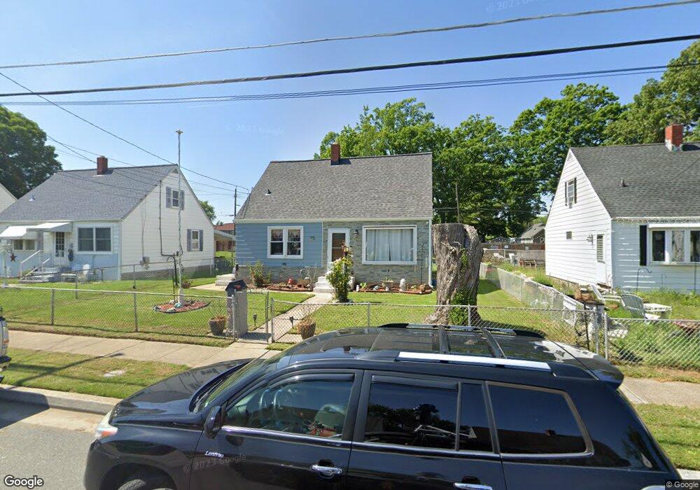
1728 Burnham Rd Dundalk, MD 21222
Estimated Value: $180,000 - $303,000
--
Bed
1
Bath
1,170
Sq Ft
$202/Sq Ft
Est. Value
About This Home
This home is located at 1728 Burnham Rd, Dundalk, MD 21222 and is currently estimated at $236,554, approximately $202 per square foot. 1728 Burnham Rd is a home located in Baltimore County with nearby schools including Edgemere Elementary School, General John Stricker Middle School, and Patapsco High & Center for Arts.
Ownership History
Date
Name
Owned For
Owner Type
Purchase Details
Closed on
Apr 7, 2022
Sold by
Marwood Llc
Bought by
Alley Michael Brian
Current Estimated Value
Home Financials for this Owner
Home Financials are based on the most recent Mortgage that was taken out on this home.
Original Mortgage
$140,409
Interest Rate
3.89%
Mortgage Type
New Conventional
Purchase Details
Closed on
Mar 25, 2022
Sold by
Brian Alley Michael
Bought by
Jackson James Lee
Home Financials for this Owner
Home Financials are based on the most recent Mortgage that was taken out on this home.
Original Mortgage
$140,409
Interest Rate
3.89%
Mortgage Type
New Conventional
Create a Home Valuation Report for This Property
The Home Valuation Report is an in-depth analysis detailing your home's value as well as a comparison with similar homes in the area
Home Values in the Area
Average Home Value in this Area
Purchase History
| Date | Buyer | Sale Price | Title Company |
|---|---|---|---|
| Alley Michael Brian | $1,400 | Maryland Title | |
| Alley Michael Brian | $1,400 | Maryland Title | |
| Jackson James Lee | $143,000 | Maryland Title |
Source: Public Records
Mortgage History
| Date | Status | Borrower | Loan Amount |
|---|---|---|---|
| Previous Owner | Jackson James Lee | $140,409 |
Source: Public Records
Tax History Compared to Growth
Tax History
| Year | Tax Paid | Tax Assessment Tax Assessment Total Assessment is a certain percentage of the fair market value that is determined by local assessors to be the total taxable value of land and additions on the property. | Land | Improvement |
|---|---|---|---|---|
| 2025 | $2,420 | $162,633 | -- | -- |
| 2024 | $2,420 | $147,967 | $0 | $0 |
| 2023 | $1,123 | $133,300 | $61,200 | $72,100 |
| 2022 | $2,191 | $132,167 | $0 | $0 |
| 2021 | $1,114 | $131,033 | $0 | $0 |
| 2020 | $1,574 | $129,900 | $61,200 | $68,700 |
| 2019 | $1,530 | $126,267 | $0 | $0 |
| 2018 | $2,281 | $122,633 | $0 | $0 |
| 2017 | $1,938 | $119,000 | $0 | $0 |
| 2016 | $2,537 | $119,000 | $0 | $0 |
| 2015 | $2,537 | $119,000 | $0 | $0 |
| 2014 | $2,537 | $120,600 | $0 | $0 |
Source: Public Records
Map
Nearby Homes
- 931A Oakleigh Beach Rd
- 1755 Drexel Rd
- 1802 John Stricker Ave
- 1804 John Stricker Ave
- 1808 John Stricker Ave
- 1810 John Stricker Ave
- 1813 John Stricker Ave
- 1820 John Stricker Ave
- Chesapeake Plan at The Cove at Sparrows Point Country Club
- Cambridge Plan at The Cove at Sparrows Point Country Club
- Potomac Plan at The Cove at Sparrows Point Country Club
- Easton Plan at The Cove at Sparrows Point Country Club
- 1815 John Stricker Ave
- 1805 Constellation Dr
- 1822 John Stricker Ave
- 1824 John Stricker Ave
- 1809 Constellation Dr
- 1826 John Stricker Ave
- 1811 Constellation Dr
- 7813 New Battle Grove Rd
- 1730 Burnham Rd
- 1726 Burnham Rd
- 1732 Burnham Rd
- 1724 Burnham Rd
- 1734 Burnham Rd
- 1722 Burnham Rd
- 1729 Burnham Rd
- 1727 Burnham Rd
- 926 Grove Ave
- 1731 Burnham Rd
- 924 Grove Ave
- 1725 Burnham Rd
- 1733 Burnham Rd
- 930 Grove Ave
- 1736 Burnham Rd
- 922 Grove Ave
- 932 Grove Ave
- 1723 Burnham Rd
- 1735 Burnham Rd
- 938 Grove Ave