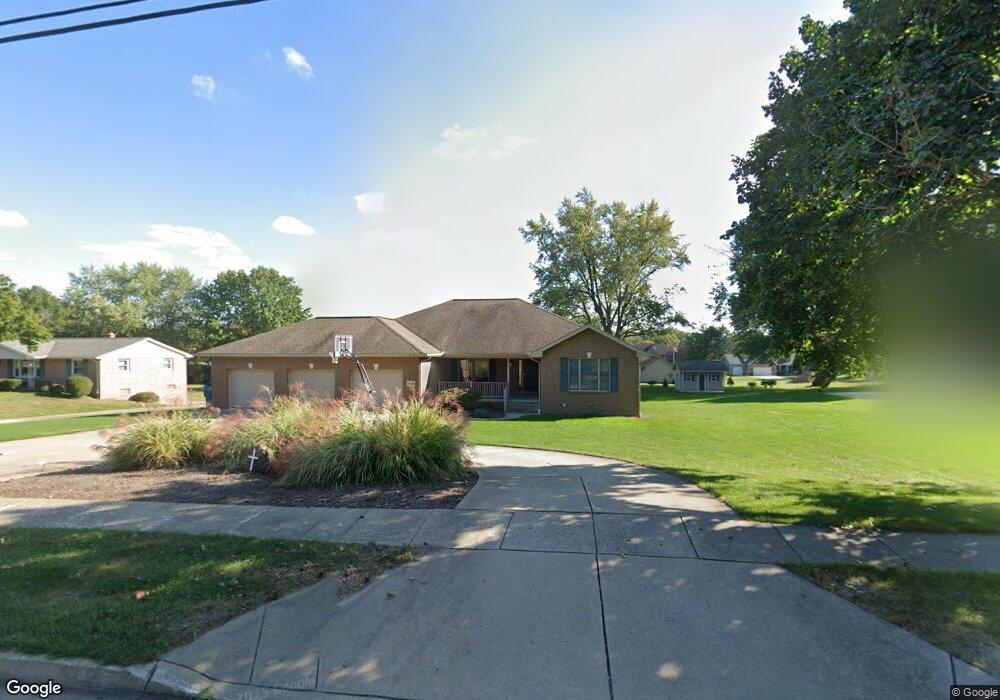
1728 E Main St Louisville, OH 44641
Estimated Value: $325,000 - $350,767
3
Beds
2
Baths
2,114
Sq Ft
$158/Sq Ft
Est. Value
About This Home
This home is located at 1728 E Main St, Louisville, OH 44641 and is currently estimated at $334,942, approximately $158 per square foot. 1728 E Main St is a home located in Stark County with nearby schools including Louisville High School and St. Thomas Aquinas High School & Middle School.
Ownership History
Date
Name
Owned For
Owner Type
Purchase Details
Closed on
Jun 12, 2002
Sold by
Louisville Land Co Inc
Bought by
Sheldon Sean R
Current Estimated Value
Purchase Details
Closed on
Jan 5, 1998
Sold by
Bordner Randy D
Bought by
Louisville Land Co Inc
Create a Home Valuation Report for This Property
The Home Valuation Report is an in-depth analysis detailing your home's value as well as a comparison with similar homes in the area
Home Values in the Area
Average Home Value in this Area
Purchase History
| Date | Buyer | Sale Price | Title Company |
|---|---|---|---|
| Sheldon Sean R | $44,500 | Midland Commerce Group | |
| Louisville Land Co Inc | $130,000 | -- |
Source: Public Records
Tax History Compared to Growth
Tax History
| Year | Tax Paid | Tax Assessment Tax Assessment Total Assessment is a certain percentage of the fair market value that is determined by local assessors to be the total taxable value of land and additions on the property. | Land | Improvement |
|---|---|---|---|---|
| 2025 | -- | $120,750 | $24,220 | $96,530 |
| 2024 | -- | $120,750 | $24,220 | $96,530 |
| 2023 | $4,661 | $108,470 | $22,860 | $85,610 |
| 2022 | $4,668 | $108,470 | $22,860 | $85,610 |
| 2021 | $4,681 | $108,470 | $22,860 | $85,610 |
| 2020 | $3,748 | $94,330 | $20,580 | $73,750 |
| 2019 | $3,764 | $96,050 | $25,730 | $70,320 |
| 2018 | $3,817 | $96,050 | $25,730 | $70,320 |
| 2017 | $3,623 | $87,970 | $22,610 | $65,360 |
| 2016 | $3,698 | $87,970 | $22,610 | $65,360 |
| 2015 | $3,708 | $87,970 | $22,610 | $65,360 |
| 2014 | $1,446 | $75,990 | $19,530 | $56,460 |
| 2013 | $1,727 | $75,990 | $19,530 | $56,460 |
Source: Public Records
Map
Nearby Homes
- 2015 E Main St
- 1812 E Broad St
- 0 Michigan Blvd
- 1715 High St
- 308 Superior St
- 641 S Nickelplate St
- 520 S Silver St
- 1170 Winding Ridge Ave
- 728 E Broad St
- 2110 Edmar St
- 910 Crosswyck Cir
- 325 Lincoln Ave
- 204 E Broad St
- 107 E Broad St
- 316 E Reno Dr
- 428 Honeycrisp Dr NE
- 3047 Mcintosh Dr NE
- 432 Honeycrisp Dr NE
- 2962 Mcintosh Dr NE
- 2963 Mcintosh Dr NE
- 1750 E Main St
- 1750 E Main St
- 1724 E Main St
- 1729 Cedar St
- 1721 Cedar St
- 1714 E Main St
- 1802 E Main St
- 1731 E Main St
- 1741 E Main St
- 105 Sycamore Dr
- 1715 E Main St
- 125 Cypress Ave
- 1816 E Main St Unit 2
- 1816 E Main St
- 1705 Cedar St
- 1814 E Main St
- 1814 E Main St Unit 1814
- 1814 E Main St Unit 1815
- 1805 E Main St
- 1705 E Main St