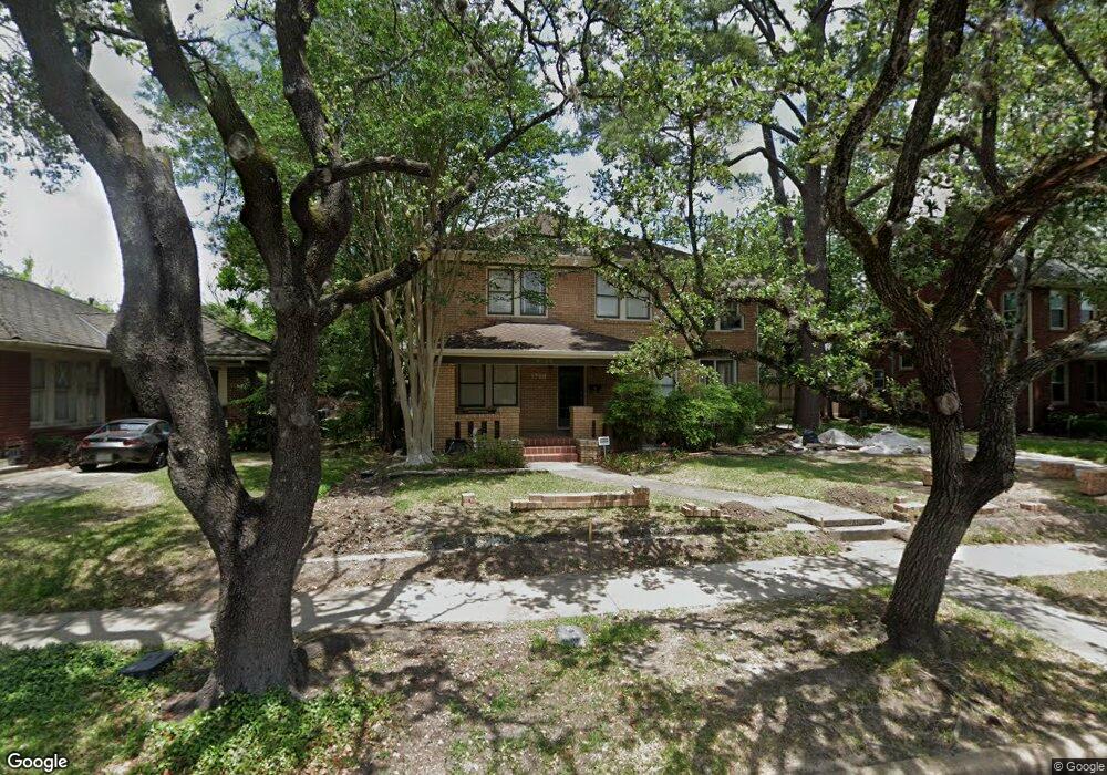
1728 Kipling St Houston, TX 77098
Montrose NeighborhoodEstimated Value: $1,157,430 - $1,783,000
3
Beds
3
Baths
2,742
Sq Ft
$497/Sq Ft
Est. Value
About This Home
This home is located at 1728 Kipling St, Houston, TX 77098 and is currently estimated at $1,361,608, approximately $496 per square foot. 1728 Kipling St is a home located in Harris County with nearby schools including Baker Montessori, Lanier Middle School, and Lamar High School.
Ownership History
Date
Name
Owned For
Owner Type
Purchase Details
Closed on
Jan 13, 2011
Sold by
Bering Memorial Methodist Church
Bought by
Barnett Gregory and Ouellette Sylvia
Current Estimated Value
Home Financials for this Owner
Home Financials are based on the most recent Mortgage that was taken out on this home.
Original Mortgage
$246,000
Outstanding Balance
$164,965
Interest Rate
4.44%
Mortgage Type
New Conventional
Estimated Equity
$1,196,643
Create a Home Valuation Report for This Property
The Home Valuation Report is an in-depth analysis detailing your home's value as well as a comparison with similar homes in the area
Home Values in the Area
Average Home Value in this Area
Purchase History
| Date | Buyer | Sale Price | Title Company |
|---|---|---|---|
| Barnett Gregory | -- | Etc |
Source: Public Records
Mortgage History
| Date | Status | Borrower | Loan Amount |
|---|---|---|---|
| Open | Barnett Gregory | $246,000 |
Source: Public Records
Tax History Compared to Growth
Tax History
| Year | Tax Paid | Tax Assessment Tax Assessment Total Assessment is a certain percentage of the fair market value that is determined by local assessors to be the total taxable value of land and additions on the property. | Land | Improvement |
|---|---|---|---|---|
| 2025 | $18,470 | $1,265,954 | $1,125,000 | $140,954 |
| 2024 | $18,470 | $1,186,777 | $1,031,250 | $155,527 |
| 2023 | $18,470 | $1,186,894 | $1,031,250 | $155,644 |
| 2022 | $20,967 | $952,230 | $750,000 | $202,230 |
| 2021 | $21,006 | $936,232 | $750,000 | $186,232 |
| 2020 | $19,841 | $819,358 | $625,000 | $194,358 |
| 2019 | $21,198 | $837,729 | $625,000 | $212,729 |
| 2018 | $15,728 | $787,963 | $585,938 | $202,025 |
| 2017 | $20,224 | $787,963 | $585,938 | $202,025 |
| 2016 | $18,386 | $751,354 | $507,813 | $243,541 |
| 2015 | $10,053 | $781,421 | $507,813 | $273,608 |
| 2014 | $10,053 | $587,135 | $468,750 | $118,385 |
Source: Public Records
Map
Nearby Homes
- 1701 Hawthorne St
- 1660 Hawthorne St
- 1660 Kipling St
- 1755 Kipling St
- 1723 Marshall St
- 1824 Marshall St
- 2415 Elmen St
- 1620 Harold St
- 1634 Marshall St
- 1612 Kipling St
- 1638 W Alabama St
- 1900 Hawthorne St
- 2413 Ralph St Unit 2
- 1849 Marshall St Unit 9
- 1842 W Alabama St
- 2506 Mandell St Unit 3
- 1912 Kipling St
- 1844 W Alabama St
- 2314 Park St
- 1539 Westheimer Rd
- 1724 Kipling St
- 1736 Kipling St
- 1720 Kipling St
- 1740 Kipling St
- 1731 Harold St
- 1725 Harold St
- 1733 Harold St
- 1721 Harold St
- 1744 Kipling St Unit GRG Apt
- 1716 Kipling St
- 1739 Harold St
- 1719 Harold St
- 1719 Harold St Unit B
- 1731 Kipling St
- 1727 Kipling St
- 1746 Kipling St
- 1733 Kipling St
- 1723 Kipling St
- 1715 Harold St
- 1741 Harold St