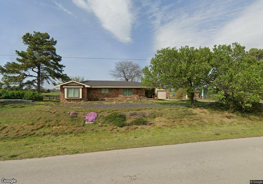
17280 Stonewall Rd Prairie Grove, AR 72753
Estimated Value: $261,998 - $378,000
--
Bed
2
Baths
1,704
Sq Ft
$177/Sq Ft
Est. Value
About This Home
This home is located at 17280 Stonewall Rd, Prairie Grove, AR 72753 and is currently estimated at $301,000, approximately $176 per square foot. 17280 Stonewall Rd is a home located in Washington County with nearby schools including Prairie Grove Elementary School, Prairie Grove Middle School, and Prairie Grove Junior High School.
Ownership History
Date
Name
Owned For
Owner Type
Purchase Details
Closed on
Nov 25, 1991
Bought by
Sullivan Douglas T
Current Estimated Value
Purchase Details
Closed on
May 6, 1988
Bought by
Dixon Cletis B and Dixon Ruthelle
Purchase Details
Closed on
Jul 21, 1986
Bought by
Funk Abram S and Funk Frances M
Purchase Details
Closed on
Jun 27, 1986
Bought by
Wilkett Cynthia
Purchase Details
Closed on
Jan 1, 1985
Bought by
Eads William and Eads Ella L
Create a Home Valuation Report for This Property
The Home Valuation Report is an in-depth analysis detailing your home's value as well as a comparison with similar homes in the area
Home Values in the Area
Average Home Value in this Area
Purchase History
| Date | Buyer | Sale Price | Title Company |
|---|---|---|---|
| Sullivan Douglas T | $80,000 | -- | |
| Dixon Cletis B | -- | -- | |
| Funk Abram S | -- | -- | |
| Wilkett Cynthia | -- | -- | |
| Eads William | -- | -- |
Source: Public Records
Tax History Compared to Growth
Tax History
| Year | Tax Paid | Tax Assessment Tax Assessment Total Assessment is a certain percentage of the fair market value that is determined by local assessors to be the total taxable value of land and additions on the property. | Land | Improvement |
|---|---|---|---|---|
| 2025 | $916 | $46,880 | $9,000 | $37,880 |
| 2024 | $972 | $46,880 | $9,000 | $37,880 |
| 2023 | $1,025 | $46,880 | $9,000 | $37,880 |
| 2022 | $1,037 | $31,000 | $4,800 | $26,200 |
| 2021 | $976 | $31,000 | $4,800 | $26,200 |
| 2020 | $914 | $31,000 | $4,800 | $26,200 |
| 2019 | $863 | $24,640 | $4,000 | $20,640 |
| 2018 | $884 | $24,640 | $4,000 | $20,640 |
| 2017 | $819 | $24,640 | $4,000 | $20,640 |
| 2016 | $840 | $24,640 | $4,000 | $20,640 |
| 2015 | $787 | $24,640 | $4,000 | $20,640 |
| 2014 | $734 | $21,143 | $4,000 | $17,143 |
Source: Public Records
Map
Nearby Homes
- 10397 S Mortensen Rd
- 16655 W Highway 62
- 18040 E Holt Rd
- 16256 W Highway 62
- 16800 Parks Corner Rd
- TBD N Mortensen Rd
- 15944 Bill Campbell Rd
- 16477 Parks Corner
- 13170 Route 45
- 16603 Parks Corner Rd
- 11561 Old Apple Hill Rd
- 17691 E Holt Rd
- 0 Applehill Tract 4 Rd Unit 4 1315344
- 208 S Wedington Blacktop Rd
- 3.41 Acres of 11281 S Wedington Blacktop Rd
- 18323 Rheas Community Rd
- 11398 N Wedington Blacktop Rd
- 0 Greasy Valley Rd Unit 1324390
- 1042 Vista Ave
- 1021 Vista Ave
- 17389 Stonewall Rd
- 17411 Stonewall Rd
- 10561 Old Thurman Rd
- 10561 Old Thurman Rd
- 17433 Stonewall Rd
- 17325 Stonewall Rd
- 16889 Stonewall Rd
- 17456 Stonewall Rd
- 17339 Stonewall Rd
- 16848 Stonewall Rd
- 10410 Roosevelt Rd
- 0 Stonewall Rd
- 16725 Stonewall Rd
- 10565 Roosevelt Rd
- 17572 Stonewall Rd
- 10952 Bond Rd
- 10170 S Wedington Blacktop Rd
- 16670 Stonewall Rd
- 10228 S Wedington Blacktop Rd
- 10155 Opal Stevens