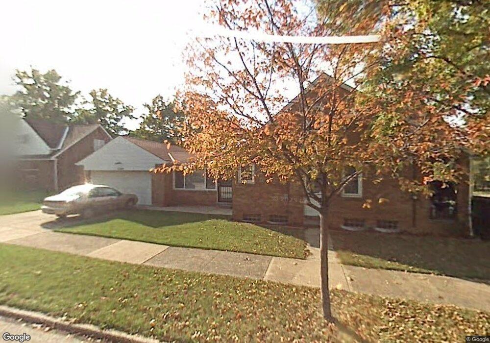
17282 Mccracken Rd Maple Heights, OH 44137
Estimated Value: $123,000 - $164,000
4
Beds
2
Baths
1,326
Sq Ft
$101/Sq Ft
Est. Value
About This Home
This home is located at 17282 Mccracken Rd, Maple Heights, OH 44137 and is currently estimated at $133,944, approximately $101 per square foot. 17282 Mccracken Rd is a home located in Cuyahoga County with nearby schools including Abraham Lincoln Elementary School, Rockside/ J.F. Kennedy School, and Italy High School.
Ownership History
Date
Name
Owned For
Owner Type
Purchase Details
Closed on
Nov 9, 2012
Sold by
Evans Renee and Warre Renee
Bought by
Ware Renee and Ware Milton L
Current Estimated Value
Home Financials for this Owner
Home Financials are based on the most recent Mortgage that was taken out on this home.
Original Mortgage
$96,250
Outstanding Balance
$41,993
Interest Rate
3.32%
Mortgage Type
New Conventional
Estimated Equity
$91,951
Purchase Details
Closed on
Apr 1, 2005
Sold by
Tomsick Phyllis A
Bought by
Evans Renee
Home Financials for this Owner
Home Financials are based on the most recent Mortgage that was taken out on this home.
Original Mortgage
$101,000
Interest Rate
5.71%
Mortgage Type
Purchase Money Mortgage
Purchase Details
Closed on
Mar 19, 1985
Sold by
Tomsick Albert A and Tomsick Phyllis A
Bought by
Tomsick Albert A
Purchase Details
Closed on
Jan 1, 1975
Bought by
Tomsick Albert A and Tomsick Phyllis A
Create a Home Valuation Report for This Property
The Home Valuation Report is an in-depth analysis detailing your home's value as well as a comparison with similar homes in the area
Home Values in the Area
Average Home Value in this Area
Purchase History
| Date | Buyer | Sale Price | Title Company |
|---|---|---|---|
| Ware Renee | -- | Ohio Real Title | |
| Evans Renee | $101,000 | City Title Agency | |
| Tomsick Albert A | -- | -- | |
| Tomsick Albert A | -- | -- |
Source: Public Records
Mortgage History
| Date | Status | Borrower | Loan Amount |
|---|---|---|---|
| Open | Ware Renee | $96,250 | |
| Closed | Evans Renee | $101,000 |
Source: Public Records
Tax History Compared to Growth
Tax History
| Year | Tax Paid | Tax Assessment Tax Assessment Total Assessment is a certain percentage of the fair market value that is determined by local assessors to be the total taxable value of land and additions on the property. | Land | Improvement |
|---|---|---|---|---|
| 2024 | $3,620 | $40,460 | $7,385 | $33,075 |
| 2023 | $2,579 | $24,290 | $4,480 | $19,810 |
| 2022 | $2,570 | $24,290 | $4,480 | $19,810 |
| 2021 | $2,741 | $24,290 | $4,480 | $19,810 |
| 2020 | $2,341 | $18,410 | $3,400 | $15,020 |
| 2019 | $2,328 | $52,600 | $9,700 | $42,900 |
| 2018 | $2,176 | $18,410 | $3,400 | $15,020 |
| 2017 | $2,197 | $16,910 | $3,150 | $13,760 |
| 2016 | $2,125 | $16,910 | $3,150 | $13,760 |
| 2015 | $2,129 | $16,910 | $3,150 | $13,760 |
| 2014 | $2,129 | $18,590 | $3,470 | $15,120 |
Source: Public Records
Map
Nearby Homes
- 5061 Philip Ave
- 5082 Philip Ave
- 5110 Philip Ave
- 5031 Cato St
- 16712 Kollin Ave
- 5185 Clement Ave
- 5208 Clement Ave
- 5231 Philip Ave
- 5212 Catherine St
- 5199 Arch St
- 5210 Theodore St
- 5257 Philip Ave
- 16241 Glenburn Ave
- 5239 Arch St
- 4737 E 174th St
- 5320 Clement Ave
- 5234 Erwin St
- 16312 Sunny Glenn Ave
- 16216 Sunny Glenn Ave
- 16702 Tarkington Ave
- 17278 Mccracken Rd
- 17274 Mccracken Rd
- 17300 Mccracken Rd
- 5044 Catherine St
- 17270 Mccracken Rd
- 17304 Mccracken Rd
- 5048 Catherine St
- 5045 Catherine St
- 17268 Mccracken Rd
- 17308 Mccracken Rd
- 5052 Catherine St
- 5049 Clement Ave
- 5049 Catherine St
- 17285 Mccracken Rd
- 17264 Mccracken Rd
- 17293 Mccracken Rd
- 17488 Mccracken Rd
- 5053 Clement Ave
- 17277 Mccracken Rd
- 5056 Catherine St