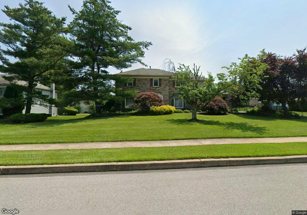
1729 Brittany Dr Ambler, PA 19002
Estimated Value: $902,000 - $1,035,000
4
Beds
4
Baths
3,836
Sq Ft
$249/Sq Ft
Est. Value
About This Home
This home is located at 1729 Brittany Dr, Ambler, PA 19002 and is currently estimated at $956,126, approximately $249 per square foot. 1729 Brittany Dr is a home located in Montgomery County with nearby schools including Jarrettown Elementary School, Sandy Run Middle School, and Upper Dublin High School.
Ownership History
Date
Name
Owned For
Owner Type
Purchase Details
Closed on
Nov 20, 2006
Sold by
Miller Susan C and Miller Paul L
Bought by
Yang Chih Chieh and Shen Lin Yun
Current Estimated Value
Home Financials for this Owner
Home Financials are based on the most recent Mortgage that was taken out on this home.
Original Mortgage
$400,000
Outstanding Balance
$238,593
Interest Rate
6.36%
Estimated Equity
$717,533
Purchase Details
Closed on
Jul 7, 2000
Sold by
Huang Tien Te and Huang Yeuh Mei Wu
Bought by
Miller Paul L and Miller Susan C
Create a Home Valuation Report for This Property
The Home Valuation Report is an in-depth analysis detailing your home's value as well as a comparison with similar homes in the area
Home Values in the Area
Average Home Value in this Area
Purchase History
| Date | Buyer | Sale Price | Title Company |
|---|---|---|---|
| Yang Chih Chieh | $500,000 | None Available | |
| Miller Paul L | $338,000 | -- |
Source: Public Records
Mortgage History
| Date | Status | Borrower | Loan Amount |
|---|---|---|---|
| Open | Yang Chih Chieh | $400,000 |
Source: Public Records
Tax History Compared to Growth
Tax History
| Year | Tax Paid | Tax Assessment Tax Assessment Total Assessment is a certain percentage of the fair market value that is determined by local assessors to be the total taxable value of land and additions on the property. | Land | Improvement |
|---|---|---|---|---|
| 2025 | $14,524 | $297,850 | -- | -- |
| 2024 | $14,524 | $297,850 | -- | -- |
| 2023 | $14,185 | $297,850 | $0 | $0 |
| 2022 | $13,877 | $297,850 | $0 | $0 |
| 2021 | $13,531 | $297,850 | $0 | $0 |
| 2020 | $13,140 | $297,850 | $0 | $0 |
| 2019 | $12,378 | $297,850 | $0 | $0 |
| 2018 | $12,919 | $285,350 | $84,530 | $200,820 |
| 2017 | $11,927 | $285,350 | $84,530 | $200,820 |
| 2016 | $11,815 | $285,350 | $84,530 | $200,820 |
| 2015 | $11,159 | $285,350 | $84,530 | $200,820 |
| 2014 | $11,159 | $285,350 | $84,530 | $200,820 |
Source: Public Records
Map
Nearby Homes
- 1733 Waterford Way
- 105 Magnolia St
- 1425 Welsh Rd
- 237 Magnolia St
- 6 Pheasant Run
- 516 Galleria St
- 505 Galleria St
- 996 Whitney Ln
- 300 Witmer Rd
- 1380 Harris Rd
- 1536 Fulton Dr
- 1485 Mundock Rd
- 1525 Limekiln Pike
- 311 Green Meadow Ln
- 45 Brookside Ct
- 43 Black Watch Ct
- 3 Emily Ct
- 1710 Twining Rd
- 65 Ember Ln
- 1300 Kirks Ln
- 1725 Brittany Dr
- 1733 Brittany Dr
- 1728 Waterford Way
- 1732 Waterford Way
- 1721 Brittany Dr
- 1724 Waterford Way
- 1732 Brittany Dr
- 1736 Brittany Dr
- 1728 Brittany Dr
- 1720 Waterford Way
- 1740 Brittany Dr
- 1717 Brittany Dr
- 1724 Brittany Dr
- 1741 Waterford Way
- 1716 Waterford Way
- 1744 Brittany Dr
- 1725 Waterford Way
- 1729 Waterford Way
- 1737 Waterford Way
- 1720 Brittany Dr