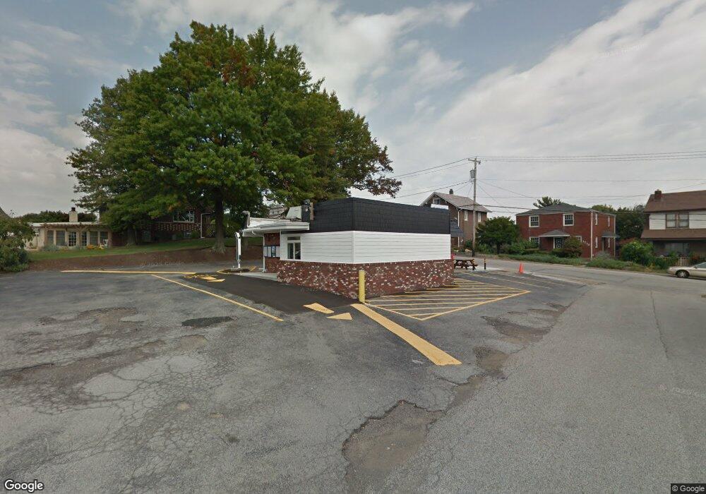
1729 Freeport Rd New Kensington, PA 15068
Estimated Value: $115,865
--
Bed
--
Bath
--
Sq Ft
0.26
Acres
About This Home
This home is located at 1729 Freeport Rd, New Kensington, PA 15068 and is currently estimated at $115,865. 1729 Freeport Rd is a home located in Westmoreland County with nearby schools including Mary Queen of Apostles School.
Ownership History
Date
Name
Owned For
Owner Type
Purchase Details
Closed on
Apr 6, 2023
Sold by
Central Development Corp Llc
Bought by
Barnes Patrick and Barnes April
Current Estimated Value
Purchase Details
Closed on
Mar 10, 2021
Sold by
Rodites Marcella M
Bought by
Central Development Corp Llc
Purchase Details
Closed on
May 10, 2012
Sold by
Mccalister Maria Theresa and Mccalister Philip
Bought by
Myers Thomas J and Phillips Michael A J
Purchase Details
Closed on
Mar 12, 2012
Sold by
Myers Thomas J and Michael A J Phillips H
Bought by
Rodites Nick and Rodites Marcella M
Create a Home Valuation Report for This Property
The Home Valuation Report is an in-depth analysis detailing your home's value as well as a comparison with similar homes in the area
Home Values in the Area
Average Home Value in this Area
Purchase History
| Date | Buyer | Sale Price | Title Company |
|---|---|---|---|
| Barnes Patrick | $100,000 | None Listed On Document | |
| Central Development Corp Llc | $82,000 | None Available | |
| Myers Thomas J | -- | None Available | |
| Rodites Nick | $65,000 | None Available |
Source: Public Records
Tax History Compared to Growth
Tax History
| Year | Tax Paid | Tax Assessment Tax Assessment Total Assessment is a certain percentage of the fair market value that is determined by local assessors to be the total taxable value of land and additions on the property. | Land | Improvement |
|---|---|---|---|---|
| 2025 | $2,646 | $15,460 | $9,090 | $6,370 |
| 2024 | $2,622 | $15,460 | $9,090 | $6,370 |
| 2023 | $2,491 | $15,460 | $9,090 | $6,370 |
| 2022 | $2,420 | $15,460 | $9,090 | $6,370 |
| 2021 | $2,369 | $15,460 | $9,090 | $6,370 |
| 2020 | $2,323 | $15,460 | $9,090 | $6,370 |
| 2019 | $2,315 | $15,460 | $9,090 | $6,370 |
| 2018 | $2,284 | $15,460 | $9,090 | $6,370 |
| 2017 | $2,284 | $15,460 | $9,090 | $6,370 |
| 2016 | $2,284 | $15,460 | $9,090 | $6,370 |
| 2015 | $2,284 | $15,460 | $9,090 | $6,370 |
| 2014 | $2,205 | $15,460 | $9,090 | $6,370 |
Source: Public Records
Map
Nearby Homes
- 1741 Freeport Rd Unit U
- 1735 Kimball Ave
- 1802 Kimball Ave
- 1809 Kimball Ave
- 1717 Ridge Ave
- 1810 Ridge Ave
- 1407 Drey St Unit 29
- 1802 Alcoa Dr
- 1038 Manor Rd
- 1400 Orchard Ave
- 1627 Woodmont Ave
- 1909 Woodmont Ave
- 1915 Woodmont Ave
- 1520 Woodmont Ave
- 2108 Hollingsworth St
- 2004 Woodmont Ave
- 1515 Woodmont Ave
- 1919 Victoria Ave
- 620 Ridge Ave
- 1024 Knollwood Rd
- 1725 Freeport Rd
- 1723 Freeport Rd
- 1737 Freeport Rd
- 1730 Freeport Rd
- 1721 Freeport Rd
- 1732 Freeport Rd
- 1728 Freeport Rd
- 1726 Freeport Rd
- 1719 Freeport Rd
- 1736 Freeport Rd
- 1739 Freeport Rd
- 1720 Freeport Rd
- 1726 Kimball Ave
- 1728 Kimball Ave
- 1734 Kimball Ave Unit REI
- 1717 Freeport Rd
- 1724 Kimball Ave
- 1746 Kimball Ave
- 1738 Freeport Rd
- 1720 Kimball Ave