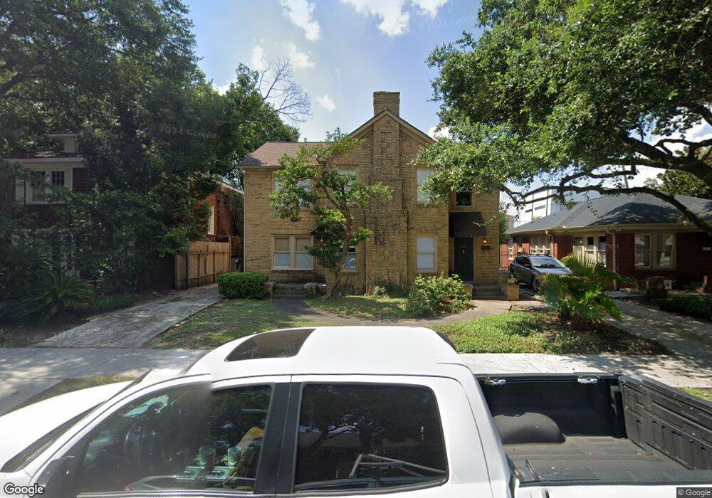
1729 Hawthorne St Houston, TX 77098
Montrose NeighborhoodEstimated Value: $739,000 - $922,000
5
Beds
3
Baths
3,328
Sq Ft
$249/Sq Ft
Est. Value
About This Home
This home is located at 1729 Hawthorne St, Houston, TX 77098 and is currently estimated at $829,946, approximately $249 per square foot. 1729 Hawthorne St is a home located in Harris County with nearby schools including Baker Montessori, Lanier Middle School, and Lamar High School.
Ownership History
Date
Name
Owned For
Owner Type
Purchase Details
Closed on
Jul 2, 2024
Sold by
Robertson Carolyn Agee
Bought by
Salva Leslie A and Robertson Stuart
Current Estimated Value
Purchase Details
Closed on
Nov 30, 2001
Sold by
Kelly Neil D
Bought by
Robertson David M and Robertson Carolyn
Home Financials for this Owner
Home Financials are based on the most recent Mortgage that was taken out on this home.
Original Mortgage
$201,750
Interest Rate
6.57%
Create a Home Valuation Report for This Property
The Home Valuation Report is an in-depth analysis detailing your home's value as well as a comparison with similar homes in the area
Home Values in the Area
Average Home Value in this Area
Purchase History
| Date | Buyer | Sale Price | Title Company |
|---|---|---|---|
| Salva Leslie A | -- | None Listed On Document | |
| Robertson David M | -- | American Title Co |
Source: Public Records
Mortgage History
| Date | Status | Borrower | Loan Amount |
|---|---|---|---|
| Previous Owner | Robertson David M | $201,750 |
Source: Public Records
Tax History Compared to Growth
Tax History
| Year | Tax Paid | Tax Assessment Tax Assessment Total Assessment is a certain percentage of the fair market value that is determined by local assessors to be the total taxable value of land and additions on the property. | Land | Improvement |
|---|---|---|---|---|
| 2025 | $13,493 | $685,642 | $642,000 | $43,642 |
| 2024 | $13,493 | $644,846 | $588,500 | $56,346 |
| 2023 | $13,493 | $659,621 | $588,500 | $71,121 |
| 2022 | $10,973 | $498,354 | $428,000 | $70,354 |
| 2021 | $11,018 | $472,747 | $428,000 | $44,747 |
| 2020 | $12,944 | $534,510 | $487,920 | $46,590 |
| 2019 | $13,525 | $534,510 | $487,920 | $46,590 |
| 2018 | $13,345 | $527,380 | $457,425 | $69,955 |
| 2017 | $13,994 | $527,380 | $457,425 | $69,955 |
| 2016 | $12,762 | $480,932 | $396,435 | $84,497 |
| 2015 | $11,555 | $488,542 | $396,435 | $92,107 |
| 2014 | $11,555 | $449,494 | $365,940 | $83,554 |
Source: Public Records
Map
Nearby Homes
- 1701 Hawthorne St
- 1660 Hawthorne St
- 1660 Kipling St
- 1755 Kipling St
- 1620 Harold St
- 1723 Marshall St
- 2415 Elmen St
- 1634 Marshall St
- 1612 Kipling St
- 2413 Ralph St Unit 2
- 2506 Mandell St Unit 3
- 1824 Marshall St
- 1539 Westheimer Rd
- 1638 W Alabama St
- 2314 Park St
- 1612 W Alabama St Unit ABCD
- 1900 Hawthorne St
- 1640 Sul Ross St
- 3705 Mandell St Unit 8
- 1531 Marshall St Unit 3
- 1733 Hawthorne St
- 1719 Hawthorne St
- 1737 Hawthorne St
- 1728 Harold St
- 1732 Harold St
- 1720 Harold St
- 1740 Harold St
- 1718 Harold St
- 1717 Hawthorne St
- 1741 Hawthorne St
- 1728 Hawthorne St
- 1728 Hawthorne St Unit 3
- 1732 Hawthorne St
- 1730 Hawthorne St
- 1726 Hawthorne St
- 1734 Hawthorne St
- 1744 Harold St
- 1716 Harold St
- 1745 Hawthorne St
- 1722 Hawthorne St