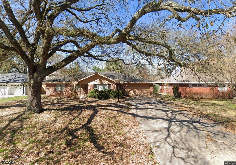
1729 Hollister St Houston, TX 77055
Spring Branch Central NeighborhoodEstimated Value: $680,423 - $1,766,000
5
Beds
5
Baths
5,140
Sq Ft
$200/Sq Ft
Est. Value
About This Home
This home is located at 1729 Hollister St, Houston, TX 77055 and is currently estimated at $1,029,606, approximately $200 per square foot. 1729 Hollister St is a home located in Harris County with nearby schools including Valley Oaks Elementary School, Spring Branch Middle School, and Memorial High School.
Ownership History
Date
Name
Owned For
Owner Type
Purchase Details
Closed on
Jun 13, 2023
Sold by
Zorbas Katherine A
Bought by
Notre Capital Management Inc
Current Estimated Value
Purchase Details
Closed on
Apr 13, 1999
Sold by
Davis Robert T and Davis Cynthia F
Bought by
Zorbas Katherine A
Home Financials for this Owner
Home Financials are based on the most recent Mortgage that was taken out on this home.
Original Mortgage
$97,600
Interest Rate
6.87%
Purchase Details
Closed on
Oct 14, 1994
Sold by
Hillis Sue Ann and Kingsbury Sue Ann
Bought by
Davis Robert T and Davis Cynthia F
Home Financials for this Owner
Home Financials are based on the most recent Mortgage that was taken out on this home.
Original Mortgage
$61,750
Interest Rate
8.46%
Create a Home Valuation Report for This Property
The Home Valuation Report is an in-depth analysis detailing your home's value as well as a comparison with similar homes in the area
Home Values in the Area
Average Home Value in this Area
Purchase History
| Date | Buyer | Sale Price | Title Company |
|---|---|---|---|
| Notre Capital Management Inc | -- | None Listed On Document | |
| Zorbas Katherine A | -- | Chicago Title | |
| Davis Robert T | -- | Stewart Title |
Source: Public Records
Mortgage History
| Date | Status | Borrower | Loan Amount |
|---|---|---|---|
| Previous Owner | Zorbas Katherine A | $97,600 | |
| Previous Owner | Davis Robert T | $61,750 |
Source: Public Records
Tax History Compared to Growth
Tax History
| Year | Tax Paid | Tax Assessment Tax Assessment Total Assessment is a certain percentage of the fair market value that is determined by local assessors to be the total taxable value of land and additions on the property. | Land | Improvement |
|---|---|---|---|---|
| 2025 | $11,976 | $508,800 | $508,800 | -- |
| 2024 | $11,976 | $543,308 | $424,000 | $119,308 |
| 2023 | $11,976 | $546,930 | $424,000 | $122,930 |
| 2022 | $11,520 | $472,548 | $371,000 | $101,548 |
| 2021 | $11,430 | $468,173 | $371,000 | $97,173 |
| 2020 | $11,974 | $459,561 | $371,000 | $88,561 |
| 2019 | $11,770 | $460,441 | $371,000 | $89,441 |
| 2018 | $3,853 | $456,660 | $371,000 | $85,660 |
| 2017 | $9,363 | $456,660 | $371,000 | $85,660 |
| 2016 | $8,511 | $456,660 | $371,000 | $85,660 |
| 2015 | $5,516 | $411,823 | $371,000 | $40,823 |
| 2014 | $5,516 | $268,884 | $180,200 | $88,684 |
Source: Public Records
Map
Nearby Homes
- 8935 Pado St
- 8911 Grovner Place
- 8913 Grovner Place
- 8915 Grovner Place
- 8919 Grovner Place
- 8925 Grovner Place
- 8927 Grovner Place
- 8929 Grovner Place
- 1745 Plan at Regents Court
- 2185 Plan at Regents Court
- 1925 Plan at Regents Court
- 2115 Plan at Regents Court
- 8933 Grovner Place
- 8928 Grovner Place
- 8926 Grovner Place
- 1715 Bologna Ln
- 8706 Ojeman Creek Ln
- 1709 Bologna Ln
- 1707 Bologna Ln
- 8928 Covenant Place
- 1733 Hollister St
- 1725 Hollister St
- 1726 Cranway Dr
- 1737 Hollister St
- 1721 Hollister St
- 1722 Cranway Dr
- 8920 Pado St
- 1730 Hollister St
- 1726 Hollister St
- 1718 Cranway Dr
- 1717 Hollister St
- 1722 Hollister St
- 1738 Hollister St
- 8750 Turriff St
- 1721 Cranway Dr
- 1713 Hollister St
- 1714 Cranway Dr
- 8924 Pado St
- 1717 Cranway Dr
- 1716 Hollister St