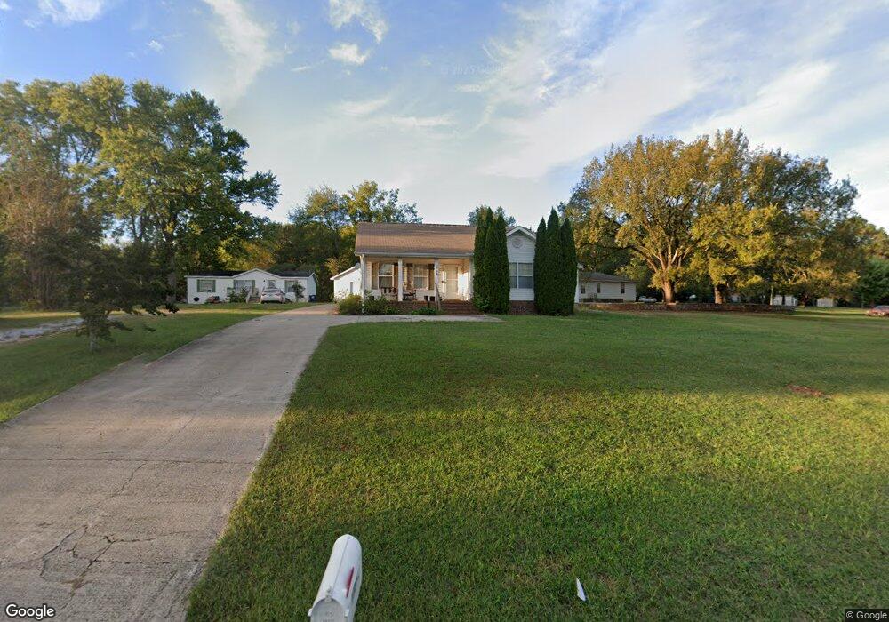
1729 Nick Davis Rd Harvest, AL 35749
Harvest-Cluttsville NeighborhoodEstimated Value: $232,638 - $275,000
--
Bed
--
Bath
1,398
Sq Ft
$179/Sq Ft
Est. Value
About This Home
This home is located at 1729 Nick Davis Rd, Harvest, AL 35749 and is currently estimated at $249,660, approximately $178 per square foot. 1729 Nick Davis Rd is a home with nearby schools including Harvest Elementary School, Sparkman Middle School, and Sparkman High School.
Ownership History
Date
Name
Owned For
Owner Type
Purchase Details
Closed on
Sep 4, 2009
Sold by
Puckett Jimmy W and Puckett Fran M
Bought by
Mears Nathan D and Mears Kristina N
Current Estimated Value
Home Financials for this Owner
Home Financials are based on the most recent Mortgage that was taken out on this home.
Original Mortgage
$106,632
Outstanding Balance
$69,027
Interest Rate
5.15%
Mortgage Type
New Conventional
Estimated Equity
$180,633
Create a Home Valuation Report for This Property
The Home Valuation Report is an in-depth analysis detailing your home's value as well as a comparison with similar homes in the area
Home Values in the Area
Average Home Value in this Area
Purchase History
| Date | Buyer | Sale Price | Title Company |
|---|---|---|---|
| Mears Nathan D | -- | -- |
Source: Public Records
Mortgage History
| Date | Status | Borrower | Loan Amount |
|---|---|---|---|
| Open | Mears Nathan D | $106,632 |
Source: Public Records
Tax History Compared to Growth
Tax History
| Year | Tax Paid | Tax Assessment Tax Assessment Total Assessment is a certain percentage of the fair market value that is determined by local assessors to be the total taxable value of land and additions on the property. | Land | Improvement |
|---|---|---|---|---|
| 2025 | $544 | $16,340 | $1,400 | $14,940 |
| 2024 | $544 | $15,820 | $1,400 | $14,420 |
| 2023 | $525 | $15,300 | $1,400 | $13,900 |
| 2022 | $433 | $13,240 | $900 | $12,340 |
| 2021 | $401 | $12,380 | $900 | $11,480 |
| 2020 | $373 | $11,600 | $900 | $10,700 |
| 2019 | $355 | $11,120 | $900 | $10,220 |
| 2018 | $325 | $10,280 | $0 | $0 |
| 2017 | $325 | $10,280 | $0 | $0 |
| 2016 | $325 | $10,280 | $0 | $0 |
| 2015 | $325 | $10,280 | $0 | $0 |
| 2014 | $329 | $10,400 | $0 | $0 |
Source: Public Records
Map
Nearby Homes
- 106 Smith Vasser Rd
- 28736 Nick Davis Rd
- 1016 Highgrove Heights NW
- 1141 Birkhall Blvd NW
- 1005 Highgrove Heights NW
- Manchester II Tanger Glen Trail
- 1104 Tanger Glen Trail
- 1013 Tanger Glen Trail
- 1110 Tanger Glen Trail
- 103 Duskwood Dr
- Kathryn Plan at Oak Forest
- Cali Plan at Oak Forest
- Fraser Plan at Oak Forest
- Robinson Plan at Oak Forest
- Destin Plan at Oak Forest
- Aria Plan at Oak Forest
- Madison Plan at Oak Forest
- 111 Engineer Ct
- 1111 Tanger Glen Trail NW
- Braselton II Trail
- 1717 Nick Davis Rd
- 1739 Nick Davis Rd
- 1730 Nick Davis Rd
- 1769 Nick Davis Rd
- 1691 Nick Davis Rd
- 1750 Nick Davis Rd
- 1693 Nick Davis Rd
- 1726 Nick Davis Rd
- 1694 Nick Davis Rd
- 1783 Nick Davis Rd
- 237 Love Ln
- 1676 Nick Davis Rd
- 1675 Nick Davis Rd
- 1069 Nick Davis Rd
- 1665 Nick Davis Rd
- 2631 Old Railroad Bed Rd
- 2683 Old Railroad Bed Rd
- 238 Love Ln
- 1653 Nick Davis Rd
- 2603 Old Railroad Bed Rd