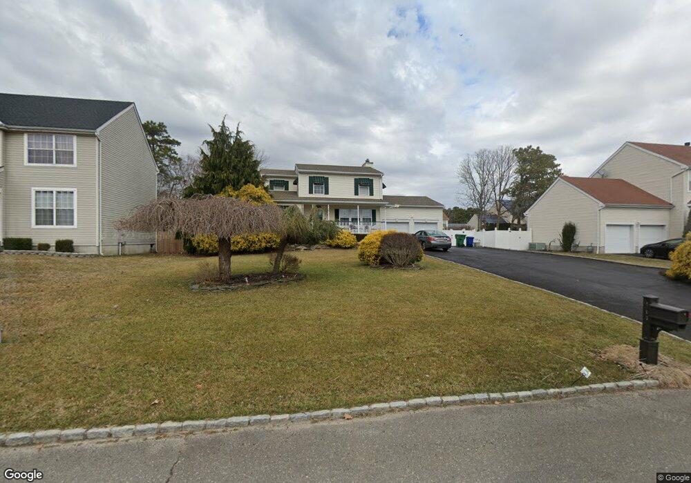
173 10th Ave Manchester, NJ 08759
Manchester Township NeighborhoodEstimated Value: $644,411 - $708,000
4
Beds
3
Baths
2,828
Sq Ft
$241/Sq Ft
Est. Value
About This Home
This home is located at 173 10th Ave, Manchester, NJ 08759 and is currently estimated at $682,853, approximately $241 per square foot. 173 10th Ave is a home located in Ocean County with nearby schools including Manchester Township High School.
Ownership History
Date
Name
Owned For
Owner Type
Purchase Details
Closed on
Oct 14, 2005
Sold by
Plesher Richard M and Plesher Marianne D
Bought by
Lally Richard A and Lally Patricia
Current Estimated Value
Home Financials for this Owner
Home Financials are based on the most recent Mortgage that was taken out on this home.
Original Mortgage
$165,000
Outstanding Balance
$88,093
Interest Rate
5.72%
Mortgage Type
Stand Alone First
Estimated Equity
$594,760
Purchase Details
Closed on
Aug 28, 1997
Sold by
Aaron Developers Inc
Bought by
Piesher Richard M
Home Financials for this Owner
Home Financials are based on the most recent Mortgage that was taken out on this home.
Original Mortgage
$121,850
Interest Rate
7.31%
Create a Home Valuation Report for This Property
The Home Valuation Report is an in-depth analysis detailing your home's value as well as a comparison with similar homes in the area
Home Values in the Area
Average Home Value in this Area
Purchase History
| Date | Buyer | Sale Price | Title Company |
|---|---|---|---|
| Lally Richard A | $467,500 | Lawyers Title Ins | |
| Piesher Richard M | $128,300 | -- |
Source: Public Records
Mortgage History
| Date | Status | Borrower | Loan Amount |
|---|---|---|---|
| Open | Lally Richard A | $165,000 | |
| Previous Owner | Piesher Richard M | $121,850 |
Source: Public Records
Tax History Compared to Growth
Tax History
| Year | Tax Paid | Tax Assessment Tax Assessment Total Assessment is a certain percentage of the fair market value that is determined by local assessors to be the total taxable value of land and additions on the property. | Land | Improvement |
|---|---|---|---|---|
| 2025 | $8,089 | $603,600 | $291,300 | $312,300 |
| 2024 | $7,677 | $329,500 | $73,200 | $256,300 |
| 2023 | $7,298 | $329,500 | $73,200 | $256,300 |
| 2022 | $7,298 | $329,500 | $73,200 | $256,300 |
| 2021 | $7,140 | $329,500 | $73,200 | $256,300 |
| 2020 | $6,952 | $329,500 | $73,200 | $256,300 |
| 2019 | $7,492 | $292,100 | $78,200 | $213,900 |
| 2018 | $7,463 | $292,100 | $78,200 | $213,900 |
| 2017 | $7,492 | $292,100 | $78,200 | $213,900 |
| 2016 | $7,402 | $292,100 | $78,200 | $213,900 |
| 2015 | $7,265 | $292,100 | $78,200 | $213,900 |
| 2014 | $7,116 | $292,100 | $78,200 | $213,900 |
Source: Public Records
Map
Nearby Homes
- 44 2nd St
- 42 3rd St
- 424 Third Ave
- 333 Savannah Rd
- 1991 Route 37 W Unit 177
- 1881 New Jersey 37 Unit 246
- 882 Liverpool Cir Unit A
- 609 Commonwealth Blvd
- 835B Liverpool Cir
- 833 Westminster Ct Unit C
- 914A Liverpool Cir
- 1012 Bismarck St
- 501 Bismarck St
- 701 Madison Ave
- 716 Commonwealth Blvd
- 948A Liverpool Cir Unit 948A
- 928B Liverpool Cir Unit 928B
- 800 Northampton Blvd
- 801 Commonwealth Blvd
- 749A Liverpool Cir Unit 749A
- 201 10th Ave
- 149 10th Ave
- 180 Commonwealth Blvd
- 231 10th Ave
- 150 Commonwealth Blvd
- 200 Commonwealth Blvd
- 125 10th Ave
- 172 10th Ave
- 148 10th Ave
- 100 Commonwealth Blvd
- 200 10th Ave
- 230 Commonwealth Blvd
- 271 10th Ave
- 124 10th Ave
- 230 10th Ave
- 25 Hillside Dr
- 280 Commonwealth Blvd
- 100 10th Ave
- 270 10th Ave
- 1 Hillside Dr