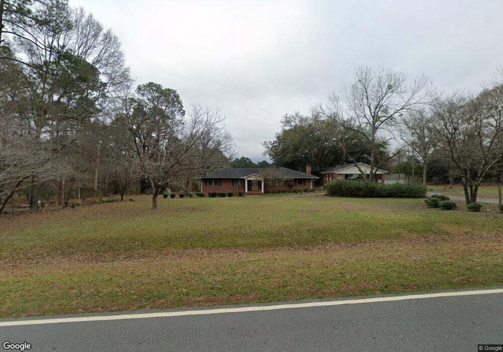
173 Bates Rd Cochran, GA 31014
Estimated Value: $190,000 - $258,000
3
Beds
1
Bath
1,680
Sq Ft
$128/Sq Ft
Est. Value
About This Home
This home is located at 173 Bates Rd, Cochran, GA 31014 and is currently estimated at $215,582, approximately $128 per square foot. 173 Bates Rd is a home located in Bleckley County with nearby schools including Bleckley County Primary School, Bleckley County Elementary School, and Bleckley Middle School.
Ownership History
Date
Name
Owned For
Owner Type
Purchase Details
Closed on
Mar 17, 2021
Sold by
Smith Jessie L
Bought by
Livingston Andrew J
Current Estimated Value
Home Financials for this Owner
Home Financials are based on the most recent Mortgage that was taken out on this home.
Original Mortgage
$70,000
Outstanding Balance
$4,977
Interest Rate
2.8%
Mortgage Type
New Conventional
Estimated Equity
$210,605
Purchase Details
Closed on
Apr 26, 1999
Sold by
Livingston Ann D
Bought by
Smith Jessie L and Smith Et
Create a Home Valuation Report for This Property
The Home Valuation Report is an in-depth analysis detailing your home's value as well as a comparison with similar homes in the area
Home Values in the Area
Average Home Value in this Area
Purchase History
| Date | Buyer | Sale Price | Title Company |
|---|---|---|---|
| Livingston Andrew J | $90,667 | -- | |
| Smith Jessie L | -- | -- | |
| Livingston Ann D | -- | -- |
Source: Public Records
Mortgage History
| Date | Status | Borrower | Loan Amount |
|---|---|---|---|
| Open | Livingston Andrew J | $70,000 |
Source: Public Records
Tax History
| Year | Tax Paid | Tax Assessment Tax Assessment Total Assessment is a certain percentage of the fair market value that is determined by local assessors to be the total taxable value of land and additions on the property. | Land | Improvement |
|---|---|---|---|---|
| 2025 | $2,244 | $84,076 | $2,280 | $81,796 |
| 2024 | $2,249 | $84,076 | $2,280 | $81,796 |
| 2023 | $2,333 | $84,076 | $2,280 | $81,796 |
| 2022 | $2,050 | $75,356 | $2,280 | $73,076 |
| 2021 | $1,474 | $50,608 | $1,800 | $48,808 |
| 2020 | $1,474 | $50,608 | $1,800 | $48,808 |
| 2019 | $1,023 | $37,070 | $2,160 | $34,910 |
| 2018 | $1,090 | $37,070 | $2,160 | $34,910 |
| 2017 | $1,031 | $37,070 | $2,160 | $34,910 |
| 2016 | $1,032 | $37,070 | $2,160 | $34,910 |
| 2015 | -- | $37,070 | $2,160 | $34,910 |
| 2014 | -- | $37,070 | $2,160 | $34,910 |
| 2013 | -- | $37,070 | $2,160 | $34,910 |
Source: Public Records
Map
Nearby Homes
- 139 and 137 Ga Hwy 257
- 6471 Cochran Hwy
- 349 Empire Chester Hwy
- 868 Mac Thompson Rd
- 596 Ga Highway 257
- LOT 46 Woodland Trail Rd
- LOT 47 Woodland Trail Rd
- LOT 24 Woodland Trail Rd
- 0 Woodland Trail Rd Unit 12994880
- 0 Mac Thompson Rd Unit 16072590
- 0 Mac Thompson Rd Unit 261700
- 500 Bowman Rd
- 176 Pineland Estates Rd
- 119 Moll Dr
- 0 Wood Oak Cir Unit 233873
- 0 Wood Oak Cir Unit 9278951
- 175 Wood Oak Cir
- 238 Wood Oak Cir
- RV Park Mac Thompson Rd
- Land Mac Thompson Rd
- 185 Bates Rd
- 115 Parrot Rd
- 196 Bates Rd
- 109 Parrot Rd
- 115 Randall Rd
- 209 Bates Rd
- 120 Ward Hill Church Rd
- 110 Randall Rd
- 210 Bates Rd
- 217 Bates Rd
- 130 Bates Rd
- 137 Ward Hill Church Rd
- 111 Holt Perkins Rd
- - Ward Hill Church Rd
- 121 Randall Rd
- 135 Holt Perkins Rd
- 141 Ward Hill Church Rd
- 113 Randall Rd
- 162 Ward Hill Church Rd
- 230 Bates Rd
Your Personal Tour Guide
Ask me questions while you tour the home.