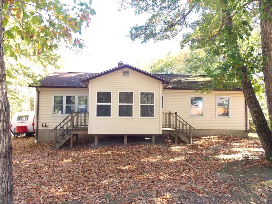
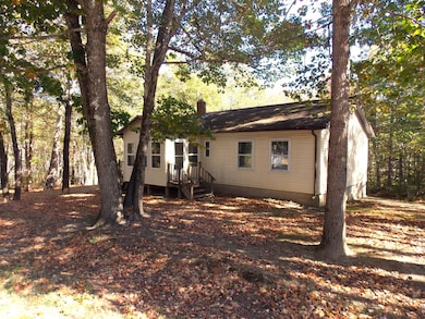
173 Bog Rd Northport, ME 04849
Estimated payment $1,710/month
Highlights
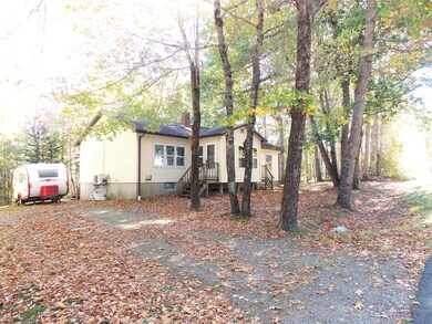
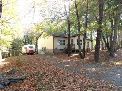
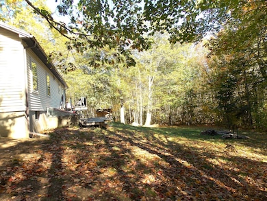
- View of Trees or Woods
- Wooded Lot
- No HOA
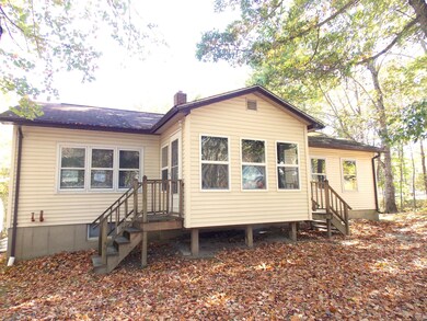
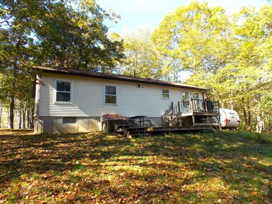
- Deck
- Ranch Style House
- Cooling Available
About This Home
This cozy ranch has both convenience of living and location. Just minutes from Belfast and Route 1, this ranch has a quiet setting while staying close to the ocean and town. Enjoy one floor living, relax on the back deck, and be at the shore in moments!
Home Details
Home Type
- Single Family
Est. Annual Taxes
- $1,855
Year Built
- Built in 1975
Lot Details
- 1.85 Acre Lot
- Rural Setting
- Sloped Lot
- Wooded Lot
Parking
- Gravel Driveway
Home Design
- Ranch Style House
- Concrete Foundation
- Wood Frame Construction
- Shingle Roof
- Vinyl Siding
- Concrete Perimeter Foundation
Interior Spaces
- 1,104 Sq Ft Home
- Living Room
- Dining Room
- Views of Woods
- Electric Range
Flooring
- Carpet
- Vinyl
Bedrooms and Bathrooms
- 3 Bedrooms
- 2 Full Bathrooms
Unfinished Basement
- Basement Fills Entire Space Under The House
- Interior Basement Entry
Utilities
- Cooling Available
- Heating System Uses Oil
- Heating System Uses Wood
- Heat Pump System
- Baseboard Heating
- Natural Gas Not Available
- Private Water Source
- Well
- Septic System
- Private Sewer
Additional Features
- Green Energy Fireplace or Wood Stove
- Deck
Community Details
- No Home Owners Association
Listing and Financial Details
- Tax Lot 44-A
- Assessor Parcel Number NRPR-000001-000000-000044A-R000000
Map
Home Values in the Area
Average Home Value in this Area
Tax History
| Year | Tax Paid | Tax Assessment Tax Assessment Total Assessment is a certain percentage of the fair market value that is determined by local assessors to be the total taxable value of land and additions on the property. | Land | Improvement |
|---|---|---|---|---|
| 2024 | $1,855 | $104,800 | $35,700 | $69,100 |
| 2023 | $1,703 | $104,800 | $35,700 | $69,100 |
| 2022 | $1,666 | $104,800 | $35,700 | $69,100 |
| 2021 | $1,624 | $104,800 | $35,700 | $69,100 |
| 2020 | $1,598 | $104,800 | $35,700 | $69,100 |
| 2019 | $1,666 | $104,800 | $35,700 | $69,100 |
| 2018 | $1,522 | $104,800 | $35,700 | $69,100 |
| 2017 | $1,512 | $104,800 | $35,700 | $69,100 |
| 2016 | $1,483 | $104,800 | $35,700 | $69,100 |
| 2015 | $1,446 | $104,800 | $35,700 | $69,100 |
| 2014 | $1,708 | $104,800 | $35,700 | $69,100 |
| 2013 | $1,483 | $104,800 | $35,700 | $69,100 |
Property History
| Date | Event | Price | List to Sale | Price per Sq Ft |
|---|---|---|---|---|
| 10/15/2025 10/15/25 | For Sale | $295,000 | -- | $267 / Sq Ft |
Purchase History
| Date | Type | Sale Price | Title Company |
|---|---|---|---|
| Not Resolvable | -- | -- |
Mortgage History
| Date | Status | Loan Amount | Loan Type |
|---|---|---|---|
| Open | $88,000 | Stand Alone Second |
Source: Maine Listings
MLS Number: 1640839
APN: NRPR-000001-000000-000044A-R000000
Disclaimer: Certain information contained herein is derived from information provided by parties other than Homes.com. All information provided is deemed reliable, but is not guaranteed to be accurate and should be independently verified.
![]() Listing data is derived in whole or in part from Maine Real Estate Information System, Inc. (d/b/a Maine Listings) and is for consumers' personal, noncommercial use only. Dimensions are approximate and not guaranteed. All data should be independently verified.
Listing data is derived in whole or in part from Maine Real Estate Information System, Inc. (d/b/a Maine Listings) and is for consumers' personal, noncommercial use only. Dimensions are approximate and not guaranteed. All data should be independently verified.
© 2025 Maine Real Estate Information System, Inc. All Rights Reserved. Equal Housing Opportunity.
Homes.com, LLC, 17600 Laguna Canyon Rd Irvine, CA 92618 (888)-952-6393
![]()
- 192 Flanders Rd
- 223 Priest Rd
- 225 Priest Rd
- Lot 26 Mariners Watch Rd
- 139 Prescott Hill Rd
- R-3 L5 Beech Hill Rd
- R-3 L2-A Beech Hill Rd
- R-3 L5&2A Beech Hill Rd
- L46 (Part) Beech Hill Rd
- 1145 Moosewood Ln
- 1025 Douglas Dr
- 86 Cross St
- R-7 17-C Eagle Dr
- 95 Bayside Rd
- L 58 Part Horse Jockey Ln
- 49 Bayside Rd
- 381 Atlantic Hwy
- 11 Bowling Green Ln
- 48 George St
- 27 Bowling Green Ln
- 144 Upper Bluff Rd Unit A
- 60 Doak Rd
- 74 Battle Ave Unit B
- 12 Free St
- 1 Norwood Ave Unit B
- 5 West Dr
- 5 Bracken Ln
- 103 US Route 1 Unit 3upstairsunit
- 18 Wenbelle Dr Unit 328
- 18 Wenbelle Dr Unit 302
- 3 Cushing St Unit 2
- 7 Gilchrest St Place Unit 9
- 7 Gilchrest St Place Unit 6
- 153 Clark Rd Unit A
- 54 Main St
- 64 Main St
- 64 Main St
- 1331 Old Rte One Unit A2
- 14 Atlantic Ave
- 1 Pine Grove Dr
