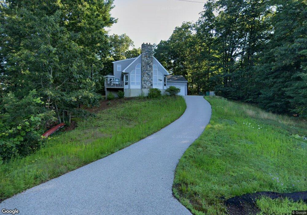
173 Carr St Whitinsville, MA 01588
Estimated Value: $516,000 - $636,000
4
Beds
3
Baths
1,914
Sq Ft
$309/Sq Ft
Est. Value
About This Home
This home is located at 173 Carr St, Whitinsville, MA 01588 and is currently estimated at $592,363, approximately $309 per square foot. 173 Carr St is a home located in Worcester County with nearby schools including Northbridge Elementary School, Northbridge Middle School, and Northbridge High School.
Ownership History
Date
Name
Owned For
Owner Type
Purchase Details
Closed on
Sep 10, 2004
Sold by
Hare David B and Hare Marion L
Bought by
Martin David P and Martin Susan P
Current Estimated Value
Create a Home Valuation Report for This Property
The Home Valuation Report is an in-depth analysis detailing your home's value as well as a comparison with similar homes in the area
Home Values in the Area
Average Home Value in this Area
Purchase History
| Date | Buyer | Sale Price | Title Company |
|---|---|---|---|
| Martin David P | $80,000 | -- | |
| Martin David P | $80,000 | -- |
Source: Public Records
Mortgage History
| Date | Status | Borrower | Loan Amount |
|---|---|---|---|
| Open | Martin David P | $177,000 |
Source: Public Records
Tax History Compared to Growth
Tax History
| Year | Tax Paid | Tax Assessment Tax Assessment Total Assessment is a certain percentage of the fair market value that is determined by local assessors to be the total taxable value of land and additions on the property. | Land | Improvement |
|---|---|---|---|---|
| 2025 | $6,378 | $541,000 | $182,500 | $358,500 |
| 2024 | $6,179 | $511,100 | $182,500 | $328,600 |
| 2023 | $6,217 | $479,700 | $167,300 | $312,400 |
| 2022 | $5,756 | $418,000 | $128,700 | $289,300 |
| 2021 | $3,962 | $391,400 | $122,500 | $268,900 |
| 2020 | $2,361 | $379,900 | $122,500 | $257,400 |
| 2019 | $4,739 | $365,400 | $122,500 | $242,900 |
| 2018 | $4,501 | $347,800 | $116,500 | $231,300 |
| 2017 | $4,470 | $330,400 | $116,500 | $213,900 |
| 2016 | $4,408 | $320,600 | $105,900 | $214,700 |
| 2015 | $4,290 | $320,600 | $105,900 | $214,700 |
| 2014 | $4,251 | $320,600 | $105,900 | $214,700 |
Source: Public Records
Map
Nearby Homes
- 2 D St
- 14 C St Unit 24
- 14 C St Unit 14
- 11 A St Unit 11
- 24 Crescent St Unit 6
- 56 Prescott Rd
- 201 Prescott Rd
- 8 Virginia Ave
- 46 Rebecca Rd
- 192 Rebecca Rd
- 86 Kingsnorth St
- 731 Samuel Dr
- 20 Wunschel Dr
- 3 Bayliss Way
- 9 Banning Dr
- 22 Bayliss Way
- Lots 1-9 Spring St
- 26 Bayliss Way
- 90 Nathaniel Dr
- 68 Lackey Dam Rd