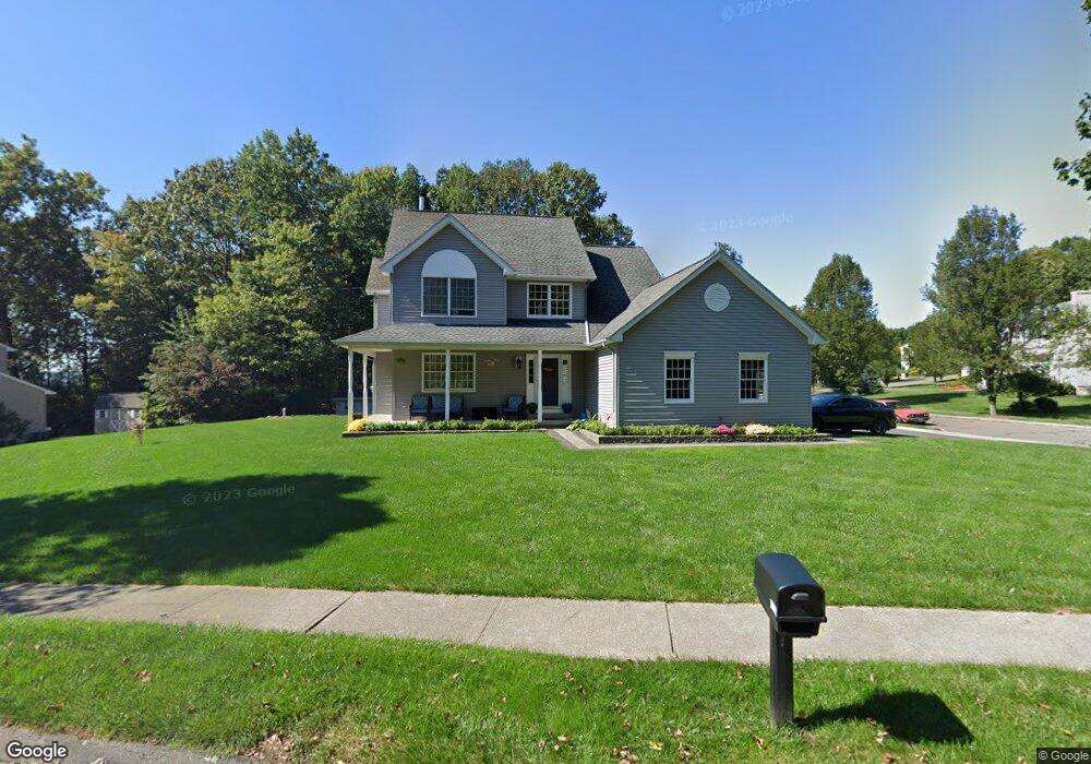
173 Donovan Rd Naugatuck, CT 06770
Estimated Value: $417,000 - $525,000
3
Beds
3
Baths
2,004
Sq Ft
$227/Sq Ft
Est. Value
About This Home
This home is located at 173 Donovan Rd, Naugatuck, CT 06770 and is currently estimated at $455,184, approximately $227 per square foot. 173 Donovan Rd is a home located in New Haven County with nearby schools including City Hill Middle School and Naugatuck High School.
Ownership History
Date
Name
Owned For
Owner Type
Purchase Details
Closed on
Jan 12, 1999
Sold by
Carriage Homes
Bought by
Simoes Roger and Simoes Ana
Current Estimated Value
Home Financials for this Owner
Home Financials are based on the most recent Mortgage that was taken out on this home.
Original Mortgage
$160,000
Interest Rate
6.5%
Mortgage Type
Purchase Money Mortgage
Create a Home Valuation Report for This Property
The Home Valuation Report is an in-depth analysis detailing your home's value as well as a comparison with similar homes in the area
Home Values in the Area
Average Home Value in this Area
Purchase History
| Date | Buyer | Sale Price | Title Company |
|---|---|---|---|
| Simoes Roger | $184,900 | -- |
Source: Public Records
Mortgage History
| Date | Status | Borrower | Loan Amount |
|---|---|---|---|
| Closed | Simoes Roger | $143,300 | |
| Closed | Simoes Roger | $160,000 |
Source: Public Records
Tax History
| Year | Tax Paid | Tax Assessment Tax Assessment Total Assessment is a certain percentage of the fair market value that is determined by local assessors to be the total taxable value of land and additions on the property. | Land | Improvement |
|---|---|---|---|---|
| 2025 | $9,292 | $233,520 | $35,840 | $197,680 |
| 2024 | $9,759 | $233,520 | $35,840 | $197,680 |
| 2023 | $10,450 | $233,520 | $35,840 | $197,680 |
| 2022 | $8,200 | $171,730 | $37,750 | $133,980 |
| 2021 | $8,200 | $171,730 | $37,750 | $133,980 |
| 2020 | $8,200 | $171,730 | $37,750 | $133,980 |
| 2019 | $8,114 | $171,730 | $37,750 | $133,980 |
| 2018 | $8,487 | $175,530 | $53,200 | $122,330 |
| 2017 | $8,522 | $175,530 | $53,200 | $122,330 |
| 2016 | $8,355 | $175,270 | $53,200 | $122,070 |
| 2015 | $7,987 | $175,270 | $53,200 | $122,070 |
| 2014 | $7,898 | $175,270 | $53,200 | $122,070 |
| 2012 | $7,183 | $214,100 | $55,200 | $158,900 |
Source: Public Records
Map
Nearby Homes
- 25 Tyler Hill Rd
- 85 Cold Spring Cir
- 111 Wooster St Unit 4A
- 51 Brook St Unit 6A
- 51 Brook St Unit 3B
- 36 Longview Terrace
- 137 Lincoln St
- 163 City Hill St
- 46 Mulberry St
- 190 Auburn St
- 119 Prospect St
- 32 Stanley St
- 22 Neagle St
- 210 Johnson St
- 35 Monahan Ln
- 18 Cadbury Place
- 171 Union City Rd
- 121 Johnson St
- 465 N Main St
- 231 N Main St
- 183 Donovan Rd
- 193 Donovan Rd
- 180 Donovan Rd
- 9 Sierra Ridge Rd
- 192 Donovan Rd
- 16 Sierra Ridge Rd
- 203 Donovan Rd
- 121 Donovan Rd
- 213 Donovan Rd
- 208 Donovan Rd
- 115 Donovan Rd
- 22 Sierra Ridge Rd
- 84 Tyler Hill Rd
- 223 Donovan Rd
- 218 Donovan Rd
- 126 Donovan Rd
- 102 Tyler Hill Rd
- 27 Sierra Ridge Rd
- 109 Donovan Rd
Your Personal Tour Guide
Ask me questions while you tour the home.