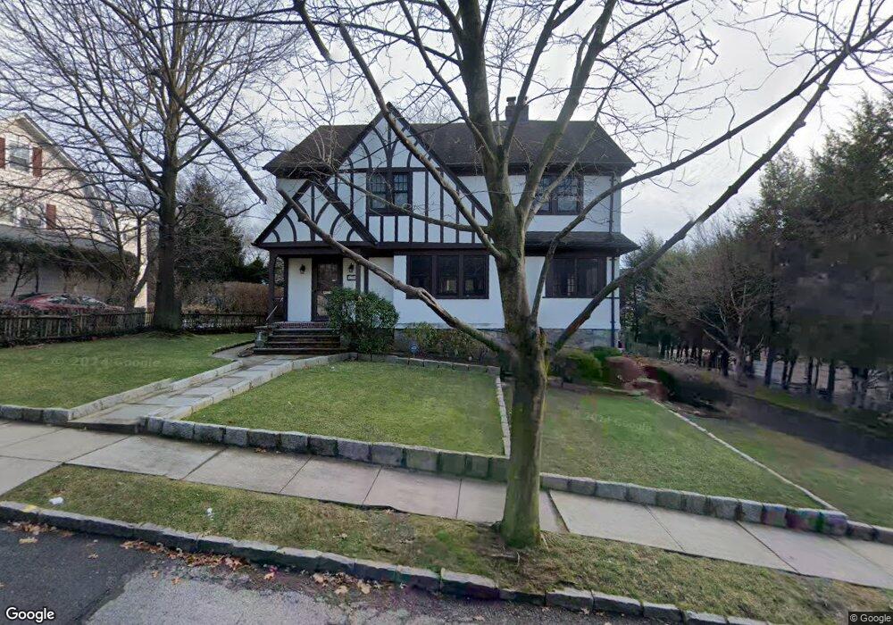
173 Ellison Ave Bronxville, NY 10708
Cedar Knolls NeighborhoodEstimated Value: $1,215,268 - $1,504,000
4
Beds
3
Baths
2,296
Sq Ft
$573/Sq Ft
Est. Value
About This Home
This home is located at 173 Ellison Ave, Bronxville, NY 10708 and is currently estimated at $1,315,067, approximately $572 per square foot. 173 Ellison Ave is a home located in Westchester County with nearby schools including St. Eugene School and Saint Joseph School.
Ownership History
Date
Name
Owned For
Owner Type
Purchase Details
Closed on
Jan 27, 2000
Sold by
Knapp Richard
Bought by
Knapp Richard and Moesel Carol
Current Estimated Value
Purchase Details
Closed on
Sep 24, 1999
Sold by
Raffa Anthony and Keating Michele
Bought by
Knapp Richard
Home Financials for this Owner
Home Financials are based on the most recent Mortgage that was taken out on this home.
Original Mortgage
$244,000
Interest Rate
7.5%
Mortgage Type
Unknown
Purchase Details
Closed on
Aug 21, 1997
Sold by
Vecchione Joanne and Paulus Helen Barbara
Bought by
Raffa Anthony and Keating Michele
Create a Home Valuation Report for This Property
The Home Valuation Report is an in-depth analysis detailing your home's value as well as a comparison with similar homes in the area
Home Values in the Area
Average Home Value in this Area
Purchase History
| Date | Buyer | Sale Price | Title Company |
|---|---|---|---|
| Knapp Richard | -- | -- | |
| Knapp Richard | $466,900 | -- | |
| Raffa Anthony | $307,000 | The Title Guarantee Company |
Source: Public Records
Mortgage History
| Date | Status | Borrower | Loan Amount |
|---|---|---|---|
| Previous Owner | Knapp Richard | $244,000 |
Source: Public Records
Tax History Compared to Growth
Tax History
| Year | Tax Paid | Tax Assessment Tax Assessment Total Assessment is a certain percentage of the fair market value that is determined by local assessors to be the total taxable value of land and additions on the property. | Land | Improvement |
|---|---|---|---|---|
| 2024 | $2,869 | $16,100 | $4,700 | $11,400 |
| 2023 | $2,854 | $16,100 | $4,700 | $11,400 |
| 2022 | $2,835 | $16,100 | $4,700 | $11,400 |
| 2021 | $12,854 | $16,100 | $4,700 | $11,400 |
| 2020 | $12,761 | $16,100 | $4,700 | $11,400 |
| 2019 | $15,169 | $16,100 | $4,700 | $11,400 |
| 2018 | $11,875 | $16,100 | $4,700 | $11,400 |
| 2017 | -- | $16,100 | $4,700 | $11,400 |
| 2016 | $13,396 | $16,100 | $4,700 | $11,400 |
| 2015 | -- | $16,100 | $4,700 | $11,400 |
| 2014 | -- | $16,100 | $4,700 | $11,400 |
| 2013 | -- | $16,100 | $4,700 | $11,400 |
Source: Public Records
Map
Nearby Homes
- 139 Ellison Ave
- 46 Dellwood Rd
- 16 Bryn Mawr Pkwy
- 119 Pondfield Rd W
- 49 Rockledge Rd Unit 12E
- 133 Pondfield Rd W Unit 2B
- 764 Palmer Rd Unit 1B
- 29 Chatfield Rd
- 209 Pondfield Rd W
- 15 Sunnybrook Rd Unit 2A
- 86 Pondfield Rd W
- 212 Pondfield Rd W
- 766 Palmer Rd Unit 2D
- 9 Winchester Ave Unit 2B
- 609 Palmer Rd Unit 3M
- 609 Palmer Rd Unit 4C
- 609 Palmer Rd Unit 4J
- 10 Rockledge Rd
- 824 Palmer Rd Unit 1D
- 615 Palmer Rd Unit 602
- 181 Ellison Ave
- 161 Ellison Ave
- 138 Millard Ave
- 174 Ellison Ave
- 7 Millison Close
- 153 Ellison Ave
- 134 Millard Ave
- 168 Ellison Ave
- 172 Ellison Ave Unit 1
- 172 Ellison Ave
- 10 Millison Close
- 142 Millard Ave
- 162 Ellison Ave
- 182 Ellison Ave
- 8 Millison Close
- 141 Millard Ave
- 135 Millard Ave
- 147 Ellison Ave
- 147 Millard Ave
- 129 Millard Ave