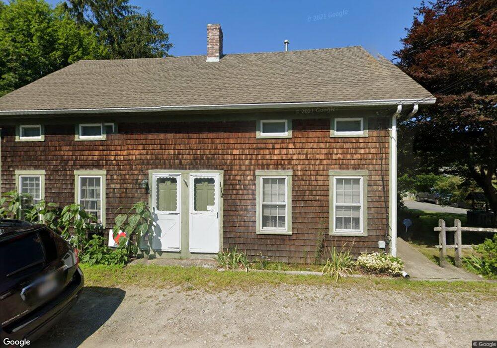
173 Forge Rd Unit 175 Westport, MA 02790
Estimated Value: $408,268 - $540,000
2
Beds
--
Bath
1,927
Sq Ft
$245/Sq Ft
Est. Value
About This Home
This home is located at 173 Forge Rd Unit 175, Westport, MA 02790 and is currently estimated at $472,756, approximately $245 per square foot. 173 Forge Rd Unit 175 is a home located in Bristol County with nearby schools including Alice A. Macomber Primary School, Westport Elementary School, and Westport Middle-High School.
Ownership History
Date
Name
Owned For
Owner Type
Purchase Details
Closed on
Apr 13, 2017
Sold by
Carreiro Barbara A
Bought by
Carreiro Barbara Anne
Current Estimated Value
Purchase Details
Closed on
Sep 21, 1978
Bought by
Carreiro Barbara A and Carreiro Barbara
Create a Home Valuation Report for This Property
The Home Valuation Report is an in-depth analysis detailing your home's value as well as a comparison with similar homes in the area
Home Values in the Area
Average Home Value in this Area
Purchase History
| Date | Buyer | Sale Price | Title Company |
|---|---|---|---|
| Carreiro Barbara Anne | -- | -- | |
| Carreiro Barbara A | -- | -- |
Source: Public Records
Mortgage History
| Date | Status | Borrower | Loan Amount |
|---|---|---|---|
| Previous Owner | Carreiro Barbara A | $147,000 | |
| Previous Owner | Carreiro Barbara A | $175,000 | |
| Previous Owner | Carreiro Barbara A | $30,000 |
Source: Public Records
Tax History Compared to Growth
Tax History
| Year | Tax Paid | Tax Assessment Tax Assessment Total Assessment is a certain percentage of the fair market value that is determined by local assessors to be the total taxable value of land and additions on the property. | Land | Improvement |
|---|---|---|---|---|
| 2025 | $2,130 | $285,900 | $147,400 | $138,500 |
| 2024 | $2,116 | $273,800 | $136,600 | $137,200 |
| 2023 | $2,096 | $256,900 | $123,900 | $133,000 |
| 2022 | $1,880 | $221,700 | $117,700 | $104,000 |
| 2021 | $1,819 | $211,000 | $107,000 | $104,000 |
| 2020 | $1,697 | $201,300 | $97,300 | $104,000 |
| 2019 | $1,672 | $202,200 | $97,300 | $104,900 |
| 2018 | $1,594 | $195,100 | $109,400 | $85,700 |
| 2017 | $1,508 | $189,200 | $105,900 | $83,300 |
| 2016 | $1,469 | $185,700 | $102,400 | $83,300 |
| 2015 | $1,373 | $173,100 | $104,700 | $68,400 |
Source: Public Records
Map
Nearby Homes
- 96 Forge Rd
- 29 Union Ave
- 3 Roller Coaster Way Unit Lot 1
- 27 Dias Ave
- 461 Reed Rd
- 16 S Berryman St
- 15 S Breault St
- 735 Reed Rd
- 56 Lakeside Ave
- 55 Lakeside Ave
- 9 Kyle Jacob Rd
- 818 Reed Rd
- 4 Main Rd
- 565 Highland Ave
- 0 Van Buren St
- 47 Fallon Dr
- 116 Gifford Rd
- Lot 0 Marcotte
- 320 Old Westport Rd
- 23 Donna St
- 1133 American Legion Hwy
- 177 Forge Rd Unit 179
- 183 Forge Rd Unit 185
- 1123 American Legion Hwy
- 174 Forge Rd
- 187-189 Forge Rd
- 187 Forge Rd Unit 189
- 178 Forge Rd
- 1126 American Legion Hwy
- 1134 American Legion Hwy Unit B
- 1134 American Legion Hwy Unit A
- 1134 American Legion Hwy
- 1134 American Legion Hwy Unit D
- 1134 American Legion Hwy Unit 4
- 1134 American Legion Hwy Unit E
- 191 Forge Rd Unit 193
- 188 Forge Rd
- 1122 American Legion Hwy
- 2 Cheryls Way
- 2 Cheryls Way Unit 1