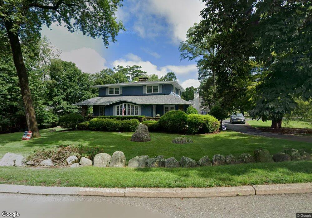
173 Mahwah Rd Mahwah, NJ 07430
Estimated Value: $960,836 - $1,100,000
--
Bed
--
Bath
2,804
Sq Ft
$366/Sq Ft
Est. Value
About This Home
This home is located at 173 Mahwah Rd, Mahwah, NJ 07430 and is currently estimated at $1,024,959, approximately $365 per square foot. 173 Mahwah Rd is a home located in Bergen County with nearby schools including Mahwah High School.
Ownership History
Date
Name
Owned For
Owner Type
Purchase Details
Closed on
Feb 27, 2006
Current Estimated Value
Purchase Details
Closed on
Sep 13, 2000
Sold by
Collins Jane S
Bought by
Collins Margaret J and Thomas Sanford W
Home Financials for this Owner
Home Financials are based on the most recent Mortgage that was taken out on this home.
Original Mortgage
$150,000
Interest Rate
8%
Purchase Details
Closed on
Aug 3, 1999
Sold by
Collins Margaret J
Bought by
Collins Margaret J and Collins Exemption Part Trust
Create a Home Valuation Report for This Property
The Home Valuation Report is an in-depth analysis detailing your home's value as well as a comparison with similar homes in the area
Home Values in the Area
Average Home Value in this Area
Purchase History
| Date | Buyer | Sale Price | Title Company |
|---|---|---|---|
| -- | -- | -- | |
| Collins Margaret J | $155,000 | -- | |
| Collins Margaret J | -- | -- |
Source: Public Records
Mortgage History
| Date | Status | Borrower | Loan Amount |
|---|---|---|---|
| Previous Owner | Collins Margaret J | $150,000 |
Source: Public Records
Tax History Compared to Growth
Tax History
| Year | Tax Paid | Tax Assessment Tax Assessment Total Assessment is a certain percentage of the fair market value that is determined by local assessors to be the total taxable value of land and additions on the property. | Land | Improvement |
|---|---|---|---|---|
| 2025 | $12,343 | $598,000 | $357,600 | $240,400 |
| 2024 | $12,181 | $598,000 | $357,600 | $240,400 |
| 2023 | $11,793 | $598,000 | $357,600 | $240,400 |
| 2022 | $11,793 | $598,000 | $357,600 | $240,400 |
| 2021 | $11,667 | $598,000 | $357,600 | $240,400 |
| 2020 | $11,386 | $598,000 | $357,600 | $240,400 |
| 2019 | $11,009 | $598,000 | $357,600 | $240,400 |
| 2018 | $10,854 | $598,000 | $357,600 | $240,400 |
| 2017 | $10,680 | $598,000 | $357,600 | $240,400 |
| 2016 | $10,447 | $598,000 | $357,600 | $240,400 |
| 2015 | $10,304 | $598,000 | $357,600 | $240,400 |
| 2014 | $10,130 | $598,000 | $357,600 | $240,400 |
Source: Public Records
Map
Nearby Homes
- 12 Alcott Rd
- 37 Hillside Ave
- 66 Thunderhead Place
- 13 Winter Terrace
- 324 Franklin Turnpike
- 163 Rutherford Rd
- 16 Gardner St
- 2 Reid Ct
- 2256 Margaret Ct Unit 21A
- 1415 York St
- 2120 Gunston Ct
- 2130 Isabelle Ct
- 12 Sagamore Ave
- 2115 Henry Ct Unit 1
- 2170 Kent Ct
- 1248 Garrison Ct Unit E1
- 2054 Charles Ct
- 1194 Richmond Rd Unit A2
- 199 Parkside Dr
- 235 Parkside Dr Unit 235