Estimated Value: $753,000 - $914,000
4
Beds
4
Baths
2,772
Sq Ft
$298/Sq Ft
Est. Value
About This Home
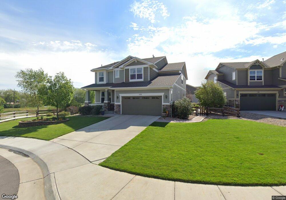
This home is located at 173 Maxwell Cir, Erie, CO 80516 and is currently estimated at $825,061, approximately $297 per square foot. 173 Maxwell Cir is a home with nearby schools including Red Hawk Elementary School, Erie Middle School, and Erie High School.
Ownership History
Date
Name
Owned For
Owner Type
Purchase Details
Closed on
Jun 25, 2014
Sold by
Ratcliff Knight Lawrence and Ratcliff Knight Katie
Bought by
The Katie Knight Revocable Trust
Current Estimated Value
Purchase Details
Closed on
Nov 30, 2012
Sold by
Meritage Homes Of Colorado Inc
Bought by
Ratcliff Knight Lawrence and Ratcliff Knight Katie
Home Financials for this Owner
Home Financials are based on the most recent Mortgage that was taken out on this home.
Original Mortgage
$384,750
Outstanding Balance
$266,945
Interest Rate
3.4%
Mortgage Type
New Conventional
Estimated Equity
$558,116
Create a Home Valuation Report for This Property
The Home Valuation Report is an in-depth analysis detailing your home's value as well as a comparison with similar homes in the area
Home Values in the Area
Average Home Value in this Area
Purchase History
| Date | Buyer | Sale Price | Title Company |
|---|---|---|---|
| The Katie Knight Revocable Trust | -- | None Available | |
| Ratcliff Knight Lawrence | $410,165 | Heritage Title |
Source: Public Records
Mortgage History
| Date | Status | Borrower | Loan Amount |
|---|---|---|---|
| Open | Ratcliff Knight Lawrence | $384,750 |
Source: Public Records
Tax History Compared to Growth
Tax History
| Year | Tax Paid | Tax Assessment Tax Assessment Total Assessment is a certain percentage of the fair market value that is determined by local assessors to be the total taxable value of land and additions on the property. | Land | Improvement |
|---|---|---|---|---|
| 2025 | $8,422 | $47,090 | $8,750 | $38,340 |
| 2024 | $8,422 | $47,090 | $8,750 | $38,340 |
| 2023 | $8,200 | $53,290 | $10,420 | $42,870 |
| 2022 | $6,309 | $38,240 | $7,160 | $31,080 |
| 2021 | $6,398 | $39,340 | $7,360 | $31,980 |
| 2020 | $6,118 | $37,800 | $5,430 | $32,370 |
| 2019 | $6,156 | $37,800 | $5,430 | $32,370 |
| 2018 | $5,729 | $35,300 | $4,540 | $30,760 |
| 2017 | $5,622 | $35,300 | $4,540 | $30,760 |
| 2016 | $5,097 | $32,820 | $4,780 | $28,040 |
| 2015 | $4,994 | $32,820 | $4,780 | $28,040 |
| 2014 | $4,482 | $29,320 | $4,780 | $24,540 |
Source: Public Records
Map
Nearby Homes
- 110 Ferris Ln
- 195 Briggs St
- 270 Holbrook St
- 420 Anderson St
- 410 Anderson St
- 132 Ambrose St
- 111 Ambrose St
- 173 Ambrose St
- 0 High St Unit REC9712912
- 365 Briggs St
- 0 Holbrook St
- 250 Holbrook St
- 555 Gallegos Cir
- 370 Lawley Dr
- 448 Biscuit St
- 448 Biscuit St Unit 1-23
- 122 Jackson Dr
- 93 Jackson Ln
- 580 Pierce St
- 626 Gallegos St
- 175 Maxwell Cir
- 168 Maxwell Cir
- 166 Maxwell Cir
- 178 Maxwell Cir
- 176 Maxwell Cir
- 180 Maxwell Cir
- 182 Maxwell Cir
- 185 Maxwell Cir
- 174 Maxwell Cir
- 164 Maxwell Cir
- 184 Maxwell Cir
- 187 Maxwell Cir
- 186 Maxwell Cir
- 162 Maxwell Cir
- 100 Westwood Way
- 189 Maxwell Cir
- 188 Maxwell Cir
- 110 Westwood Way
- 160 Maxwell Cir
- 190 Maxwell Cir