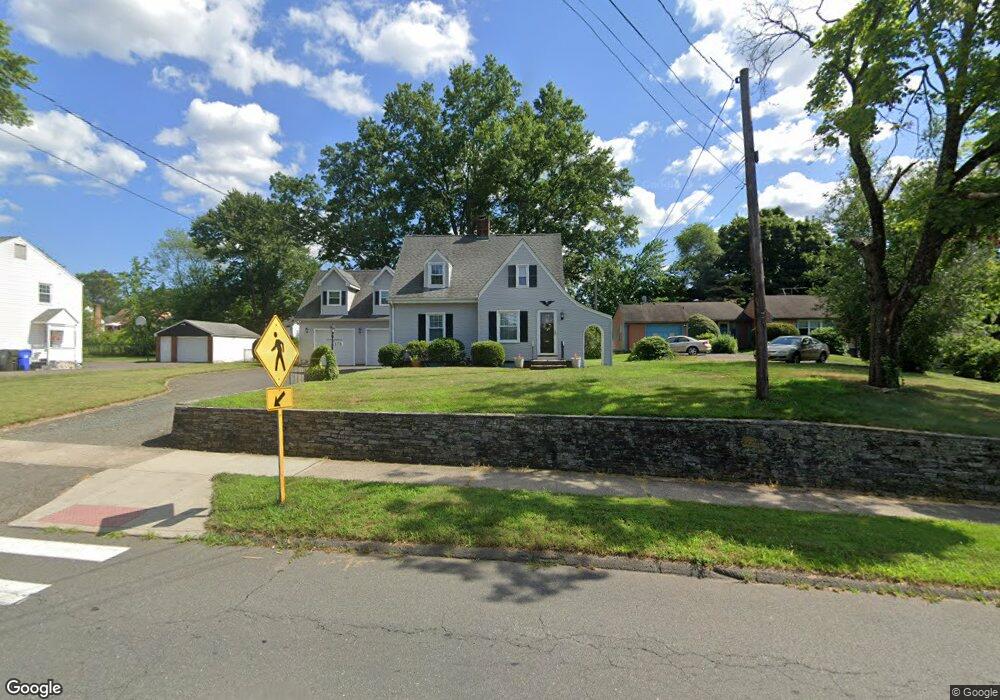
173 Stoddard Ave Newington, CT 06111
Estimated Value: $355,000 - $508,000
--
Bed
2
Baths
--
Sq Ft
0.37
Acres
About This Home
This home is located at 173 Stoddard Ave, Newington, CT 06111 and is currently estimated at $418,176. 173 Stoddard Ave is a home located in Hartford County with nearby schools including Anna Reynolds School, Martin Kellogg Middle School, and Newington High School.
Ownership History
Date
Name
Owned For
Owner Type
Purchase Details
Closed on
Feb 25, 1993
Sold by
Wright William S and Wright Susan K
Bought by
Natale Nicholas J and Natale Sherry R
Current Estimated Value
Home Financials for this Owner
Home Financials are based on the most recent Mortgage that was taken out on this home.
Original Mortgage
$133,950
Interest Rate
8.03%
Mortgage Type
Unknown
Create a Home Valuation Report for This Property
The Home Valuation Report is an in-depth analysis detailing your home's value as well as a comparison with similar homes in the area
Home Values in the Area
Average Home Value in this Area
Purchase History
| Date | Buyer | Sale Price | Title Company |
|---|---|---|---|
| Natale Nicholas J | $141,000 | -- |
Source: Public Records
Mortgage History
| Date | Status | Borrower | Loan Amount |
|---|---|---|---|
| Closed | Natale Nicholas J | $103,000 | |
| Closed | Natale Nicholas J | $7,500 | |
| Closed | Natale Nicholas J | $119,000 | |
| Closed | Natale Nicholas J | $133,950 |
Source: Public Records
Tax History Compared to Growth
Tax History
| Year | Tax Paid | Tax Assessment Tax Assessment Total Assessment is a certain percentage of the fair market value that is determined by local assessors to be the total taxable value of land and additions on the property. | Land | Improvement |
|---|---|---|---|---|
| 2025 | $7,425 | $185,710 | $57,680 | $128,030 |
| 2024 | $7,326 | $184,670 | $57,680 | $126,990 |
| 2023 | $7,084 | $184,670 | $57,680 | $126,990 |
| 2022 | $7,108 | $184,670 | $57,680 | $126,990 |
| 2021 | $7,167 | $184,670 | $57,680 | $126,990 |
| 2020 | $7,026 | $178,860 | $54,070 | $124,790 |
| 2019 | $7,056 | $178,860 | $54,070 | $124,790 |
| 2018 | $6,886 | $178,860 | $54,070 | $124,790 |
| 2017 | $6,544 | $178,860 | $54,070 | $124,790 |
| 2016 | $6,394 | $178,860 | $54,070 | $124,790 |
| 2014 | $6,068 | $174,520 | $53,870 | $120,650 |
Source: Public Records
Map
Nearby Homes
- 140 Camp Ave
- 35 Harding Ave
- 27 Harding Ave
- 105 Gilbert Rd
- 31 Dacosta Dr
- 47 Francis Dr
- 20 Surrey Dr Unit B16 aka B4
- 131 Williamstown Ct Unit 131
- 305 Hampton Ct
- 263 Williamstown Ct
- 29 Sunnyside Rd
- 37 Commonwealth Ave
- 84 Connecticut Ave
- 57 Welles Dr
- 16 Thornton Dr
- 559 Mountain Rd
- 228 Reservoir Rd
- 236 Sterling Dr Unit 236
- 218 Sterling Dr Unit 218
- 9 Old Farm Dr
- 175 Stoddard Ave
- 165 Stoddard Ave
- 185 Stoddard Ave
- 157 Stoddard Ave
- 172 Camp Ave
- 164 Camp Ave
- 176 Camp Ave
- 168 Stoddard Ave
- 160 Camp Ave
- 182 Camp Ave
- 189 Stoddard Ave
- 153 Stoddard Ave
- 180 Stoddard Ave
- 156 Camp Ave
- 184 Camp Ave
- 12 Nathan Hale Dr
- 158 Stoddard Ave
- 188 Camp Ave
- 152 Camp Ave
- 191 Stoddard Ave