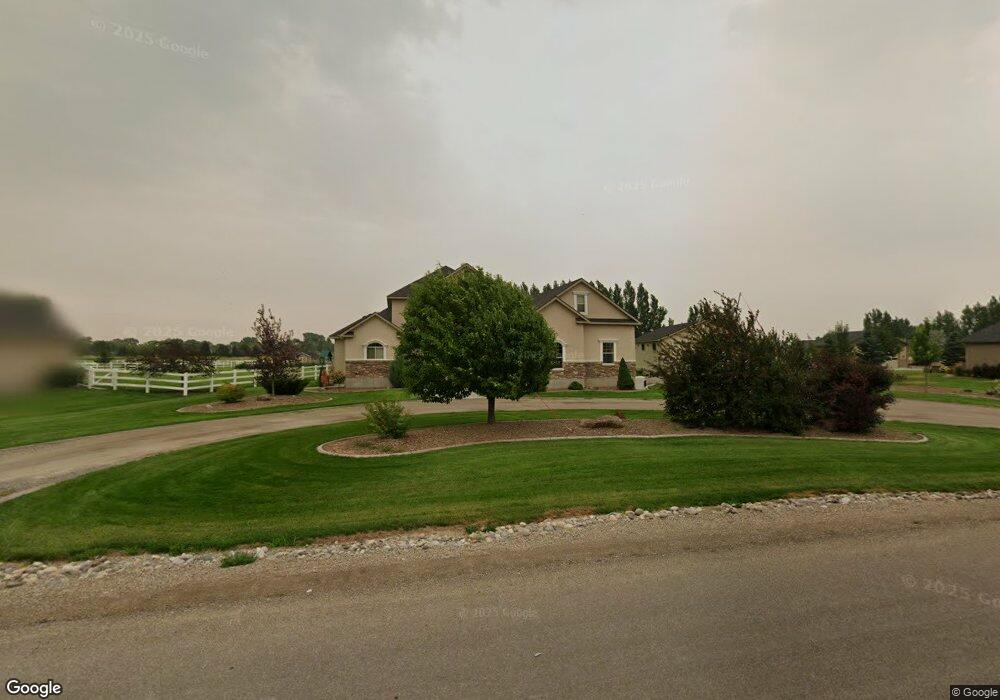
173 W 265 N Blackfoot, ID 83221
Estimated Value: $608,000 - $779,000
--
Bed
--
Bath
--
Sq Ft
1.62
Acres
About This Home
This home is located at 173 W 265 N, Blackfoot, ID 83221 and is currently estimated at $692,886. 173 W 265 N is a home with nearby schools including Ridge Crest Elementary School, Blackfoot High School, and Blackfoot Charter Community Learning Center.
Ownership History
Date
Name
Owned For
Owner Type
Purchase Details
Closed on
Aug 11, 2016
Sold by
Kesler Kelly K and Kesler Marva Lu
Bought by
Kesler Kelly K and Kesler Marva Ly
Current Estimated Value
Purchase Details
Closed on
May 28, 2009
Sold by
Eastvold Trent J and Eastvold Kelli J
Bought by
Breitweg James F and Breitweg Eileen
Purchase Details
Closed on
May 22, 2009
Sold by
Wheeler Caleb and Wheeler Sarah
Bought by
Breitweg James F and Breitweg Eileen
Purchase Details
Closed on
May 24, 2006
Sold by
Snake River View Estates Llc
Bought by
Kesler Kelly K and Kesler Marva Lu
Create a Home Valuation Report for This Property
The Home Valuation Report is an in-depth analysis detailing your home's value as well as a comparison with similar homes in the area
Home Values in the Area
Average Home Value in this Area
Purchase History
| Date | Buyer | Sale Price | Title Company |
|---|---|---|---|
| Kesler Kelly K | -- | None Available | |
| Breitweg James F | -- | -- | |
| Breitweg James F | -- | -- | |
| Kesler Kelly K | -- | -- |
Source: Public Records
Tax History Compared to Growth
Tax History
| Year | Tax Paid | Tax Assessment Tax Assessment Total Assessment is a certain percentage of the fair market value that is determined by local assessors to be the total taxable value of land and additions on the property. | Land | Improvement |
|---|---|---|---|---|
| 2025 | $2,293 | $682,537 | $102,340 | $580,197 |
| 2024 | $2,293 | $535,845 | $79,255 | $456,590 |
| 2023 | $2,196 | $535,845 | $79,255 | $456,590 |
| 2022 | $5,121 | $535,845 | $79,255 | $456,590 |
| 2021 | $2,616 | $352,052 | $69,255 | $282,797 |
| 2020 | $2,708 | $333,967 | $0 | $0 |
| 2019 | $2,966 | $333,967 | $0 | $0 |
| 2018 | $2,146 | $258,320 | $51,170 | $207,150 |
| 2017 | $2,175 | $258,320 | $51,170 | $207,150 |
| 2016 | $2,183 | $258,320 | $0 | $0 |
| 2015 | -- | $258,320 | $0 | $0 |
| 2014 | -- | $258,320 | $51,170 | $207,150 |
Source: Public Records
Map
Nearby Homes
- TBD Stem Way L2 B2
- 169 W 265 N
- TBD Stem Way L3 B2
- TBD Branch St L28 B1
- TBD Petal Drive L1 B2
- TBD Petal Drive L5 B2
- TBD Petal Drive L5 B3
- TBD Branch St L2 B5
- TBD Thorne Drive L9 B1
- TBD Thorne Dr L10 B1
- TBD Branch Way L4 B2
- TBD Branch Way L1 B3
- TBD Thorne Dr L8 B1
- TBD Thorn Ln L1 B1
- 183 265 North Ruby Rd
- 183 W 265 N
- TBD Thorne Dr L7 B1
- TBD Thorne Dr L11 B1
- TBD Thorn Ln L3 B1
- TBD Thorn Ln L6 B1
- 171 W 265 N
- 174 W 265 N
- TBD Petal Drive L2 B2
- TBD Petal Drive B2 L2
- 170 265 North Ruby Rd
- TBD Petal Drive L3 B2
- TBD Petal Drive B2 L3
- 172 W 265 N
- 177 W 265 N
- 0 Blk 3 Lot 10
- 162 W 245 N
- 167 265 North Ruby Rd
- TBD Petal Drive B2 L 1
- TBD Petal Drive B2 L5
- 168 W 265 N
- 176 W 265 N
- 164 W 245 N
- 165 Rd
- 179 W 265 N
- 178 W 265 N