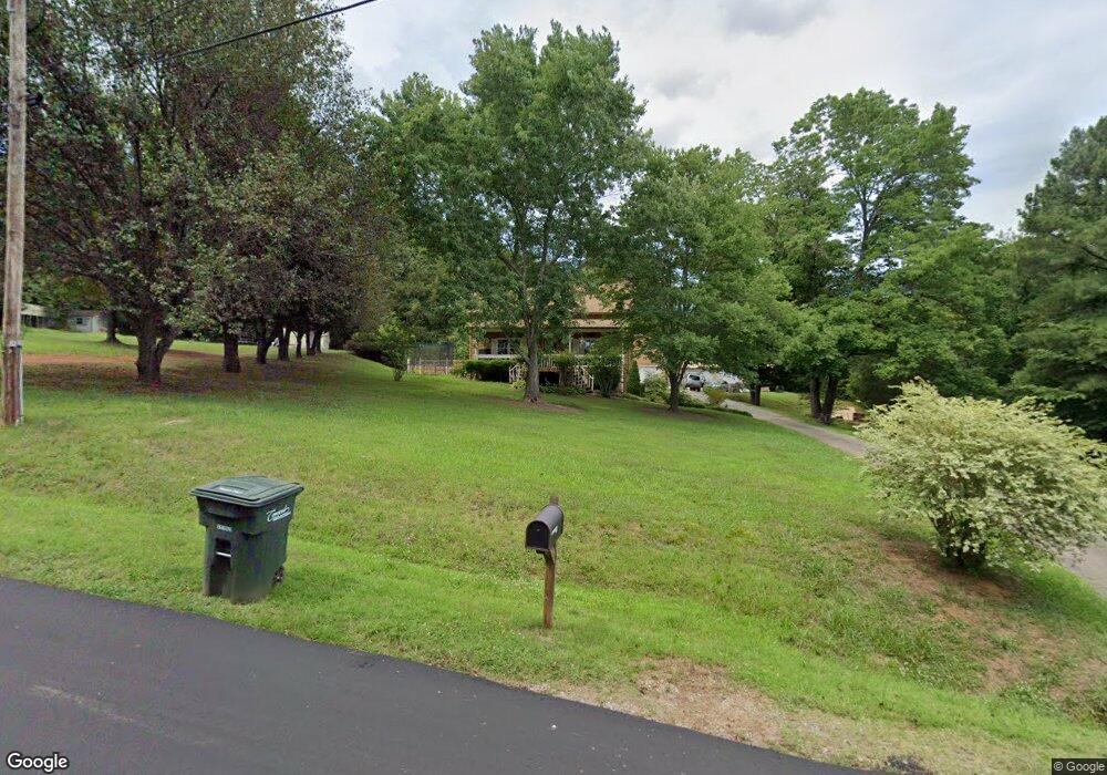
173 Woodland Cir SW Concord, NC 28025
Estimated Value: $344,000 - $384,366
3
Beds
2
Baths
1,882
Sq Ft
$192/Sq Ft
Est. Value
About This Home
This home is located at 173 Woodland Cir SW, Concord, NC 28025 and is currently estimated at $361,342, approximately $191 per square foot. 173 Woodland Cir SW is a home located in Cabarrus County with nearby schools including Rocky River Elementary School, J.N. Fries Middle School, and The Daniel Academy of Concord.
Ownership History
Date
Name
Owned For
Owner Type
Purchase Details
Closed on
Sep 8, 2004
Sold by
Hoffman Donald L and Hoffman Catherine S
Bought by
Hoffman Donald L and Hoffman Cathrene S
Current Estimated Value
Home Financials for this Owner
Home Financials are based on the most recent Mortgage that was taken out on this home.
Original Mortgage
$134,850
Outstanding Balance
$82,110
Interest Rate
9.5%
Mortgage Type
New Conventional
Estimated Equity
$279,232
Purchase Details
Closed on
Oct 1, 1985
Bought by
Hoffman Donald L
Create a Home Valuation Report for This Property
The Home Valuation Report is an in-depth analysis detailing your home's value as well as a comparison with similar homes in the area
Home Values in the Area
Average Home Value in this Area
Purchase History
| Date | Buyer | Sale Price | Title Company |
|---|---|---|---|
| Hoffman Donald L | -- | -- | |
| Hoffman Donald L | $72,000 | -- |
Source: Public Records
Mortgage History
| Date | Status | Borrower | Loan Amount |
|---|---|---|---|
| Open | Hoffman Donald L | $134,850 |
Source: Public Records
Tax History Compared to Growth
Tax History
| Year | Tax Paid | Tax Assessment Tax Assessment Total Assessment is a certain percentage of the fair market value that is determined by local assessors to be the total taxable value of land and additions on the property. | Land | Improvement |
|---|---|---|---|---|
| 2025 | $1,330 | $266,980 | $78,200 | $188,780 |
| 2024 | $1,330 | $266,980 | $78,200 | $188,780 |
| 2023 | $2,149 | $176,160 | $43,700 | $132,460 |
| 2022 | $2,149 | $176,160 | $43,700 | $132,460 |
| 2021 | $2,149 | $176,160 | $43,700 | $132,460 |
| 2020 | $2,149 | $176,160 | $43,700 | $132,460 |
| 2019 | $1,882 | $154,300 | $32,200 | $122,100 |
| 2018 | $1,852 | $154,300 | $32,200 | $122,100 |
| 2017 | $1,809 | $153,330 | $32,200 | $121,130 |
| 2016 | $1,017 | $139,320 | $32,200 | $107,120 |
| 2015 | $1,644 | $139,320 | $32,200 | $107,120 |
| 2014 | $1,644 | $139,320 | $32,200 | $107,120 |
Source: Public Records
Map
Nearby Homes
- 2752 State Highway 49
- 6175 U S 601
- 363 Morning Dew Dr
- 847 Kathryn Dr SE
- 79 Cumberland Ct SW
- 51 Plott Dr SW
- 3560 Us Highway 601 S
- 4048 Long Arrow Dr
- 0 Hwy 601 Hwy Unit 3073112
- 705 Shellbark Dr
- 760 Bartram Ave Unit 114
- 46 Donna Dale Ave SE
- 1106 Setter Ln SE
- 668 Shellbark Dr
- 4203 Long Arrow Dr
- 153 Cottontail Ln SE Unit 46
- 4285 Long Arrow Dr
- 1121 Setter Ln SE
- 4183 Broadstairs Dr
- 783 Union St S
- 167 Woodland Cir SW
- 115 Rainbow St SW
- 119 Rainbow St SW
- 163 Woodland Cir SW
- 123 Rainbow St SW
- 180 Woodland Cir SW Unit 11
- 180 Woodland Cir SW
- 161 Woodland Cir SW
- 176 Woodland Cir SW
- 111 Rainbow St SW
- 179 Woodland Cir SW
- 114 Rainbow St SW
- 4.44 Hwy 49 None
- 165 Woodland Dr SW
- 157 Woodland Dr SW
- 16.1 Hwy 49 None
- 107 Rainbow St SW
- 129 Rainbow St SW
- 169 Woodland Dr SW
- 76 Hwy 49 None S Unit 15