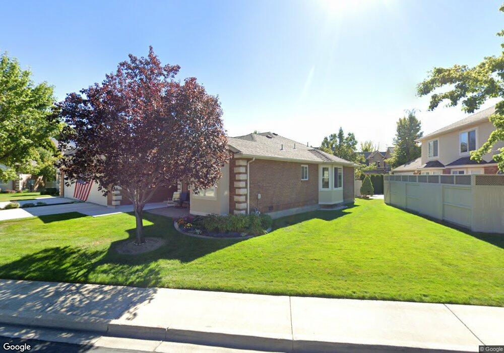
173 Woodside Dr Provo, UT 84604
Riverside NeighborhoodEstimated Value: $547,000 - $562,302
3
Beds
2
Baths
1,949
Sq Ft
$284/Sq Ft
Est. Value
About This Home
This home is located at 173 Woodside Dr, Provo, UT 84604 and is currently estimated at $552,826, approximately $283 per square foot. 173 Woodside Dr is a home located in Utah County with nearby schools including Canyon Crest Elementary School, Centennial Middle School, and Timpview High School.
Ownership History
Date
Name
Owned For
Owner Type
Purchase Details
Closed on
May 24, 2012
Sold by
Johnson Norman R and Wolfer Tracey S
Bought by
Johnson Norman R
Current Estimated Value
Purchase Details
Closed on
Sep 30, 2004
Sold by
Fry Edwina W
Bought by
Johnson Norman R and Wolfer Tracey S
Purchase Details
Closed on
Oct 24, 2003
Sold by
Fry Edwina W
Bought by
Fry Edwina W
Purchase Details
Closed on
May 29, 2001
Sold by
Lonnie Anderson 2000 Living Trust and Anderson Lonnie
Bought by
Fry Edwina W
Purchase Details
Closed on
Mar 3, 2000
Sold by
Anderson Gardner Lonnie
Bought by
Anderson Lonnie
Purchase Details
Closed on
Aug 5, 1996
Sold by
Provo Cottages L C
Bought by
Anderson Lonnie
Create a Home Valuation Report for This Property
The Home Valuation Report is an in-depth analysis detailing your home's value as well as a comparison with similar homes in the area
Home Values in the Area
Average Home Value in this Area
Purchase History
| Date | Buyer | Sale Price | Title Company |
|---|---|---|---|
| Johnson Norman R | -- | None Available | |
| Wolfer Tracey Schaub | -- | None Available | |
| Johnson Norman R | -- | Old Republic Title Company | |
| Fry Edwina W | -- | -- | |
| Fry Edwina W | -- | Empire Land Title Company | |
| Anderson Lonnie | -- | -- | |
| Anderson Lonnie | -- | -- |
Source: Public Records
Tax History Compared to Growth
Tax History
| Year | Tax Paid | Tax Assessment Tax Assessment Total Assessment is a certain percentage of the fair market value that is determined by local assessors to be the total taxable value of land and additions on the property. | Land | Improvement |
|---|---|---|---|---|
| 2025 | $2,643 | $264,110 | $88,600 | $391,600 |
| 2024 | $2,643 | $260,150 | $0 | $0 |
| 2023 | $2,837 | $275,275 | $0 | $0 |
| 2022 | $2,692 | $263,395 | $0 | $0 |
| 2021 | $2,142 | $365,600 | $90,000 | $275,600 |
| 2020 | $2,136 | $341,700 | $90,000 | $251,700 |
| 2019 | $2,019 | $336,000 | $90,000 | $246,000 |
| 2018 | $1,922 | $324,400 | $90,000 | $234,400 |
| 2017 | $1,669 | $154,770 | $0 | $0 |
| 2016 | $1,791 | $154,770 | $0 | $0 |
| 2015 | $1,701 | $148,610 | $0 | $0 |
| 2014 | $1,480 | $134,750 | $0 | $0 |
Source: Public Records
Map
Nearby Homes
- 3430 Brookside Dr
- 3477 Brookside Dr
- 3535 N 160 St W
- 3240 Shadowbrook Dr
- 3057 N 100 W
- 3013 N 100 W
- 2939 N Marrcrest Dr W
- 404 W 3700 N
- 2888 Marrcrest W
- 1311 S 1100 E
- 1171 S Carterville Rd
- 2823 N Marrcrest E
- 96 Marrcrest S
- 1237 S 1000 E
- 1636 N 320 E Unit 5
- 1660 N 320 E Unit 3
- 1648 N 320 E Unit 4
- 1625 N 320 E Unit 1
- 1624 N 320 E Unit 6
- 1615 N 320 E Unit 1
- 185 Woodside Dr
- 185 Woodside Dr Unit 46
- 191 Woodside Dr
- 159 Woodside Dr
- 188 W 3300 N
- 166 Woodside Dr
- 180 Woodside Dr
- 180 Woodside Dr Unit 23
- 3410 Brookside Dr
- 155 Woodside Dr
- 3424 Brookside Dr
- 168 Woodside Dr
- 3420 Brookside Dr
- 168 W 3300 N
- 158 Woodside Dr
- 205 Woodside Dr
- 205 Woodside Dr Unit 48
- 201 Woodside Dr Unit 47
- 150 Woodside Dr
- 147 Woodside Dr