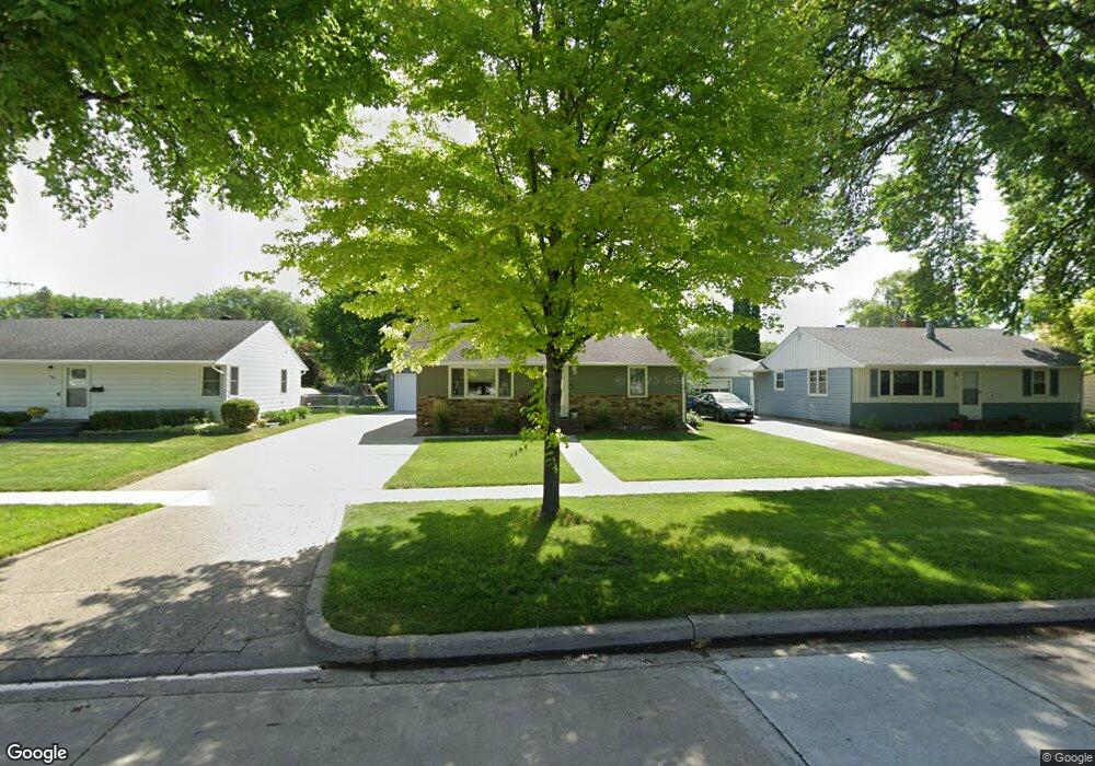
1730 15th St S Fargo, ND 58103
Lewis and Clark NeighborhoodEstimated Value: $213,000 - $278,000
2
Beds
1
Bath
960
Sq Ft
$258/Sq Ft
Est. Value
About This Home
This home is located at 1730 15th St S, Fargo, ND 58103 and is currently estimated at $248,123, approximately $258 per square foot. 1730 15th St S is a home located in Cass County with nearby schools including Lewis & Clark Elementary School, Carl Ben Eielson Middle School, and South High School.
Ownership History
Date
Name
Owned For
Owner Type
Purchase Details
Closed on
Dec 1, 2023
Sold by
Hill Molly A and Stanley Brian D
Bought by
Migler Dayla K and Samuelson Aaron L
Current Estimated Value
Home Financials for this Owner
Home Financials are based on the most recent Mortgage that was taken out on this home.
Original Mortgage
$232,800
Outstanding Balance
$229,031
Interest Rate
7.63%
Mortgage Type
New Conventional
Estimated Equity
$19,092
Purchase Details
Closed on
Jan 11, 2019
Sold by
Olson Cory G and Olson Michelle L
Bought by
Stanley Brian D and Hill Molly A
Home Financials for this Owner
Home Financials are based on the most recent Mortgage that was taken out on this home.
Original Mortgage
$148,675
Interest Rate
4.8%
Mortgage Type
New Conventional
Create a Home Valuation Report for This Property
The Home Valuation Report is an in-depth analysis detailing your home's value as well as a comparison with similar homes in the area
Home Values in the Area
Average Home Value in this Area
Purchase History
| Date | Buyer | Sale Price | Title Company |
|---|---|---|---|
| Migler Dayla K | $240,000 | The Title Company | |
| Stanley Brian D | $156,500 | Title Co |
Source: Public Records
Mortgage History
| Date | Status | Borrower | Loan Amount |
|---|---|---|---|
| Open | Migler Dayla K | $232,800 | |
| Previous Owner | Stanley Brian D | $148,675 |
Source: Public Records
Tax History Compared to Growth
Tax History
| Year | Tax Paid | Tax Assessment Tax Assessment Total Assessment is a certain percentage of the fair market value that is determined by local assessors to be the total taxable value of land and additions on the property. | Land | Improvement |
|---|---|---|---|---|
| 2024 | $2,771 | $112,950 | $28,100 | $84,850 |
| 2023 | $3,111 | $107,550 | $28,100 | $79,450 |
| 2022 | $2,777 | $93,500 | $28,100 | $65,400 |
| 2021 | $2,515 | $85,400 | $27,350 | $58,050 |
| 2020 | $2,508 | $85,400 | $27,350 | $58,050 |
| 2019 | $2,300 | $85,400 | $15,200 | $70,200 |
| 2018 | $2,270 | $85,400 | $15,200 | $70,200 |
| 2017 | $2,046 | $77,600 | $15,200 | $62,400 |
| 2016 | $1,943 | $75,350 | $15,200 | $60,150 |
| 2015 | $1,848 | $66,850 | $11,400 | $55,450 |
| 2014 | $1,771 | $61,900 | $11,400 | $50,500 |
| 2013 | $1,779 | $61,900 | $11,400 | $50,500 |
Source: Public Records
Map
Nearby Homes
- 1718 15th St S
- 1710 14th St S
- 1550 14 1 2 St S
- 1545 15th St S
- 1834 14 1 2 St S
- 1361 16th Ave S
- 1550 13 1 2 St S
- 1838 17th St S
- 1917 16 1 2 St S
- 1410 14 1 2 St S
- 1407 17th St S
- 1425 11th St S
- 1943 19th St S
- 1737 Park Blvd S
- 1439 10th St S
- 1314 14th St S
- 1725 Whitestone Cir S
- 1301 16 1 2 St S
- 2320 20th Ave S Unit 7
- 2326 20th Ave S Unit 9
- 1726 15th St S
- 1734 15th St S
- 1722 15th St S
- 1738 15th St S
- 1729 14 1/2 St S
- 1725 14 1/2 St S
- 1729 14 1 2 St S
- 1742 15th St S
- 1733 14 1 2 St S
- 1733 14 1/2 St S
- 1725 14 1 2 St S
- 1737 14 1/2 St S
- 1721 14 1/2 St S
- 1721 14 1 2 St S
- 1729 15th St S
- 1725 15th St S
- 1733 15th St S
- 1746 15th St S
- 1714 15th St S
- 1741 14 1 2 St S