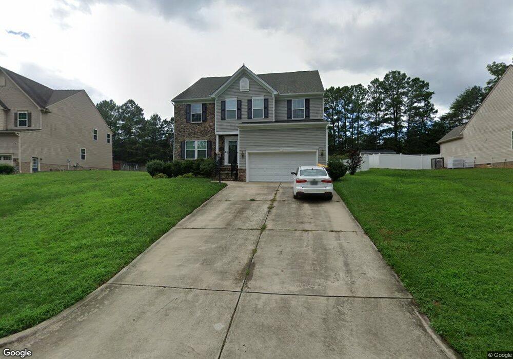
1730 Camerons Landing Blvd Hopewell, VA 23860
Estimated Value: $402,000 - $496,000
4
Beds
3
Baths
2,425
Sq Ft
$181/Sq Ft
Est. Value
About This Home
This home is located at 1730 Camerons Landing Blvd, Hopewell, VA 23860 and is currently estimated at $439,748, approximately $181 per square foot. 1730 Camerons Landing Blvd is a home located in Hopewell City with nearby schools including Carter G. Woodson Middle School, Hopewell High School, and West End Christian School.
Ownership History
Date
Name
Owned For
Owner Type
Purchase Details
Closed on
Jul 19, 2013
Sold by
Nvr Inc
Bought by
Manuel Donica
Current Estimated Value
Home Financials for this Owner
Home Financials are based on the most recent Mortgage that was taken out on this home.
Original Mortgage
$271,074
Outstanding Balance
$197,111
Interest Rate
3.92%
Mortgage Type
FHA
Estimated Equity
$242,637
Purchase Details
Closed on
Apr 29, 2013
Sold by
Camerons Landing Llc
Bought by
Nvr Inc
Create a Home Valuation Report for This Property
The Home Valuation Report is an in-depth analysis detailing your home's value as well as a comparison with similar homes in the area
Home Values in the Area
Average Home Value in this Area
Purchase History
| Date | Buyer | Sale Price | Title Company |
|---|---|---|---|
| Manuel Donica | $276,075 | -- | |
| Nvr Inc | $82,500 | -- |
Source: Public Records
Mortgage History
| Date | Status | Borrower | Loan Amount |
|---|---|---|---|
| Open | Nvr Inc | $271,074 |
Source: Public Records
Tax History Compared to Growth
Tax History
| Year | Tax Paid | Tax Assessment Tax Assessment Total Assessment is a certain percentage of the fair market value that is determined by local assessors to be the total taxable value of land and additions on the property. | Land | Improvement |
|---|---|---|---|---|
| 2025 | $4,796 | $409,900 | $48,900 | $361,000 |
| 2024 | $4,572 | $390,800 | $47,500 | $343,300 |
| 2023 | $4,416 | $390,800 | $47,500 | $343,300 |
| 2022 | $3,397 | $300,600 | $43,200 | $257,400 |
| 2021 | $3,397 | $300,600 | $43,200 | $257,400 |
| 2020 | $3,157 | $279,400 | $47,500 | $231,900 |
| 2019 | $3,157 | $279,400 | $47,500 | $231,900 |
| 2018 | $3,141 | $278,000 | $45,600 | $232,400 |
| 2017 | $3,141 | $278,000 | $45,600 | $232,400 |
| 2016 | $3,176 | $281,100 | $45,600 | $235,500 |
| 2015 | $3,176 | $281,100 | $45,600 | $235,500 |
| 2014 | $2,983 | $268,700 | $45,600 | $223,100 |
Source: Public Records
Map
Nearby Homes
- NEUVILLE Plan at Anchor Point
- PINE Plan at Anchor Point
- CABRAL Plan at Anchor Point
- DELMAR Plan at Anchor Point
- ESSEX Plan at Anchor Point
- 301 Beacon Ridge Dr Unit 109
- 4049 Eagle Dr
- 3901 Cambridge Place
- 3803 Eagle Dr
- 00 Brookneal Dr
- 3506 W Broadway
- 01 Brookneal Dr
- 3408 N Radford Dr
- 3500 N Colonial Dr
- 376 Libby Ave
- 308 Pin Oak Dr
- 420 Park Ave
- 1603 S Esther Ct
- 2111 Point of Rocks Rd
- 3611 Creekwood Dr
- 1728 Camerons Landing Blvd
- 1732 Camerons Landing Blvd
- 1726 Camerons Landing Blvd
- 1734 Cameron's Landing Blvd
- 1731 Camerons Landing Blvd
- 1729 Camerons Landing Blvd
- 1733 Camerons Landing Blvd
- 1727 Camerons Landing Blvd
- 1724 Camerons Landing Blvd
- 1735 Camerons Landing Blvd
- 1723 Camerons Landing Blvd
- 1725 Camerons Landing Blvd
- 1722 Camerons Landing Blvd
- 1801 Camerons Landing Ln
- 4118 Cameron Rd
- 4116 Cameron Rd
- 4114 Cameron Rd
- 4120 Cameron Rd
- 4112 Cameron Rd
- 1803 Camerons Landing Ln