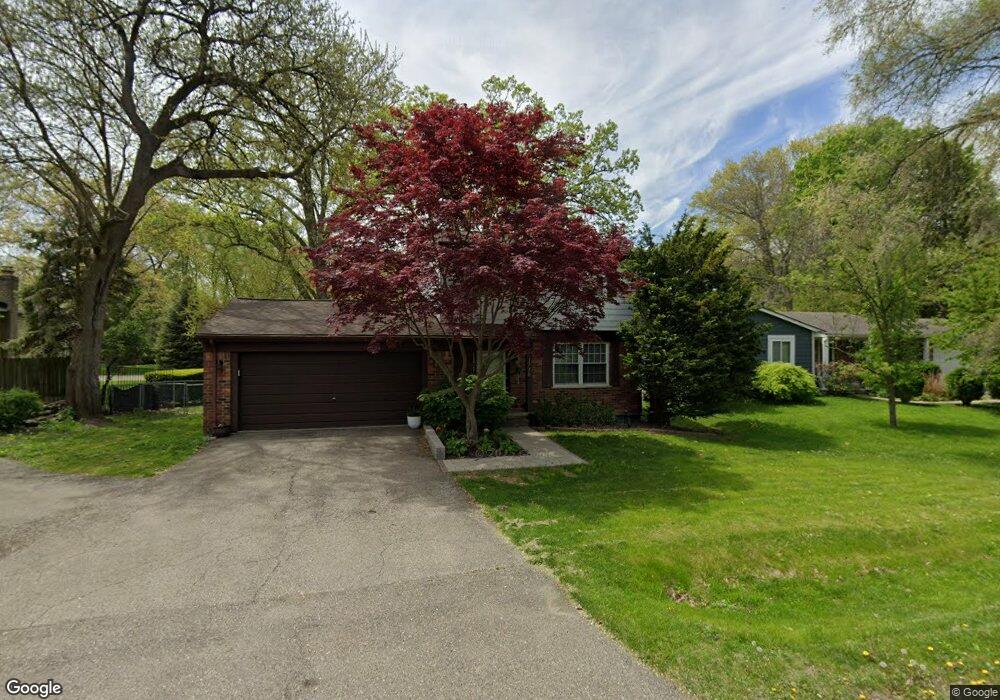
1730 Inverness St Unit Bldg-Unit Sylvan Lake, MI 48320
Estimated Value: $334,108 - $401,000
3
Beds
2
Baths
1,415
Sq Ft
$254/Sq Ft
Est. Value
About This Home
This home is located at 1730 Inverness St Unit Bldg-Unit, Sylvan Lake, MI 48320 and is currently estimated at $359,777, approximately $254 per square foot. 1730 Inverness St Unit Bldg-Unit is a home located in Oakland County with nearby schools including Walt Whitman Elementary School, Pontiac Middle School, and Pontiac High School.
Ownership History
Date
Name
Owned For
Owner Type
Purchase Details
Closed on
Jul 30, 2018
Sold by
King Randy D and King Diane E
Bought by
Milinko Michael
Current Estimated Value
Home Financials for this Owner
Home Financials are based on the most recent Mortgage that was taken out on this home.
Original Mortgage
$105,000
Outstanding Balance
$91,188
Interest Rate
4.5%
Mortgage Type
New Conventional
Estimated Equity
$268,589
Create a Home Valuation Report for This Property
The Home Valuation Report is an in-depth analysis detailing your home's value as well as a comparison with similar homes in the area
Home Values in the Area
Average Home Value in this Area
Purchase History
| Date | Buyer | Sale Price | Title Company |
|---|---|---|---|
| Milinko Michael | $225,500 | None Available |
Source: Public Records
Mortgage History
| Date | Status | Borrower | Loan Amount |
|---|---|---|---|
| Open | Milinko Michael | $105,000 |
Source: Public Records
Tax History Compared to Growth
Tax History
| Year | Tax Paid | Tax Assessment Tax Assessment Total Assessment is a certain percentage of the fair market value that is determined by local assessors to be the total taxable value of land and additions on the property. | Land | Improvement |
|---|---|---|---|---|
| 2024 | $6,127 | $143,220 | $0 | $0 |
| 2023 | $5,867 | $138,100 | $0 | $0 |
| 2022 | $5,981 | $128,880 | $0 | $0 |
| 2021 | $5,759 | $120,750 | $0 | $0 |
| 2020 | $5,623 | $109,520 | $0 | $0 |
| 2019 | $5,853 | $98,270 | $0 | $0 |
| 2018 | $4,143 | $91,080 | $0 | $0 |
| 2017 | $4,102 | $87,480 | $0 | $0 |
| 2016 | $4,124 | $80,060 | $0 | $0 |
| 2015 | -- | $85,340 | $0 | $0 |
| 2014 | -- | $65,530 | $0 | $0 |
| 2011 | -- | $65,190 | $0 | $0 |
Source: Public Records
Map
Nearby Homes
- 1796 Briarcliff St
- 1775 Woodland Ave
- 2084 Woodrow Wilson Blvd Unit A6
- 1386 Avondale St
- 1253 Atkinson Ave
- 1254 Desiax Ave
- 2468 Walce Dr
- 1785 Ward Rd
- 2216 Middlebelt Rd
- 2230 Middlebelt Rd
- 2820 Wall St
- 1160 Dorchester Ave
- 2825 Wall St
- 2314 Middlebelt Rd
- 1660 Beechmont St
- 49 Canal Dr Unit 300-049
- 1061 Dorchester Ave
- 1968 Maplewood Ave
- 21 Canal Dr Unit 300-021
- 0000 Ward Road Ward Rd
- 1730 Inverness St
- 2304 Avondale St W
- 1720 Inverness St
- 2328 Renfrew St
- 1725 Inverness St
- 1740 Inverness St
- 2261 Avondale St Unit Bldg-Unit
- 2261 Avondale St
- 2327 Renfrew St
- 1710 Inverness St
- 2340 Renfrew St
- 2347 Avondale St W
- 1711 Inverness St
- 2341 Renfrew St
- 2305 Cheltingham St
- 2358 Avondale St W
- 2315 Cheltingham St
- 2249 Avondale St
- 1709 Inverness St
- 2355 Avondale St W