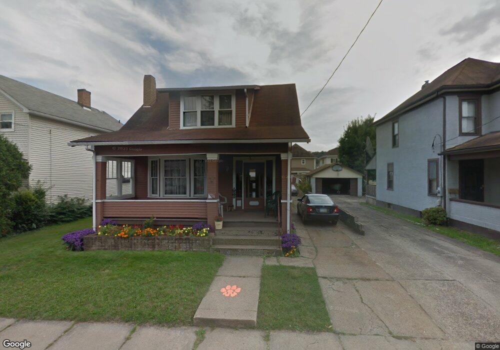
1730 Maple Ave Wellsville, OH 43968
Estimated Value: $62,000 - $103,000
3
Beds
3
Baths
1,482
Sq Ft
$58/Sq Ft
Est. Value
About This Home
This home is located at 1730 Maple Ave, Wellsville, OH 43968 and is currently estimated at $86,457, approximately $58 per square foot. 1730 Maple Ave is a home located in Columbiana County with nearby schools including Garfield Elementary School, Daw Elementary School, and Wellsville Jr./Sr. High School.
Ownership History
Date
Name
Owned For
Owner Type
Purchase Details
Closed on
Oct 1, 2020
Bought by
Lisa Kay Smith
Current Estimated Value
Home Financials for this Owner
Home Financials are based on the most recent Mortgage that was taken out on this home.
Interest Rate
2.88%
Purchase Details
Closed on
Sep 21, 2020
Sold by
Burcham Mary Ann
Bought by
Smith Lisa Kay
Home Financials for this Owner
Home Financials are based on the most recent Mortgage that was taken out on this home.
Interest Rate
2.88%
Purchase Details
Closed on
Jul 25, 2003
Sold by
Corak Cora A
Bought by
Burcham Mary Ann and Smith Lisa Kay
Purchase Details
Closed on
Mar 19, 2003
Sold by
Estate Of Peter L Corak
Bought by
Corak Cora A
Create a Home Valuation Report for This Property
The Home Valuation Report is an in-depth analysis detailing your home's value as well as a comparison with similar homes in the area
Home Values in the Area
Average Home Value in this Area
Purchase History
| Date | Buyer | Sale Price | Title Company |
|---|---|---|---|
| Lisa Kay Smith | $30,750 | -- | |
| Smith Lisa Kay | $30,800 | None Available | |
| Burcham Mary Ann | -- | -- | |
| Corak Cora A | -- | -- |
Source: Public Records
Mortgage History
| Date | Status | Borrower | Loan Amount |
|---|---|---|---|
| Closed | Lisa Kay Smith | -- |
Source: Public Records
Tax History Compared to Growth
Tax History
| Year | Tax Paid | Tax Assessment Tax Assessment Total Assessment is a certain percentage of the fair market value that is determined by local assessors to be the total taxable value of land and additions on the property. | Land | Improvement |
|---|---|---|---|---|
| 2024 | $1,211 | $25,760 | $3,290 | $22,470 |
| 2023 | $1,210 | $25,760 | $3,290 | $22,470 |
| 2022 | $1,209 | $25,760 | $3,290 | $22,470 |
| 2021 | $987 | $21,430 | $3,610 | $17,820 |
| 2020 | $986 | $21,430 | $3,610 | $17,820 |
| 2019 | $1,013 | $21,430 | $3,610 | $17,820 |
| 2018 | $864 | $19,500 | $3,290 | $16,210 |
| 2017 | $881 | $19,500 | $3,290 | $16,210 |
| 2016 | $1,004 | $18,980 | $4,380 | $14,600 |
| 2015 | $869 | $18,980 | $4,380 | $14,600 |
| 2014 | $486 | $18,980 | $4,380 | $14,600 |
Source: Public Records
Map
Nearby Homes
- 511 Aten Ave
- 1720 Clark Ave
- 1796 Chester Ave
- 1751 Crawford Ave Unit 1753
- 609 15th St
- 1825 Chester Ave
- 1225 Center St
- 1019 Commerce St
- 308 10th St
- 43818 Sherwood Rd
- 1715 Brandon Dr
- 817 Broadway Ave
- 909 Riverside Ave
- 738 Main St
- 616 Washington Ave
- 609 Broadway Ave
- 602 Main St
- 525 Riverside Ave
- 401 Broadway Ave
- 405 Main St
- 1720 Maple Ave
- 1732 Maple Ave
- 1729 Lincoln Ave
- 1733 Lincoln Ave
- 1727 Lincoln Ave
- 1735 Lincoln Ave
- 1616 Commerce St
- 1729 Maple Ave
- 1716 Maple Ave
- 1721 Maple Ave
- 1731 Maple Ave
- 1736 Maple Ave
- 1719 Lincoln Ave
- 1737 Lincoln Ave
- 411 Aten Ave
- 413 Aten Ave
- 409 Aten Ave
- 1723 Maple Ave
- 1714 Maple Ave
- 1717 Lincoln Ave