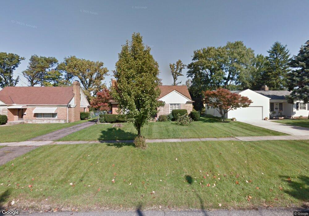
17309 Mccracken Rd Maple Heights, OH 44137
Estimated Value: $147,000 - $158,306
4
Beds
2
Baths
1,899
Sq Ft
$80/Sq Ft
Est. Value
About This Home
This home is located at 17309 Mccracken Rd, Maple Heights, OH 44137 and is currently estimated at $152,077, approximately $80 per square foot. 17309 Mccracken Rd is a home located in Cuyahoga County with nearby schools including Abraham Lincoln Elementary School, Rockside/ J.F. Kennedy School, and Barack Obama School.
Ownership History
Date
Name
Owned For
Owner Type
Purchase Details
Closed on
Jun 18, 2015
Sold by
Williams Rufus A
Bought by
Williams Rufus A and Williams Etta J
Current Estimated Value
Purchase Details
Closed on
Jun 21, 1994
Sold by
Love Dennis J
Bought by
Williams Rufus A
Home Financials for this Owner
Home Financials are based on the most recent Mortgage that was taken out on this home.
Original Mortgage
$101,950
Interest Rate
8.58%
Mortgage Type
FHA
Purchase Details
Closed on
Mar 28, 1985
Bought by
Love Dennis J & Nancy L
Purchase Details
Closed on
Jan 1, 1975
Bought by
Love Dennis J & Nancy L
Create a Home Valuation Report for This Property
The Home Valuation Report is an in-depth analysis detailing your home's value as well as a comparison with similar homes in the area
Home Values in the Area
Average Home Value in this Area
Purchase History
| Date | Buyer | Sale Price | Title Company |
|---|---|---|---|
| Williams Rufus A | -- | Haverfield Title Agency | |
| Williams Rufus A | $105,000 | -- | |
| Love Dennis J & Nancy L | -- | -- | |
| Love Dennis J & Nancy L | -- | -- |
Source: Public Records
Mortgage History
| Date | Status | Borrower | Loan Amount |
|---|---|---|---|
| Closed | Williams Rufus A | $101,950 |
Source: Public Records
Tax History Compared to Growth
Tax History
| Year | Tax Paid | Tax Assessment Tax Assessment Total Assessment is a certain percentage of the fair market value that is determined by local assessors to be the total taxable value of land and additions on the property. | Land | Improvement |
|---|---|---|---|---|
| 2024 | $2,925 | $42,000 | $9,695 | $32,305 |
| 2023 | $2,188 | $29,610 | $5,880 | $23,730 |
| 2022 | $2,217 | $29,610 | $5,880 | $23,730 |
| 2021 | $2,364 | $29,610 | $5,880 | $23,730 |
| 2020 | $1,795 | $22,440 | $4,450 | $17,990 |
| 2019 | $1,777 | $64,100 | $12,700 | $51,400 |
| 2018 | $1,686 | $22,440 | $4,450 | $17,990 |
| 2017 | $1,489 | $19,570 | $4,130 | $15,440 |
| 2016 | $1,431 | $19,570 | $4,130 | $15,440 |
| 2015 | $3,406 | $19,570 | $4,130 | $15,440 |
| 2014 | $3,406 | $21,490 | $4,550 | $16,940 |
Source: Public Records
Map
Nearby Homes
- 5082 Philip Ave
- 5031 Cato St
- 16706 Myrtle Ave
- 5150 Arch St
- 5046 Erwin St
- 4899 Lee Rd
- 5185 Anthony St
- 16610 Priebe Ave
- 5177 Cato St
- 5204 Anthony St
- 5062 Lee Rd
- 5246 Philip Ave
- 16351 Glenburn Ave
- 16408 Highview Dr
- 5210 Theodore St
- 5239 Arch St
- 5219 Joseph St
- 16241 Glenburn Ave
- 18704 Longview Ave
- 16307 Highview Dr
- 17301 Mccracken Rd
- 17487 Mccracken Rd
- 17293 Mccracken Rd
- 17493 Mccracken Rd
- 17497 Mccracken Rd
- 17285 Mccracken Rd
- 17501 Mccracken Rd
- 17308 Mccracken Rd
- 17304 Mccracken Rd
- 17488 Mccracken Rd
- 17300 Mccracken Rd
- 17492 Mccracken Rd
- 17505 Mccracken Rd
- 17496 Mccracken Rd
- 17277 Mccracken Rd
- 17282 Mccracken Rd
- 17509 Mccracken Rd
- 5045 Catherine St
- 17278 Mccracken Rd
- 5034 Philip Ave