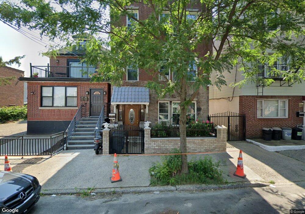
1731 Bogart Ave Unit 2 Bronx, NY 10462
Morris Park NeighborhoodEstimated Value: $1,042,000 - $1,208,000
3
Beds
1
Bath
1,100
Sq Ft
$1,022/Sq Ft
Est. Value
About This Home
This home is located at 1731 Bogart Ave Unit 2, Bronx, NY 10462 and is currently estimated at $1,124,333, approximately $1,022 per square foot. 1731 Bogart Ave Unit 2 is a home located in Bronx County with nearby schools including P.S. 083 The Donald Hertz School, Icahn Charter School 2, and St. Clare of Assisi School.
Ownership History
Date
Name
Owned For
Owner Type
Purchase Details
Closed on
Jun 30, 2005
Sold by
Shareed Mohamed
Bought by
Shareed Bibi and Shareed Kalowtie
Current Estimated Value
Home Financials for this Owner
Home Financials are based on the most recent Mortgage that was taken out on this home.
Original Mortgage
$504,000
Outstanding Balance
$258,555
Interest Rate
5.59%
Mortgage Type
Purchase Money Mortgage
Estimated Equity
$865,778
Purchase Details
Closed on
Oct 25, 1996
Sold by
Riviecco Salvatore and Riviecco Gabriella
Bought by
Shareed Mohamed
Home Financials for this Owner
Home Financials are based on the most recent Mortgage that was taken out on this home.
Original Mortgage
$233,130
Interest Rate
7.82%
Mortgage Type
FHA
Create a Home Valuation Report for This Property
The Home Valuation Report is an in-depth analysis detailing your home's value as well as a comparison with similar homes in the area
Home Values in the Area
Average Home Value in this Area
Purchase History
| Date | Buyer | Sale Price | Title Company |
|---|---|---|---|
| Shareed Bibi | -- | -- | |
| Shareed Bibi | -- | -- | |
| Shareed Mohamed | $240,000 | Commonwealth Land Title Ins | |
| Shareed Mohamed | $240,000 | Commonwealth Land Title Ins |
Source: Public Records
Mortgage History
| Date | Status | Borrower | Loan Amount |
|---|---|---|---|
| Open | Shareed Bibi | $504,000 | |
| Closed | Shareed Bibi | $504,000 | |
| Closed | Shareed Mohamed | $233,130 |
Source: Public Records
Tax History Compared to Growth
Tax History
| Year | Tax Paid | Tax Assessment Tax Assessment Total Assessment is a certain percentage of the fair market value that is determined by local assessors to be the total taxable value of land and additions on the property. | Land | Improvement |
|---|---|---|---|---|
| 2025 | $7,536 | $41,258 | $5,488 | $35,770 |
| 2024 | $7,536 | $38,923 | $5,753 | $33,170 |
| 2023 | $7,173 | $36,720 | $5,896 | $30,824 |
| 2022 | $7,043 | $58,980 | $8,700 | $50,280 |
| 2021 | $7,367 | $51,180 | $8,700 | $42,480 |
| 2020 | $6,982 | $44,880 | $8,700 | $36,180 |
| 2019 | $6,492 | $40,680 | $8,700 | $31,980 |
| 2018 | $5,940 | $30,600 | $8,700 | $21,900 |
| 2017 | $6,294 | $32,347 | $8,466 | $23,881 |
| 2016 | $6,157 | $32,347 | $8,638 | $23,709 |
| 2015 | $3,461 | $30,909 | $9,232 | $21,677 |
| 2014 | $3,461 | $29,160 | $9,660 | $19,500 |
Source: Public Records
Map
Nearby Homes
- 930 Morris Park Ave
- 959 van Nest Ave
- - Morris Park Ave
- 868 Morris Park Ave
- 1847 Bronxdale Ave
- 1646 Radcliff Ave
- 867 van Nest Ave
- 874 van Nest Ave
- 848 Morris Park Ave
- 1630 Radcliff Ave
- 845 Kinsella St
- 856 van Nest Ave
- 1831 Paulding Ave
- 1720A Paulding Ave
- 928 Rhinelander Ave
- 1631 Paulding Ave
- 953 Rhinelander Ave
- 987 Pierce Ave
- 1004 Rhinelander Ave
- 1639 Hone Ave
- 1731 Bogart Ave
- 1733 Bogart Ave
- 1729 Bogart Ave
- 1735 Bogart Ave
- 1737 Bogart Ave
- 1723 Bogart Ave
- 1721 Bogart Ave
- 1724 Fowler Ave
- 1726 Fowler Ave
- 1722 Fowler Ave
- 1720 Fowler Ave
- 1719 Bogart Ave
- 1718 Fowler Ave
- 1730 Fowler Ave
- 938 Morris Park Ave
- 936 Morris Park Ave
- 1716 Fowler Ave
- 1715 Bogart Ave
- 1730 Bogart Ave
- 1732 Bogart Ave