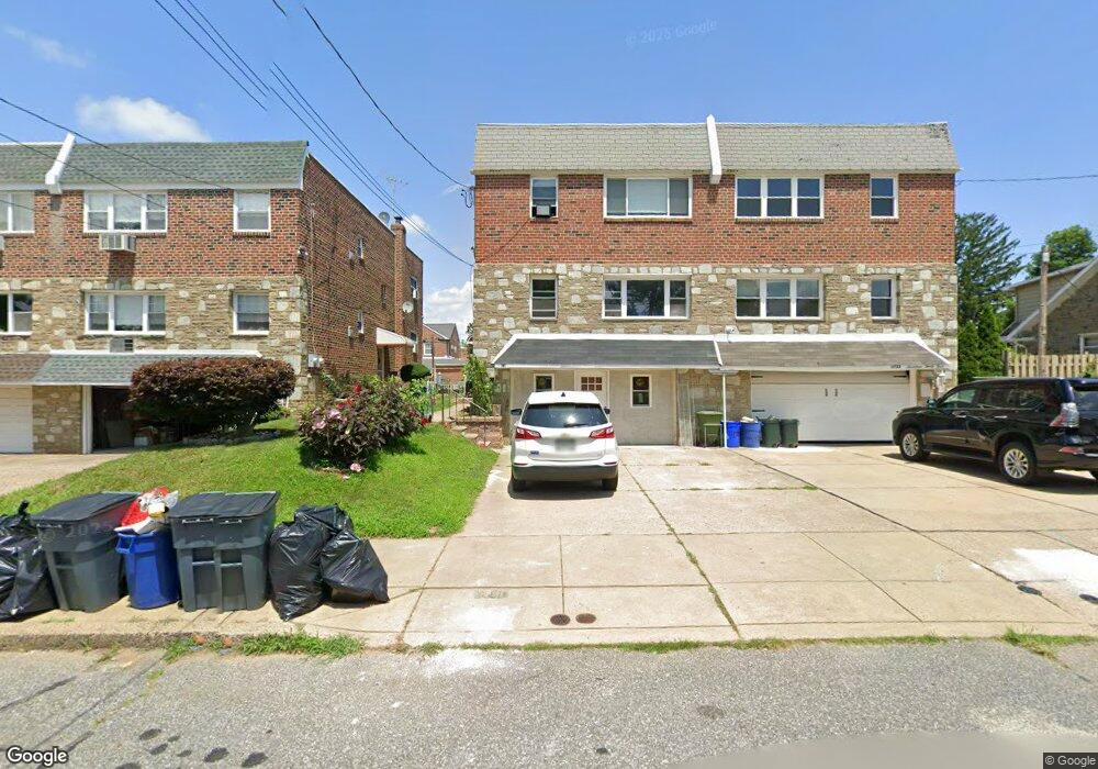
1731 Emerson St Philadelphia, PA 19152
Rhawnhurst NeighborhoodEstimated Value: $359,000 - $409,000
--
Bed
--
Bath
2,793
Sq Ft
$138/Sq Ft
Est. Value
About This Home
This home is located at 1731 Emerson St, Philadelphia, PA 19152 and is currently estimated at $386,386, approximately $138 per square foot. 1731 Emerson St is a home located in Philadelphia County with nearby schools including Farrell Louis H School, Northeast High School, and Tacony Academy Charter School.
Ownership History
Date
Name
Owned For
Owner Type
Purchase Details
Closed on
Jul 29, 2024
Sold by
Cassel Debra A
Bought by
Onorato Marco
Current Estimated Value
Purchase Details
Closed on
Aug 13, 2001
Sold by
Mento Stasia Marie and Mento Mildred K
Bought by
Glassman Gary R and Cassel Debra A
Home Financials for this Owner
Home Financials are based on the most recent Mortgage that was taken out on this home.
Original Mortgage
$100,800
Interest Rate
7.16%
Mortgage Type
Commercial
Create a Home Valuation Report for This Property
The Home Valuation Report is an in-depth analysis detailing your home's value as well as a comparison with similar homes in the area
Home Values in the Area
Average Home Value in this Area
Purchase History
| Date | Buyer | Sale Price | Title Company |
|---|---|---|---|
| Onorato Marco | $380,000 | American Legal Abstract | |
| Glassman Gary R | $126,000 | -- |
Source: Public Records
Mortgage History
| Date | Status | Borrower | Loan Amount |
|---|---|---|---|
| Previous Owner | Glassman Gary R | $100,800 |
Source: Public Records
Tax History Compared to Growth
Tax History
| Year | Tax Paid | Tax Assessment Tax Assessment Total Assessment is a certain percentage of the fair market value that is determined by local assessors to be the total taxable value of land and additions on the property. | Land | Improvement |
|---|---|---|---|---|
| 2025 | $4,569 | $396,700 | $79,340 | $317,360 |
| 2024 | $4,569 | $396,700 | $79,340 | $317,360 |
| 2023 | $4,569 | $326,400 | $65,280 | $261,120 |
| 2022 | $2,818 | $281,400 | $65,280 | $216,120 |
| 2021 | $3,448 | $0 | $0 | $0 |
| 2020 | $3,448 | $0 | $0 | $0 |
| 2019 | $3,229 | $0 | $0 | $0 |
| 2018 | $2,769 | $0 | $0 | $0 |
| 2017 | $2,769 | $0 | $0 | $0 |
| 2016 | $2,349 | $0 | $0 | $0 |
| 2015 | $2,249 | $0 | $0 | $0 |
| 2014 | -- | $197,800 | $51,084 | $146,716 |
| 2012 | -- | $29,568 | $2,868 | $26,700 |
Source: Public Records
Map
Nearby Homes
- 1804 Hoffnagle St
- 1705 Solly Ave
- 1702 Arthur St
- 8127 Langdon St
- 1732 Fox Chase Rd
- 1704 Stanwood St
- 1700 Kendrick St
- 1625 Rhawn St
- 1718 Rhawn St
- 1711 Kendrick St
- 1716 Bergen St
- 8227 Rose Petal Dr
- 1931 33 Rhawn St
- 1719 Loney St
- 1828 Megargee St
- 1443 Rhawn St
- 1620 Loney St
- 1712 Tustin St
- 2155 Benson St
- 7912 14 Loretto Ave
- 1729 Emerson St
- 1733 Emerson St
- 1727 Emerson St
- 1719 Emerson St Unit 21
- 1728 Hoffnagle St
- 1722 Hoffnagle St
- 1735 Emerson St Unit 45
- 1715-17 Emerson St
- 1715 Emerson St Unit 17
- 1740 Hoffnagle St
- 1718 Hoffnagle St
- 1742 Emerson St
- 1732 Emerson St
- 1711 Emerson St
- 8212 Frontenac St
- 1720 Emerson St
- 1709 Emerson St Unit 2
- 1709 Emerson St
- 1723 Solly Ave
- 8208 Frontenac St